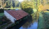

Angervilliers - Dourdan

tracegps
User

Length
25 km

Max alt
170 m

Uphill gradient
381 m

Km-Effort
30 km

Min alt
74 m

Downhill gradient
381 m
Boucle
Yes
Creation date :
2014-12-10 00:00:00.0
Updated on :
2014-12-10 00:00:00.0
5h00
Difficulty : Medium

FREE GPS app for hiking
About
Trail Walking of 25 km to be discovered at Ile-de-France, Essonne, Angervilliers. This trail is proposed by tracegps.
Description
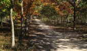
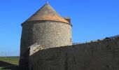
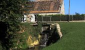
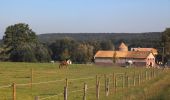
Départ d'un parking sur la D132 dans la forêt d'Angervilliers; on rejoint Machery, Angervilliers, puis le GR111 jusqu'à Dourdan. Retour par le GR de pays du Hurepoix; ensuite le moulin de Morsang, le hameau de la Bâte où on retrouve la forêt d'Angervilliers.
Positioning
Country:
France
Region :
Ile-de-France
Department/Province :
Essonne
Municipality :
Angervilliers
Location:
Unknown
Start:(Dec)
Start:(UTM)
430181 ; 5383856 (31U) N.
Comments
Trails nearby
_Le rallye de Bonnelles à Rochefort


Walking
Medium
(10)
Bonnelles,
Ile-de-France,
Yvelines,
France

14.1 km | 16.4 km-effort
3h 30min
Yes
_Les Moulins de la Rémarde


Walking
Easy
(8)
Longvilliers,
Ile-de-France,
Yvelines,
France

9.3 km | 10.4 km-effort
2h 0min
Yes
_Bullion, village vivant !


Walking
Very easy
(5)
Bullion,
Ile-de-France,
Yvelines,
France

7.1 km | 8.5 km-effort
1h 52min
Yes
_Le bois d''Haumont


Walking
Easy
(4)
Bullion,
Ile-de-France,
Yvelines,
France

5.8 km | 7.1 km-effort
1h 30min
Yes
Essonne_RD_Limours=>Viaduc=>Prédecelle=>Chaumusson


Walking
Easy
(1)
Limours,
Ile-de-France,
Essonne,
France

7.4 km | 8.4 km-effort
2h 30min
Yes

20210319_Limours_Viaduc_Prédecelle_Amont


Walking
Easy
(1)
Limours,
Ile-de-France,
Essonne,
France

8.7 km | 9.9 km-effort
2h 30min
Yes
20191019_Tour_des_Fermes_réalisé


Walking
Very easy
(1)
Pecqueuse,
Ile-de-France,
Essonne,
France

13.8 km | 15.2 km-effort
3h 43min
Yes
Autour de Bullion


Walking
Difficult
(1)
Bullion,
Ile-de-France,
Yvelines,
France

22 km | 26 km-effort
4h 30min
Yes

St Arnoult 33km-2h30


Mountain bike
Difficult
(1)
Limours,
Ile-de-France,
Essonne,
France

34 km | 39 km-effort
2h 33min
Yes


 SityTrail


