![](/images/other/stat-length.png)
![Trail Walking Saint-Chély-d'Aubrac - La voie romaine - Saint Chély d'Aubrac - Photo](https://media.geolcdn.com/t/1900/400/ext.pjpeg?maxdim=2&url=https%3A%2F%2Fservices.sitytrail.com%2FGeolivesWS%2FDownloadMedia.ashx%3FTrailID%3D107212%26Media%3D12075_1.jpg)
La voie romaine - Saint Chély d'Aubrac
tracegps
User
![Length](/images/other/stat-length.png)
![Max alt](https://static1.geolcdn.com/siteimages/upload/files/1508320355ic_sort_altitude_max_24dp.png)
![Uphill gradient](https://static1.geolcdn.com/siteimages/upload/files/1508320355ic_sort_den_pos_24dp.png)
![Km-Effort](/images/other/stat-length.png)
![Min alt](https://static1.geolcdn.com/siteimages/upload/files/1508320355ic_sort_altitude_min_24dp.png)
![Downhill gradient](https://static1.geolcdn.com/siteimages/upload/files/1508320355ic_sort_den_neg_24dp.png)
![Boucle](https://static1.geolcdn.com/siteimages/upload/files/16400158638029165_repeat_loop_refresh_sync_direction_icon.png)
![Walking](https://static1.geolcdn.com/sitytour/trail-icons/101.png)
5h30
Difficulty : Medium
![Scan this QR Code to open this trail in the SityTrail application](https://capi.geolives.com/qq0zvz2zws4bq2lad0pu/sitytour/trails/107212/qr.png?size=200)
FREE GPS app for hiking
About
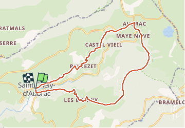
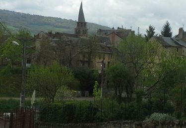
Trail Walking of 19 km to be discovered at Occitania, Aveyron, Saint-Chély-d'Aubrac. This trail is proposed by tracegps.
Description
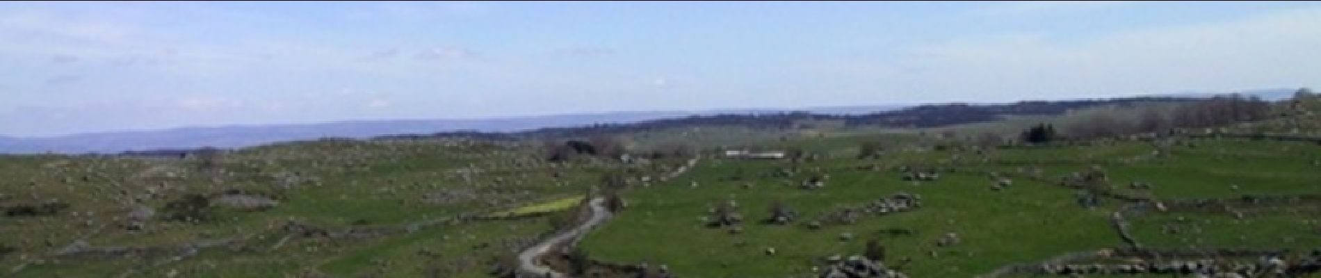
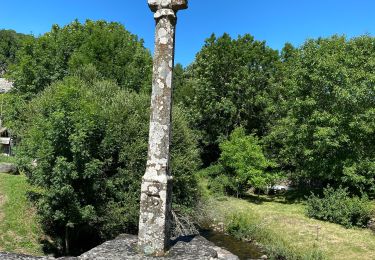
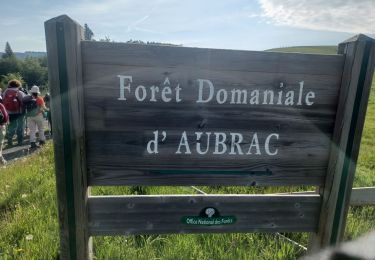
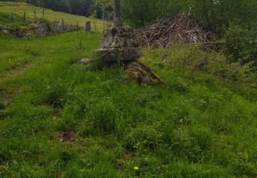
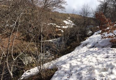
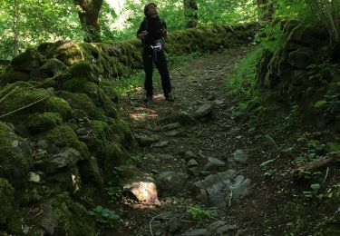
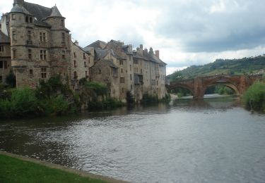
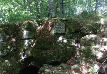
L'Aubrac est un haut plateau volcanique et granitique situé au centre-sud du Massif Central et aux confins de trois régions : Midi-Pyrénées, Languedoc-Roussillon et Auvergne. Il présente un air de famille avec son cousin le Cézallier et on peut le rattacher comme lui aux hautes terres d'Auvergne. Il est bordé au nord-ouest par les monts du Cantal, à l'est par la Margeride et au sud par les plateaux calcaires des Grands Causses. Il présente une nature et un paysage sauvage avec des hivers pouvant être rudes. Il s'agit ici d'un joli circuit empruntant une section de l'ancienne voie romaine. De magnifiques panoramas sur le plateau de l'Aubrac et sur la boralde de Saint Chély d'Aubrac. Ce village est une étape sur le chemin de Saint Jacques de Compostelle. La croix du pèlerin sur le pont vieux de Saint Chély est classée au patrimoine mondial de l'humanité.
Positioning
Comments
Trails nearby
![Trail Walking Saint-Chély-d'Aubrac - Saint Chely Espalion Avril 2018 - Photo](https://media.geolcdn.com/t/375/260/ext.jpg?maxdim=2&url=https%3A%2F%2Fservices.sitytrail.com%2FGeolivesWS%2FDownloadMedia.ashx%3FTrailID%3D954993%26Media%3Dfix__20180422144532.jpg)
![Walking Walking](https://static1.geolcdn.com/sitytour/trail-icons/101.png)
Walking
![](/images/other/stat-length.png)
![](https://static1.geolcdn.com/siteimages/upload/files/16400158638029165_repeat_loop_refresh_sync_direction_icon.png)
![Trail Walking Saint-Chély-d'Aubrac - St Chelsy, Aubrac, Les Enfrux - Photo](https://media.geolcdn.com/t/375/260/6866939b-d70d-4ab6-a2bf-25d7795a7efa.jpg&format=jpg&maxdim=2)
![Walking Walking](https://static1.geolcdn.com/sitytour/trail-icons/101.png)
Walking
![](/images/other/stat-length.png)
![](https://static1.geolcdn.com/siteimages/upload/files/16400158638029165_repeat_loop_refresh_sync_direction_icon.png)
![Trail Walking Saint-Chély-d'Aubrac - AVEYRON . AUBRAC . TOUR DES MONTS D AUBRAC N - Photo](https://media.geolcdn.com/t/375/260/12f366e9-98c7-446f-9ea1-7cc32dab7d0c.jpg&format=jpg&maxdim=2)
![Walking Walking](https://static1.geolcdn.com/sitytour/trail-icons/101.png)
Walking
![](/images/other/stat-length.png)
![](https://static1.geolcdn.com/siteimages/upload/files/16400158638029165_repeat_loop_refresh_sync_direction_icon.png)
![Trail Walking Saint-Chély-d'Aubrac - st chely st urcize - Photo](https://media.geolcdn.com/t/375/260/1113cc59-e9db-4d87-b498-865d86c5cb16.jpg&format=jpg&maxdim=2)
![Walking Walking](https://static1.geolcdn.com/sitytour/trail-icons/101.png)
Walking
![](/images/other/stat-length.png)
![](https://static1.geolcdn.com/siteimages/upload/files/16400158638029165_repeat_loop_refresh_sync_direction_icon.png)
![Trail Walking Saint-Chély-d'Aubrac - S’y chely - Photo](https://media.geolcdn.com/t/375/260/389820e6-c2c8-454b-a940-011f0455be25.jpg&format=jpg&maxdim=2)
![Walking Walking](https://static1.geolcdn.com/sitytour/trail-icons/101.png)
Walking
![](/images/other/stat-length.png)
![](https://static1.geolcdn.com/siteimages/upload/files/16400158638029165_repeat_loop_refresh_sync_direction_icon.png)
![Trail Walking Saint-Chély-d'Aubrac - St chely Aubrac - Photo](https://media.geolcdn.com/t/375/260/c658b19b-ea02-4e7f-bc49-bac78f64ab5b.jpg&format=jpg&maxdim=2)
![Walking Walking](https://static1.geolcdn.com/sitytour/trail-icons/101.png)
Walking
![](/images/other/stat-length.png)
![](https://static1.geolcdn.com/siteimages/upload/files/16400158638029165_repeat_loop_refresh_sync_direction_icon.png)
![Walking Walking](https://static1.geolcdn.com/sitytour/trail-icons/101.png)
Walking
![](/images/other/stat-length.png)
![](https://static1.geolcdn.com/siteimages/upload/files/16400158638029165_repeat_loop_refresh_sync_direction_icon.png)
![Trail Walking Saint-Chély-d'Aubrac - St chely d'aubrac - laguiole - Photo](https://media.geolcdn.com/t/375/260/ext.jpg?maxdim=2&url=https%3A%2F%2Fservices.sitytrail.com%2FGeolivesWS%2FDownloadMedia.ashx%3FTrailID%3D447022%26Media%3Dfix__20150715113242.jpg)
![Walking Walking](https://static1.geolcdn.com/sitytour/trail-icons/101.png)
Walking
![](/images/other/stat-length.png)
![](https://static1.geolcdn.com/siteimages/upload/files/16400158638029165_repeat_loop_refresh_sync_direction_icon.png)
![Trail Walking Saint-Chély-d'Aubrac - Saint Chely d'Aubrac - Saint Côme d'Olt - Photo](https://media.geolcdn.com/t/375/260/ext.jpg?maxdim=2&url=https%3A%2F%2Fservices.sitytrail.com%2FGeolivesWS%2FDownloadMedia.ashx%3FTrailID%3D411419%26Media%3Dfix__20150423132902.jpg)
![Walking Walking](https://static1.geolcdn.com/sitytour/trail-icons/101.png)
Walking
![](/images/other/stat-length.png)
![](https://static1.geolcdn.com/siteimages/upload/files/16400158638029165_repeat_loop_refresh_sync_direction_icon.png)
Très varié, très agréable ?? !