![](/images/other/stat-length.png)
![Trail Walking Bédoin - La cèdraie du Ventoux - Flassan - Photo](https://media.geolcdn.com/t/1900/400/ext.pjpeg?maxdim=2&url=https%3A%2F%2Fservices.sitytrail.com%2FGeolivesWS%2FDownloadMedia.ashx%3FTrailID%3D107157%26Media%3D12000_4.jpg)
La cèdraie du Ventoux - Flassan
tracegps
User
![Length](/images/other/stat-length.png)
![Max alt](https://static1.geolcdn.com/siteimages/upload/files/1508320355ic_sort_altitude_max_24dp.png)
![Uphill gradient](https://static1.geolcdn.com/siteimages/upload/files/1508320355ic_sort_den_pos_24dp.png)
![Km-Effort](/images/other/stat-length.png)
![Min alt](https://static1.geolcdn.com/siteimages/upload/files/1508320355ic_sort_altitude_min_24dp.png)
![Downhill gradient](https://static1.geolcdn.com/siteimages/upload/files/1508320355ic_sort_den_neg_24dp.png)
![Boucle](https://static1.geolcdn.com/siteimages/upload/files/16400158638029165_repeat_loop_refresh_sync_direction_icon.png)
![Walking](https://static1.geolcdn.com/sitytour/trail-icons/101.png)
2h15
Difficulty : Easy
![Scan this QR Code to open this trail in the SityTrail application](https://capi.geolives.com/qq0zvz2zws4bq2lad0pu/sitytour/trails/107157/qr.png?size=200)
FREE GPS app for hiking
About
Trail Walking of 6.2 km to be discovered at Provence-Alpes-Côte d'Azur, Vaucluse, Bédoin. This trail is proposed by tracegps.
Description
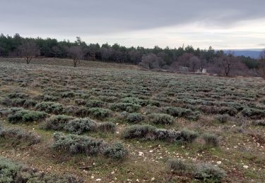
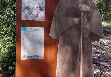
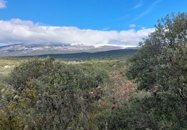
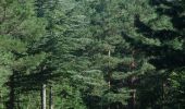
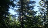
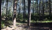
Un beau parcours pour découvrir le cèdre de l'Atlas dans une des six réserves de biosphère du Ventoux d'une superficie d'environ 60ha. Une véritable opération réussie de reboisement en 1862 dans laquelle on cherche aujourd'hui à concilier : conservation de la biodiversité, les activités humaines et économiques, dans un esprit de développement durable. Départ D974 peu après le pavillon de Roland.
Positioning
Comments
Trails nearby
![Trail Walking Bédoin - Le Mont Ventoux en randonnée par Saint Colombe - Photo](https://media.geolcdn.com/t/375/260/ext.jpg?maxdim=2&url=https%3A%2F%2Fservices.sitytrail.com%2FGeolivesWS%2FDownloadMedia.ashx%3FTrailID%3D317282%26Media%3D16469_1.jpg)
![Walking Walking](https://static1.geolcdn.com/sitytour/trail-icons/101.png)
Walking
![](/images/other/stat-length.png)
![](https://static1.geolcdn.com/siteimages/upload/files/16400158638029165_repeat_loop_refresh_sync_direction_icon.png)
![Trail Walking Flassan - Tricotage au Rocassou, à la recherche du sentier perdu !!!! - Photo](https://media.geolcdn.com/t/375/260/ad3b7676-f4f1-487c-b8df-3a57222b8e54.jpg&format=jpg&maxdim=2)
![Walking Walking](https://static1.geolcdn.com/sitytour/trail-icons/101.png)
Walking
![](/images/other/stat-length.png)
![](https://static1.geolcdn.com/siteimages/upload/files/16400158638029165_repeat_loop_refresh_sync_direction_icon.png)
![Trail Mountain bike Monieux - Neige, boue, Ventoux, sortie de Fou !!!!! - Photo](https://media.geolcdn.com/t/375/260/9d1fd927-ec9e-4172-bd8d-ff9ef853b9d1.jpg&format=jpg&maxdim=2)
![Mountain bike Mountain bike](https://static1.geolcdn.com/sitytour/trail-icons/202.png)
Mountain bike
![](/images/other/stat-length.png)
![](https://static1.geolcdn.com/siteimages/upload/files/16400158638029165_repeat_loop_refresh_sync_direction_icon.png)
![Trail Walking Bédoin - Sur les traces du reboisement du Ventoux 1860 - Photo](https://media.geolcdn.com/t/375/260/fa234f56-c4fe-4d00-97d6-2ca9e6744a73.jpg&format=jpg&maxdim=2)
![Walking Walking](https://static1.geolcdn.com/sitytour/trail-icons/101.png)
Walking
![](/images/other/stat-length.png)
![](https://static1.geolcdn.com/siteimages/upload/files/16400158638029165_repeat_loop_refresh_sync_direction_icon.png)
![Trail Mountain bike Bédoin - Frache, crête de la Tune et Ventouret - Photo](https://media.geolcdn.com/t/375/260/effad160-5fe6-4dec-8989-b60dc094dbb1.jpg&format=jpg&maxdim=2)
![Mountain bike Mountain bike](https://static1.geolcdn.com/sitytour/trail-icons/202.png)
Mountain bike
![](/images/other/stat-length.png)
![](https://static1.geolcdn.com/siteimages/upload/files/16400158638029165_repeat_loop_refresh_sync_direction_icon.png)
![Trail Walking Flassan - Sentiers sauvages de la Combe Ripert - Photo](https://media.geolcdn.com/t/375/260/93898e07-b925-4601-bf8c-4f651337a563.jpg&format=jpg&maxdim=2)
![Walking Walking](https://static1.geolcdn.com/sitytour/trail-icons/101.png)
Walking
![](/images/other/stat-length.png)
![](https://static1.geolcdn.com/siteimages/upload/files/16400158638029165_repeat_loop_refresh_sync_direction_icon.png)
![Trail Mountain bike Bédoin - Randuro sous les sapins blancs - Photo](https://media.geolcdn.com/t/375/260/b0bac01d-ef10-47db-928b-ff65b8d41793.jpg&format=jpg&maxdim=2)
![Mountain bike Mountain bike](https://static1.geolcdn.com/sitytour/trail-icons/202.png)
Mountain bike
![](/images/other/stat-length.png)
![](https://static1.geolcdn.com/siteimages/upload/files/16400158638029165_repeat_loop_refresh_sync_direction_icon.png)
![Trail Walking Flassan - La Cabane des chasseurs / Combe Ripert - Photo](https://media.geolcdn.com/t/375/260/89cf918a-a7cd-4cc9-8cda-73d8e6c3fda1.jpg&format=jpg&maxdim=2)
![Walking Walking](https://static1.geolcdn.com/sitytour/trail-icons/101.png)
Walking
![](/images/other/stat-length.png)
![](https://static1.geolcdn.com/siteimages/upload/files/16400158638029165_repeat_loop_refresh_sync_direction_icon.png)
![Trail Walking Bédoin - Sur les Traces du Père Noël 🎅 - Photo](https://media.geolcdn.com/t/375/260/09583966-25c5-4863-b43d-4db2ee326b10.jpg&format=jpg&maxdim=2)
![Walking Walking](https://static1.geolcdn.com/sitytour/trail-icons/101.png)
Walking
![](/images/other/stat-length.png)
![](https://static1.geolcdn.com/siteimages/upload/files/16400158638029165_repeat_loop_refresh_sync_direction_icon.png)