![](/images/other/stat-length.png)
![Trail Walking Seix - Tour du Valier depuis Estours en 2 jours - Photo](https://media.geolcdn.com/t/1900/400/ext.pjpeg?maxdim=2&url=https%3A%2F%2Fservices.sitytrail.com%2FGeolivesWS%2FDownloadMedia.ashx%3FTrailID%3D107061%26Media%3D11877_2.jpg)
Tour du Valier depuis Estours en 2 jours
tracegps
User
![Length](/images/other/stat-length.png)
![Max alt](https://static1.geolcdn.com/siteimages/upload/files/1508320355ic_sort_altitude_max_24dp.png)
![Uphill gradient](https://static1.geolcdn.com/siteimages/upload/files/1508320355ic_sort_den_pos_24dp.png)
![Km-Effort](/images/other/stat-length.png)
![Min alt](https://static1.geolcdn.com/siteimages/upload/files/1508320355ic_sort_altitude_min_24dp.png)
![Downhill gradient](https://static1.geolcdn.com/siteimages/upload/files/1508320355ic_sort_den_neg_24dp.png)
![Boucle](https://static1.geolcdn.com/siteimages/upload/files/16400158638029165_repeat_loop_refresh_sync_direction_icon.png)
![Walking](https://static1.geolcdn.com/sitytour/trail-icons/101.png)
11h00
Difficulty : Very difficult
![Scan this QR Code to open this trail in the SityTrail application](https://capi.geolives.com/qq0zvz2zws4bq2lad0pu/sitytour/trails/107061/qr.png?size=200)
FREE GPS app for hiking
About
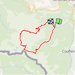
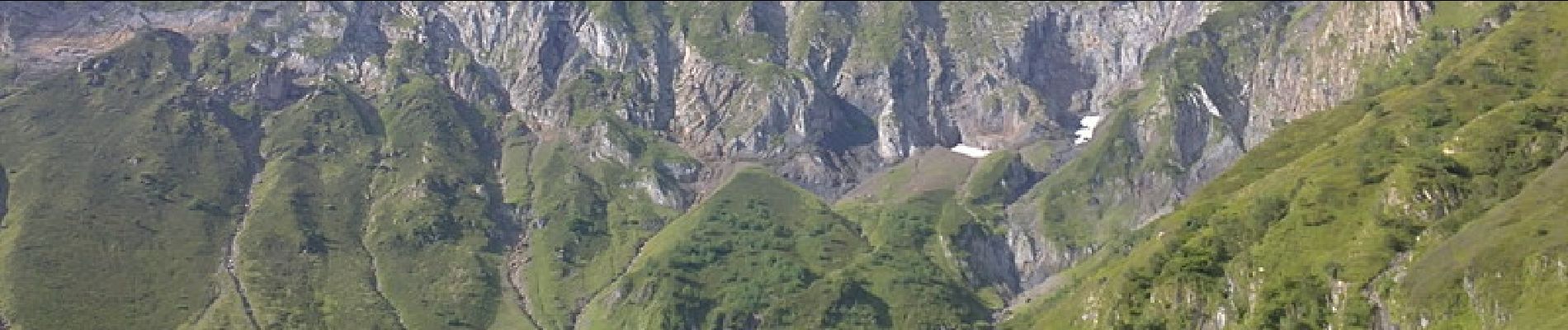
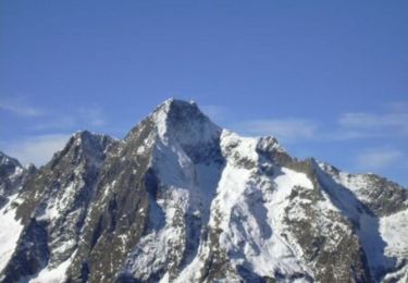
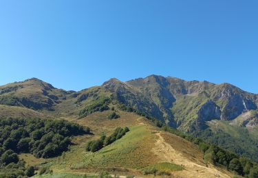
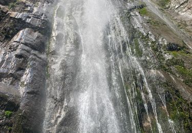
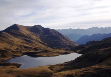
Trail Walking of 27 km to be discovered at Occitania, Ariège, Seix. This trail is proposed by tracegps.
Description
3kms après Seix sur la D3 direction Guzet Neige. A Moulin Lauga tourner à droite direction Estours, passer devant une centrale électrique sur la gauche continuer jusqu'au terminus où se trouve une autre centrale électrique. Jour1: Laisser la voiture au parking d'Estours à coté de la centrale électrique, prendre le chemin qui continue à longer le ruisseau d'Estours, passer la cabane de l'Artigue, monter le bois du Puech d'Aula jusqu'a la cabane d'Aula. A la cabane d'Aula, prendre un sentier très mal tracé sur la droite qui contourne le Quer de Bassibié par la droite en direction de col de Peyre Blanc. Au col suivre le sentier qui part sur la droite vers le Petit Valier jusqu'au col du Faustin puis l'ascension finale du Mont Valier. Descendre au refuge des Estagnous. Jour2: Au refuge prendre le sentier qui part au Nord (Col du Pécouch), descendre au déversoir des Étang de Milouga, remonter à la cabane d'Espugue. Ensuite continuer 200m après la cabane et virer sur la droite à l'Est pour passer au col de Crabérou. Descendre toujours vers l'est jusqu'à un plateau herbeux (la Lauze) où il est difficile de trouver le sentier pour entrer dans le bois qui mène à la cabane de Subéra. A la cabane suivre toujours vers l'est le sentier qui passe à la cabane de Lameza et qui vous ramène au parking d'Estours.
Positioning
Comments
Trails nearby
![Trail Walking Seix - Le Pic de Fonta - Photo](https://media.geolcdn.com/t/375/260/ext.jpg?maxdim=2&url=https%3A%2F%2Fservices.sitytrail.com%2FGeolivesWS%2FDownloadMedia.ashx%3FTrailID%3D109126%26Media%3D3167_1.jpg)
![Walking Walking](https://static1.geolcdn.com/sitytour/trail-icons/101.png)
Walking
![](/images/other/stat-length.png)
![](https://static1.geolcdn.com/siteimages/upload/files/16400158638029165_repeat_loop_refresh_sync_direction_icon.png)
![Trail Walking Bethmale - Cap de Bouirex - Photo](https://media.geolcdn.com/t/375/260/cd5f9d82-9db3-4878-a9ba-18a6e8856ce6.jpg&format=jpg&maxdim=2)
![Walking Walking](https://static1.geolcdn.com/sitytour/trail-icons/101.png)
Walking
![](/images/other/stat-length.png)
![](https://static1.geolcdn.com/siteimages/upload/files/16400158638029165_repeat_loop_refresh_sync_direction_icon.png)
![Trail Walking Seix - 2022 TRANSPYRÉNÉENNE : 6ème etape : Refuge d’Esbints - cabane Aula - Photo](https://media.geolcdn.com/t/375/260/c1446be7-6220-41d3-9aa6-02c934de1eff.jpg&format=jpg&maxdim=2)
![Walking Walking](https://static1.geolcdn.com/sitytour/trail-icons/101.png)
Walking
![](/images/other/stat-length.png)
![](https://static1.geolcdn.com/siteimages/upload/files/16400158638029165_repeat_loop_refresh_sync_direction_icon.png)
![Trail Walking Bethmale - Col de la core - Photo](https://media.geolcdn.com/t/375/260/4994e3ec-bda9-4da3-924c-fcb0e68be84a.jpg&format=jpg&maxdim=2)
![Walking Walking](https://static1.geolcdn.com/sitytour/trail-icons/101.png)
Walking
![](/images/other/stat-length.png)
![](https://static1.geolcdn.com/siteimages/upload/files/16400158638029165_repeat_loop_refresh_sync_direction_icon.png)
![Trail Walking Sentenac-d'Oust - 2020-08-25 col de la cor - col d'Auédole - étang d'Ayes - col d'Auédole - étang d'Eychelle - col de la core. - Photo](https://media.geolcdn.com/t/375/260/1d8e5b8e-ece0-4a83-9c05-d7dab1c422f8.jpg&format=jpg&maxdim=2)
![Walking Walking](https://static1.geolcdn.com/sitytour/trail-icons/101.png)
Walking
![](/images/other/stat-length.png)
![](https://static1.geolcdn.com/siteimages/upload/files/16400158638029165_repeat_loop_refresh_sync_direction_icon.png)
![Trail Walking Seix - Cour Vic - Photo](https://media.geolcdn.com/t/375/260/ext.jpg?maxdim=2&url=https%3A%2F%2Fstatic1.geolcdn.com%2Fsiteimages%2Fupload%2Ffiles%2F1553511878bg_sport_marche.png)
![Walking Walking](https://static1.geolcdn.com/sitytour/trail-icons/101.png)
![Trail Walking Seix - Cabane d'Aula - Photo](https://media.geolcdn.com/t/375/260/ext.jpg?maxdim=2&url=https%3A%2F%2Fservices.sitytrail.com%2FGeolivesWS%2FDownloadMedia.ashx%3FTrailID%3D834166%26Media%3Dfix__20170824100911.jpg)
![Walking Walking](https://static1.geolcdn.com/sitytour/trail-icons/101.png)
Walking
![](/images/other/stat-length.png)
![](https://static1.geolcdn.com/siteimages/upload/files/16400158638029165_repeat_loop_refresh_sync_direction_icon.png)
![Trail Walking Bethmale - Pyrénées-140903 - CapBouirex - Photo](https://media.geolcdn.com/t/375/260/ext.jpg?maxdim=2&url=https%3A%2F%2Fservices.sitytrail.com%2FGeolivesWS%2FDownloadMedia.ashx%3FTrailID%3D343286%26Media%3Dfix__20140903142824.jpg)
![Walking Walking](https://static1.geolcdn.com/sitytour/trail-icons/101.png)
Walking
![](/images/other/stat-length.png)
![](https://static1.geolcdn.com/siteimages/upload/files/16400158638029165_repeat_loop_refresh_sync_direction_icon.png)
![Trail Mountain bike Bethmale - Col de la Core - Port d'Aulat-Montgarri - Port d'Urets - Photo](https://media.geolcdn.com/t/375/260/ext.jpg?maxdim=2&url=https%3A%2F%2Fservices.sitytrail.com%2FGeolivesWS%2FDownloadMedia.ashx%3FTrailID%3D103910%26Media%3D6757_3.jpg)
![Mountain bike Mountain bike](https://static1.geolcdn.com/sitytour/trail-icons/202.png)
Mountain bike
![](/images/other/stat-length.png)
![](https://static1.geolcdn.com/siteimages/upload/files/16400158638029165_repeat_loop_refresh_sync_direction_icon.png)