![](/images/other/stat-length.png)
![Trail Cycle Dunkirk - Autour de Dunkerque - Photo](https://media.geolcdn.com/t/1900/400/ext.pjpeg?maxdim=2&url=https%3A%2F%2Fservices.sitytrail.com%2FGeolivesWS%2FDownloadMedia.ashx%3FTrailID%3D107002%26Media%3D11796_6.jpg)
Autour de Dunkerque
tracegps
User
![Length](/images/other/stat-length.png)
Length
57 km
![Max alt](https://static1.geolcdn.com/siteimages/upload/files/1508320355ic_sort_altitude_max_24dp.png)
Max alt
18 m
![Uphill gradient](https://static1.geolcdn.com/siteimages/upload/files/1508320355ic_sort_den_pos_24dp.png)
Uphill gradient
193 m
![Km-Effort](/images/other/stat-length.png)
Km-Effort
60 km
![Min alt](https://static1.geolcdn.com/siteimages/upload/files/1508320355ic_sort_altitude_min_24dp.png)
Min alt
-3 m
![Downhill gradient](https://static1.geolcdn.com/siteimages/upload/files/1508320355ic_sort_den_neg_24dp.png)
Downhill gradient
193 m
![Boucle](https://static1.geolcdn.com/siteimages/upload/files/16400158638029165_repeat_loop_refresh_sync_direction_icon.png)
Boucle
Yes
Creation date :
2014-12-10 00:00:00.0
Updated on :
2014-12-10 00:00:00.0
![Cycle](https://static1.geolcdn.com/sitytour/trail-icons/200.png)
3h00
Difficulty : Medium
![Scan this QR Code to open this trail in the SityTrail application](https://capi.geolives.com/qq0zvz2zws4bq2lad0pu/sitytour/trails/107002/qr.png?size=200)
FREE GPS app for hiking
About
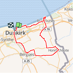
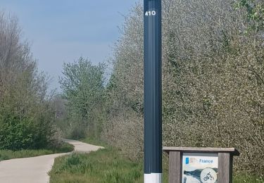
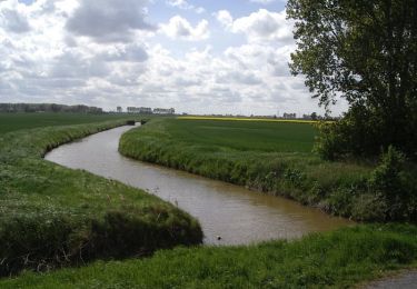
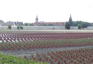
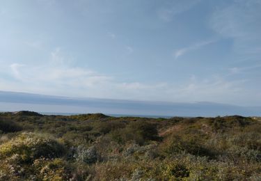
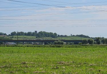
Trail Cycle of 57 km to be discovered at Hauts-de-France, Nord, Dunkirk. This trail is proposed by tracegps.
Description
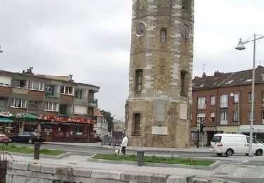
Circuit proposé par le guide du «Petit futé, édition 2007» Départ du quai des hollandais à Dunkerque. Retrouvez le circuit et son descriptif dans le guide 2007 du Petit Futé.
Positioning
Country:
France
Region :
Hauts-de-France
Department/Province :
Nord
Municipality :
Dunkirk
Location:
Dunkerque
Start:(Dec)
Start:(UTM)
456207 ; 5654273 (31U) N.
Comments
Trails nearby
![Trail Walking Dunkirk - Parcours d'architecture - Malo les Bains - Photo](https://media.geolcdn.com/t/375/260/ext.jpg?maxdim=2&url=https%3A%2F%2Fservices.sitytrail.com%2FGeolivesWS%2FDownloadMedia.ashx%3FTrailID%3D105238%26Media%3D8888_6.jpg)
![Walking Walking](https://static1.geolcdn.com/sitytour/trail-icons/101.png)
Parcours d'architecture - Malo les Bains
Walking
Easy
(2)
Dunkirk,
Hauts-de-France,
Nord,
France
![](/images/other/stat-length.png)
6 km | 6.4 km-effort
1h 30min
![](https://static1.geolcdn.com/siteimages/upload/files/16400158638029165_repeat_loop_refresh_sync_direction_icon.png)
Yes
![Trail Walking Leffrinckoucke - La dune Dewulf à Leffrinckoucke - Photo](https://media.geolcdn.com/t/375/260/abe5025f-cfa7-4895-992a-7ecc6a041d70.jpeg&format=jpg&maxdim=2)
![Walking Walking](https://static1.geolcdn.com/sitytour/trail-icons/101.png)
La dune Dewulf à Leffrinckoucke
Walking
Easy
Leffrinckoucke,
Hauts-de-France,
Nord,
France
![](/images/other/stat-length.png)
5 km | 5.3 km-effort
1h 24min
![](https://static1.geolcdn.com/siteimages/upload/files/16400158638029165_repeat_loop_refresh_sync_direction_icon.png)
Yes
![Trail Road bike Dunkirk - Dunkerque-frontière belge - Photo](https://media.geolcdn.com/t/375/260/2487dd4c-e2d7-43d3-a0c9-e180786a9c0b.jpg&format=jpg&maxdim=2)
![Road bike Road bike](https://static1.geolcdn.com/sitytour/trail-icons/201.png)
Dunkerque-frontière belge
Road bike
Easy
Dunkirk,
Hauts-de-France,
Nord,
France
![](/images/other/stat-length.png)
31 km | 33 km-effort
3h 4min
![](https://static1.geolcdn.com/siteimages/upload/files/16400158638029165_repeat_loop_refresh_sync_direction_icon.png)
No
![Trail Walking Coudekerque-Branche - Circuit des Forts de Coukerque à Bergues - Coudekerque-Branche - Photo](https://media.geolcdn.com/t/375/260/ext.jpg?maxdim=2&url=https%3A%2F%2Fservices.sitytrail.com%2FGeolivesWS%2FDownloadMedia.ashx%3FTrailID%3D111844%26Media%3D8605_6.jpg)
![Walking Walking](https://static1.geolcdn.com/sitytour/trail-icons/101.png)
Circuit des Forts de Coukerque à Bergues - Coudekerque-Branche
Walking
Difficult
Coudekerque-Branche,
Hauts-de-France,
Nord,
France
![](/images/other/stat-length.png)
14.4 km | 15.2 km-effort
3h 34min
![](https://static1.geolcdn.com/siteimages/upload/files/16400158638029165_repeat_loop_refresh_sync_direction_icon.png)
Yes
![Trail Walking Dunkirk - Circuit Jean Bart - Dunkerque - Photo](https://media.geolcdn.com/t/375/260/ext.jpg?maxdim=2&url=https%3A%2F%2Fservices.sitytrail.com%2FGeolivesWS%2FDownloadMedia.ashx%3FTrailID%3D109200%26Media%3D3280_6.jpg)
![Walking Walking](https://static1.geolcdn.com/sitytour/trail-icons/101.png)
Circuit Jean Bart - Dunkerque
Walking
Easy
Dunkirk,
Hauts-de-France,
Nord,
France
![](/images/other/stat-length.png)
6 km | 6.5 km-effort
1h 30min
![](https://static1.geolcdn.com/siteimages/upload/files/16400158638029165_repeat_loop_refresh_sync_direction_icon.png)
Yes
![Trail Walking Leffrinckoucke - Circuit des Maraichers - Leffrinckoucke - Photo](https://media.geolcdn.com/t/375/260/ext.jpg?maxdim=2&url=https%3A%2F%2Fservices.sitytrail.com%2FGeolivesWS%2FDownloadMedia.ashx%3FTrailID%3D105239%26Media%3D8889_5.jpg)
![Walking Walking](https://static1.geolcdn.com/sitytour/trail-icons/101.png)
Circuit des Maraichers - Leffrinckoucke
Walking
Medium
Leffrinckoucke,
Hauts-de-France,
Nord,
France
![](/images/other/stat-length.png)
10.6 km | 11.2 km-effort
2h 40min
![](https://static1.geolcdn.com/siteimages/upload/files/16400158638029165_repeat_loop_refresh_sync_direction_icon.png)
Yes
![Trail Walking Leffrinckoucke - Dune leffrinckoucke - Photo](https://media.geolcdn.com/t/375/260/d490e8a4-67de-4056-bf06-76399241eeb9.jpg&format=jpg&maxdim=2)
![Walking Walking](https://static1.geolcdn.com/sitytour/trail-icons/101.png)
Dune leffrinckoucke
Walking
Very difficult
Leffrinckoucke,
Hauts-de-France,
Nord,
France
![](/images/other/stat-length.png)
11.9 km | 12.8 km-effort
2h 53min
![](https://static1.geolcdn.com/siteimages/upload/files/16400158638029165_repeat_loop_refresh_sync_direction_icon.png)
Yes
![Trail Electric bike Téteghem-Coudekerque-Village - d'Etaples à Bray Dunes - Photo](https://media.geolcdn.com/t/375/260/85b4b7aa-d8ea-4fd2-a4be-ca2e3c68d43c.jpg&format=jpg&maxdim=2)
![Electric bike Electric bike](https://static1.geolcdn.com/sitytour/trail-icons/205.png)
d'Etaples à Bray Dunes
Electric bike
Very easy
Téteghem-Coudekerque-Village,
Hauts-de-France,
Nord,
France
![](/images/other/stat-length.png)
87 km | 93 km-effort
8h 26min
![](https://static1.geolcdn.com/siteimages/upload/files/16400158638029165_repeat_loop_refresh_sync_direction_icon.png)
No
![Trail Bicycle tourism Dunkirk - Rando Vélo avec Johannes 14/10/22 - Photo](https://media.geolcdn.com/t/375/260/ext.jpg?maxdim=2&url=https%3A%2F%2Fstatic1.geolcdn.com%2Fsiteimages%2Fupload%2Ffiles%2F1524743154velo.jpg)
![Bicycle tourism Bicycle tourism](https://static1.geolcdn.com/sitytour/trail-icons/204.png)
Rando Vélo avec Johannes 14/10/22
Bicycle tourism
Easy
Dunkirk,
Hauts-de-France,
Nord,
France
![](/images/other/stat-length.png)
31 km | 33 km-effort
2h 0min
![](https://static1.geolcdn.com/siteimages/upload/files/16400158638029165_repeat_loop_refresh_sync_direction_icon.png)
No