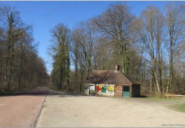
8.4 km | 10.2 km-effort
Cinqueux - Monceaux
tracegps
User
Length
13 km
Max alt
106 m
Uphill gradient
167 m
Km-Effort
15.2 km
Min alt
29 m
Downhill gradient
169 m
Boucle
Yes
Creation date :
2014-12-10 00:00:00.0
Updated on :
2014-12-10 00:00:00.0
2h49
Difficulty : Medium
FREE GPS app for hiking
About
Trail Walking of 13 km to be discovered at Hauts-de-France, Oise, Brenouille. This trail is proposed by tracegps.
Description
Circuit de 13Km avec malgré tout une petite cote sympa à la sortie d'Angicourt.
Positioning
Country:
France
Region :
Hauts-de-France
Department/Province :
Oise
Municipality :
Brenouille
Location:
Unknown
Start:(Dec)
Start:(UTM)
466362 ; 5461479 (31U) N.
Comments
Trails nearby
La mare aux oiseaux - Beaurepaire
Walking
Medium
(1)
Beaurepaire,
Hauts-de-France,
Oise,
France
2h 10min
Yes
Balade entre Saint-Martin-Longueau et Sacy-le-Petit
On foot
Easy
(1)
Saint-Martin-Longueau,
Hauts-de-France,
Oise,
France
13 km | 14.2 km-effort
Unknown
Yes
ot 6 octobre 24
Mountain bike
Medium
Pont-Sainte-Maxence,
Hauts-de-France,
Oise,
France
23 km | 27 km-effort
1h 54min
Yes
sortie AU5v Pentecôte 2022
Bicycle tourism
Easy
Pont-Sainte-Maxence,
Hauts-de-France,
Oise,
France
26 km | 29 km-effort
Unknown
Yes
balade pedestre 11 avril 2022
On foot
Easy
Pont-Sainte-Maxence,
Hauts-de-France,
Oise,
France
7.2 km | 9.1 km-effort
2h 4min
Yes
balade printanière du 23 mars
Electric bike
Easy
Pont-Sainte-Maxence,
Hauts-de-France,
Oise,
France
22 km | 26 km-effort
2h 14min
Yes
sortie 18 janvier 22
Electric bike
Easy
Pont-Sainte-Maxence,
Hauts-de-France,
Oise,
France
23 km | 27 km-effort
2h 4min
Yes
balade décembre 1er jour hiver
Electric bike
Easy
Pont-Sainte-Maxence,
Hauts-de-France,
Oise,
France
27 km | 32 km-effort
2h 21min
Yes
balade en halatte circuit 4
Electric bike
Medium
Pont-Sainte-Maxence,
Hauts-de-France,
Oise,
France
21 km | 26 km-effort
2h 7min
Yes