


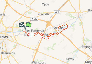


12.9 km | 14.3 km-effort


User


FREE GPS app for hiking
 SityTrail
IGN / Geographical institutes
SityTrail World
The world is yours!
Trail Mountain bike of 24 km to be discovered at Hauts-de-France, Pas-de-Calais, Athies. This trail is proposed by tracegps.
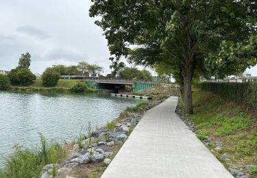
Aller le long de la berge Sud de la Scarpe, retour sur l'autre berge.

Walking

Walking
Walking

Walking
Walking
Walking

Walking

Walking

Walking