![](/images/other/stat-length.png)
![Trail Mountain bike Mondouzil - Les coteaux Est de Toulouse en VTT - de Mondouzil à Flourens - Photo](https://media.geolcdn.com/t/1900/400/ext.pjpeg?maxdim=2&url=https%3A%2F%2Fservices.sitytrail.com%2FGeolivesWS%2FDownloadMedia.ashx%3FTrailID%3D106849%26Media%3D11571_5.jpg)
Les coteaux Est de Toulouse en VTT - de Mondouzil à Flourens
tracegps
User
![Length](/images/other/stat-length.png)
![Max alt](https://static1.geolcdn.com/siteimages/upload/files/1508320355ic_sort_altitude_max_24dp.png)
![Uphill gradient](https://static1.geolcdn.com/siteimages/upload/files/1508320355ic_sort_den_pos_24dp.png)
![Km-Effort](/images/other/stat-length.png)
![Min alt](https://static1.geolcdn.com/siteimages/upload/files/1508320355ic_sort_altitude_min_24dp.png)
![Downhill gradient](https://static1.geolcdn.com/siteimages/upload/files/1508320355ic_sort_den_neg_24dp.png)
![Boucle](https://static1.geolcdn.com/siteimages/upload/files/16400158638029165_repeat_loop_refresh_sync_direction_icon.png)
![Mountain bike](https://static1.geolcdn.com/sitytour/trail-icons/202.png)
1h30
Difficulty : Medium
![Scan this QR Code to open this trail in the SityTrail application](https://capi.geolives.com/qq0zvz2zws4bq2lad0pu/sitytour/trails/106849/qr.png?size=200)
FREE GPS app for hiking
About
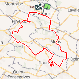
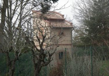
Trail Mountain bike of 21 km to be discovered at Occitania, Haute-Garonne, Mondouzil. This trail is proposed by tracegps.
Description
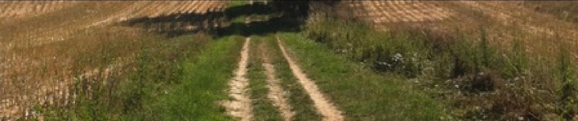
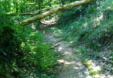
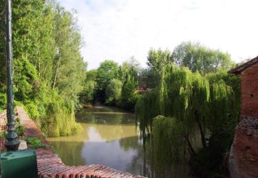
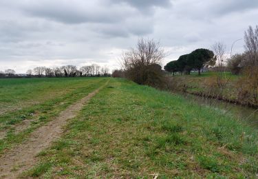
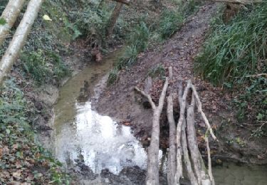
A partir du tracé du Fil Vert 2011, circuit du samedi, j’ai conservé la partie la moins urbaine. Départ de Mondouzil vers Mons. Après le Château de Mondouzil, on emprunte un sentier large puis étroit dans un bois privé, mais sans interdiction de passage. On traverse Mons sur un chemin très agréable avant de prendre à gauche une belle descente qui nous fait longer le lac de Trinchant. On reprend une petite partie goudronnée avant de retrouver un large chemin pour filer sur La Seillonne que l’on traverse sur un pont béton, attention pas de parapet… A droite puis à gauche vers La Grande Coupette sur une route départementale pour faire le tour du Lac de Flourens, une belle retenue bordée de verdure et de promeneurs. On retrouve le goudron pour passer sur la digue du lac puis remonter vers La Marchande avant de retrouver de larges pistes de terre. Puis la partie la moins intéressante par la D57 puis la D64 vers la Clinique d’Aufréry. De la circulation pour nous rappeler que l’on n’est pas si loin de la ville… Je m’écarte à ce moment du tracé original du Fil Vert qui redescend sur Balma. Je prolonge sur la D64 pour retrouver les chemins. Passage à Cayrol, puis à gauche, attention contourner l’arbre abattu par le champ à gauche. On se retrouve à Pin Balma, la traversée est amusante par un chemin bien entretenu puis la traversée d’un lotissement tout en cotes. On tourne à gauche sur la D66 puis de suite à droite pour une chouette descente (en bas de laquelle je n’ai pas retrouvé une source ??) et remontée vers Les Pountous et retour à Mondouzil. Au total un parcours facile et agréable avec une majorité de chemins aux portes de Toulouse. Merci le Grand Toulouse !!!
Positioning
Comments
Trails nearby
![Trail Walking Saint-Jean - Du Lac de St Jean de L'Union à Saint Geniès Bellevue par le ruisseau de Pichounelle - Photo](https://media.geolcdn.com/t/375/260/ext.jpg?maxdim=2&url=https%3A%2F%2Fservices.sitytrail.com%2FGeolivesWS%2FDownloadMedia.ashx%3FTrailID%3D105269%26Media%3D8937_4.jpg)
![Walking Walking](https://static1.geolcdn.com/sitytour/trail-icons/101.png)
Walking
![](/images/other/stat-length.png)
![](https://static1.geolcdn.com/siteimages/upload/files/16400158638029165_repeat_loop_refresh_sync_direction_icon.png)
![Trail Walking Saint-Marcel-Paulel - Les sentiers de Saint Marcel Paulel - Photo](https://media.geolcdn.com/t/375/260/ext.jpg?maxdim=2&url=https%3A%2F%2Fservices.sitytrail.com%2FGeolivesWS%2FDownloadMedia.ashx%3FTrailID%3D103718%26Media%3D6285_5.jpg)
![Walking Walking](https://static1.geolcdn.com/sitytour/trail-icons/101.png)
Walking
![](/images/other/stat-length.png)
![](https://static1.geolcdn.com/siteimages/upload/files/16400158638029165_repeat_loop_refresh_sync_direction_icon.png)
![Trail Mountain bike Saint-Jean - st jean pechbonnieu 1ère fois - Photo](https://media.geolcdn.com/t/375/260/ext.jpg?maxdim=2&url=https%3A%2F%2Fstatic1.geolcdn.com%2Fsiteimages%2Fupload%2Ffiles%2F1524743154velo.jpg)
![Mountain bike Mountain bike](https://static1.geolcdn.com/sitytour/trail-icons/202.png)
Mountain bike
![](/images/other/stat-length.png)
![](https://static1.geolcdn.com/siteimages/upload/files/16400158638029165_repeat_loop_refresh_sync_direction_icon.png)
![Trail Walking Montrabé - Rando des écoles - Montrabé - Photo](https://media.geolcdn.com/t/375/260/ext.jpg?maxdim=2&url=https%3A%2F%2Fservices.sitytrail.com%2FGeolivesWS%2FDownloadMedia.ashx%3FTrailID%3D173051%26Media%3D14572_5.jpg)
![Walking Walking](https://static1.geolcdn.com/sitytour/trail-icons/101.png)
Walking
![](/images/other/stat-length.png)
![](https://static1.geolcdn.com/siteimages/upload/files/16400158638029165_repeat_loop_refresh_sync_direction_icon.png)
![Trail Running Saint-Jean - Du Lac de St Jean de L'Union à Saint Geniès Bellevue par le ruisseau de Pichounelle - Photo](https://media.geolcdn.com/t/375/260/ext.jpg?maxdim=2&url=https%3A%2F%2Fservices.sitytrail.com%2FGeolivesWS%2FDownloadMedia.ashx%3FTrailID%3D105270%26Media%3D8937_4.jpg)
![Running Running](https://static1.geolcdn.com/sitytour/trail-icons/103.png)
Running
![](/images/other/stat-length.png)
![](https://static1.geolcdn.com/siteimages/upload/files/16400158638029165_repeat_loop_refresh_sync_direction_icon.png)
![Trail Running Saint-Marcel-Paulel - Les sentiers de Saint Marcel Paulel - Photo](https://media.geolcdn.com/t/375/260/ext.jpg?maxdim=2&url=https%3A%2F%2Fservices.sitytrail.com%2FGeolivesWS%2FDownloadMedia.ashx%3FTrailID%3D103719%26Media%3D6285_5.jpg)
![Running Running](https://static1.geolcdn.com/sitytour/trail-icons/103.png)
Running
![](/images/other/stat-length.png)
![](https://static1.geolcdn.com/siteimages/upload/files/16400158638029165_repeat_loop_refresh_sync_direction_icon.png)
![Trail Walking Saint-Jean - Projet TT22 au départ de St Jean - Photo](https://media.geolcdn.com/t/375/260/5a219919-5176-472a-a689-aa98fab39714.jpg&format=jpg&maxdim=2)
![Walking Walking](https://static1.geolcdn.com/sitytour/trail-icons/101.png)
Walking
![](/images/other/stat-length.png)
![](https://static1.geolcdn.com/siteimages/upload/files/16400158638029165_repeat_loop_refresh_sync_direction_icon.png)
![Trail Walking Saint-Jean - entre st jean et st geniès - Photo](https://media.geolcdn.com/t/375/260/ext.jpg?maxdim=2&url=https%3A%2F%2Fservices.sitytrail.com%2FGeolivesWS%2FDownloadMedia.ashx%3FTrailID%3D368190%26Media%3Dfix__20141207162221.jpg)
![Walking Walking](https://static1.geolcdn.com/sitytour/trail-icons/101.png)
Walking
![](/images/other/stat-length.png)
![](https://static1.geolcdn.com/siteimages/upload/files/16400158638029165_repeat_loop_refresh_sync_direction_icon.png)
![Trail Running Saint-Jean - Rouffiac - Montrabé - Photo](https://media.geolcdn.com/t/375/260/ext.jpg?maxdim=2&url=https%3A%2F%2Fservices.sitytrail.com%2FGeolivesWS%2FDownloadMedia.ashx%3FTrailID%3D101975%26Media%3D2272_1.jpg)
![Running Running](https://static1.geolcdn.com/sitytour/trail-icons/103.png)
Running
![](/images/other/stat-length.png)
![](https://static1.geolcdn.com/siteimages/upload/files/16400158638029165_repeat_loop_refresh_sync_direction_icon.png)