Trail Walking Sauzet - De Sauzet à St Pantaléon - Photo

De Sauzet à St Pantaléon

 tracegps
tracegps

User

© OpenStreetMap contributors
Length
Length
29 km
Max alt
Max alt
296 m
Uphill gradient
Uphill gradient
478 m
Km-Effort
Km-Effort  
35 km
Min alt
Min alt
187 m
Downhill gradient
Downhill gradient
477 m
Boucle
Boucle
Yes
Creation date :
2014-12-10 00:00:00.0
Updated on :
2014-12-10 00:00:00.0

(0 Reviews)

Walking
Walking
6h00
Difficulty : Difficult

Scan this QR Code to open this trail in the SityTrail application

FREE GPS app for hiking

Logo SityTrail SityTrail

IGN / Geographical institutes

Download SityTrail from the App Store Download SityTrail from Google Play

Logo SityTrail SityTrail World

The world is yours!

Download SityTrail from the App Store Download SityTrail from Google Play Download SityTrail on Huawei AppGallery

About

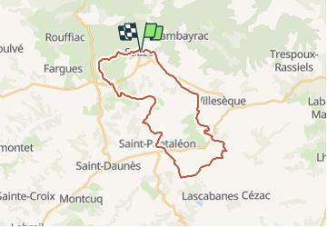
Trail Walking of 29 km to be discovered at Occitania, Lot, Sauzet. This trail is proposed by tracegps.

Description

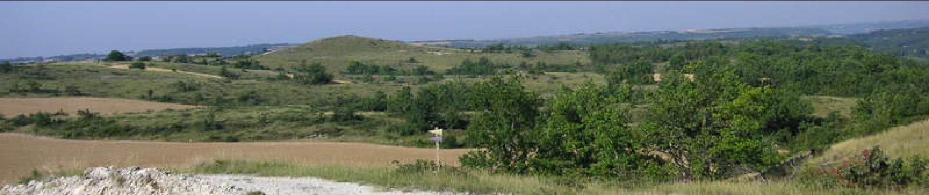
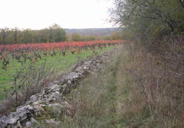
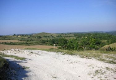
Départ parking de la mairie de Sauzet. Prendre la 4ème rue à gauche en direction d'Albas D37. Très belle randonnée qui est représentative des paysages du Quercy Blanc.

Elevation profile

Photos

Positioning

Country:
France
Region :
Occitania
Department/Province :
Lot
Municipality :
Sauzet
Location:
Unknown
Start:(UTM)
361024 ; 4919744 (31T) N.

Trails nearby

Trail Walking Villesèque - Villeseque Bagat  - Photo
Walking
GUIDE
antignacs

Walking

Very easy
Villesèque, Occitania, Lot, France
13.9 km | 16.4 km-effort
2h 59min
Yes
Trail Mountain bike Sauzet - De Sauzet à Luzech - Photo
Mountain bike
tracegps

Mountain bike

Difficult
Sauzet, Occitania, Lot, France
30 km | 39 km-effort
2h 30min
Yes
Trail Walking Sauzet - De Sauzet à Luzech - Photo
Walking
tracegps

Walking

Difficult
Sauzet, Occitania, Lot, France
30 km | 39 km-effort
7h 0min
Yes
Trail Mountain bike Sauzet - De Sauzet à St Pantaléon - Photo
Mountain bike
tracegps

Mountain bike

Medium
Sauzet, Occitania, Lot, France
29 km | 35 km-effort
2h 30min
Yes
Trail Walking Cambayrac - Cambeyrac - Photo
Walking
thomas.o.vert

Walking

Medium
Cambayrac, Occitania, Lot, France
9.8 km | 12.4 km-effort
2h 11min
Yes
Trail Walking Villesèque - Trebai 3 - Photo
Walking
GUIDE
antignacs

Walking

Easy
Villesèque, Occitania, Lot, France
8.3 km | 10.3 km-effort
1h 56min
Yes
Trail Walking Saint-Vincent-Rive-d'Olt - Château Labouysse - Photo
Walking
gouinpatrice

Walking

Easy
Saint-Vincent-Rive-d'Olt, Occitania, Lot, France
6.4 km | 9 km-effort
1h 56min
Yes
Trail Walking Cambayrac - gorges de landorre Cambayrac - Photo
Walking
BernardEsteban

Walking

Medium
Cambayrac, Occitania, Lot, France
13.1 km | 16.3 km-effort
4h 46min
Yes
Trail Bicycle tourism Albas - R_paul alblas lot - Photo
Bicycle tourism
verleihnix

Bicycle tourism

Medium
Albas, Occitania, Lot, France
45 km | 56 km-effort
3h 40min
Yes


Close
My subscriptions