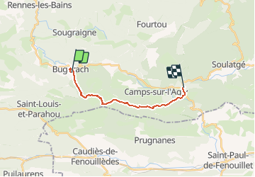
![](/images/other/stat-length.png)
![Trail Walking Bugarach - Sentier Cathare - de Bugarach à Cubières - Photo](https://media.geolcdn.com/t/1900/400/ext.pjpeg?maxdim=2&url=https%3A%2F%2Fservices.sitytrail.com%2FGeolivesWS%2FDownloadMedia.ashx%3FTrailID%3D106637%26Media%3D11247_6.jpg)
Sentier Cathare - de Bugarach à Cubières
tracegps
User
![Length](/images/other/stat-length.png)
![Max alt](https://static1.geolcdn.com/siteimages/upload/files/1508320355ic_sort_altitude_max_24dp.png)
![Uphill gradient](https://static1.geolcdn.com/siteimages/upload/files/1508320355ic_sort_den_pos_24dp.png)
![Km-Effort](/images/other/stat-length.png)
![Min alt](https://static1.geolcdn.com/siteimages/upload/files/1508320355ic_sort_altitude_min_24dp.png)
![Downhill gradient](https://static1.geolcdn.com/siteimages/upload/files/1508320355ic_sort_den_neg_24dp.png)
![Boucle](https://static1.geolcdn.com/siteimages/upload/files/16400158638029165_repeat_loop_refresh_sync_direction_icon.png)
![Walking](https://static1.geolcdn.com/sitytour/trail-icons/101.png)
6h30
Difficulty : Medium
![Scan this QR Code to open this trail in the SityTrail application](https://capi.geolives.com/qq0zvz2zws4bq2lad0pu/sitytour/trails/106637/qr.png?size=200)
FREE GPS app for hiking
About
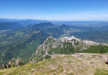
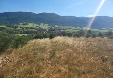
Trail Walking of 14.2 km to be discovered at Occitania, Aude, Bugarach. This trail is proposed by tracegps.
Description
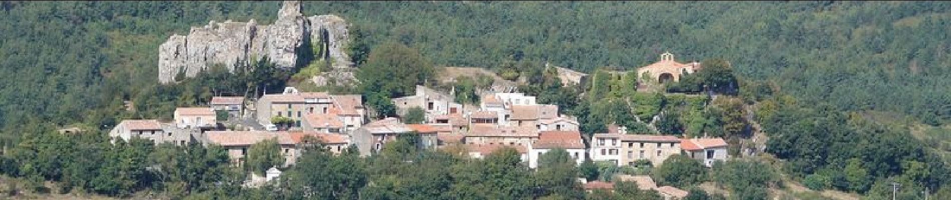
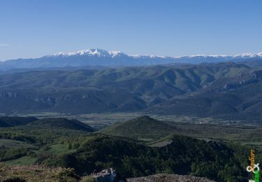
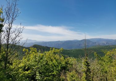
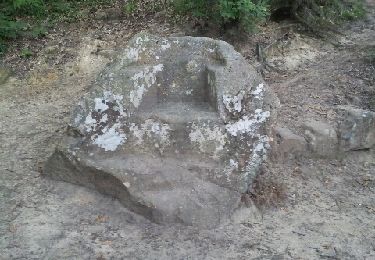
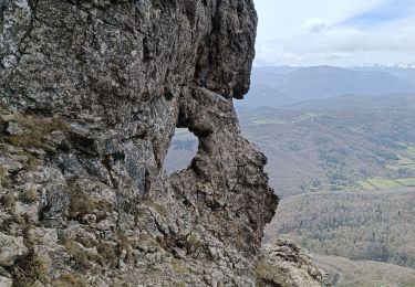
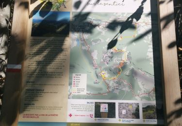
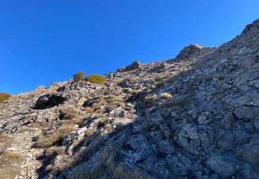
Étape 6 -20 kms- 700m dénivelé. Cette étape un peu particulière peut se faire de 2 façons sur le milieu du tronçon. La première partie commune: - Arrivé sous le pic, au gros bloc et un panneau sur la gauche "Sentier de la Fenêtre", prendre ce sentier. Montée un peu dure et parfois avec les mains pour attendre le sommet (attention en cas de fort vent) et ensuite on revient sur nos pas 150 m et on suit un sentier (sur la gauche) qui passe sous le pic et qui va rejoindre la crête (pose des mains et une partie équipée de corde sur 5 m) et ensuite le col de Péchine. Cette variante n'est à faire que par des personnes qui ont un bon pied montagnard et pas peur du vide. Ce parcours n'est pas sur la trace de ce tronçon mais sur celui Pic de Bugarach. - Arrivé sous le pic, au gros bloc et le panneau "Sentier de la Fenêtre" sur la gauche, aller tout droit dans la foret. Arriver à Campeau et suivre le sentier qui va au dessus du village de Camps. La descente sur Cubières est très jolie. Le village de Cubières aux Portes de l'Aude et des Pyrénées Orientales.
Positioning
Comments
Trails nearby
![Trail Walking Bugarach - Le Pech de Bugarach - Photo](https://media.geolcdn.com/t/375/260/ext.jpg?maxdim=2&url=https%3A%2F%2Fservices.sitytrail.com%2FGeolivesWS%2FDownloadMedia.ashx%3FTrailID%3D103373%26Media%3D5434_4.jpg)
![Walking Walking](https://static1.geolcdn.com/sitytour/trail-icons/101.png)
Walking
![](/images/other/stat-length.png)
![](https://static1.geolcdn.com/siteimages/upload/files/16400158638029165_repeat_loop_refresh_sync_direction_icon.png)
![Trail Walking Bugarach - Le Pech de Bugarach 1230 m, depuis le Col du Linas - Photo](https://media.geolcdn.com/t/375/260/ext.jpg?maxdim=2&url=https%3A%2F%2Fservices.sitytrail.com%2FGeolivesWS%2FDownloadMedia.ashx%3FTrailID%3D191665%26Media%3D15324_1.jpg)
![Walking Walking](https://static1.geolcdn.com/sitytour/trail-icons/101.png)
Walking
![](/images/other/stat-length.png)
![](https://static1.geolcdn.com/siteimages/upload/files/16400158638029165_repeat_loop_refresh_sync_direction_icon.png)
![Trail Walking Bugarach - Bugarach par la fenêtre - Photo](https://media.geolcdn.com/t/375/260/f61c8120-4edd-4c37-b8d1-8f8539bc9df7.jpg&format=jpg&maxdim=2)
![Walking Walking](https://static1.geolcdn.com/sitytour/trail-icons/101.png)
Walking
![](/images/other/stat-length.png)
![](https://static1.geolcdn.com/siteimages/upload/files/16400158638029165_repeat_loop_refresh_sync_direction_icon.png)
![Trail Walking Rennes-les-Bains - Sources Rennes les bains - Photo](https://media.geolcdn.com/t/375/260/ext.jpg?maxdim=2&url=https%3A%2F%2Fservices.sitytrail.com%2FGeolivesWS%2FDownloadMedia.ashx%3FTrailID%3D139042%26Media%3D20120625205934.jpeg)
![Walking Walking](https://static1.geolcdn.com/sitytour/trail-icons/101.png)
Walking
![](/images/other/stat-length.png)
![](https://static1.geolcdn.com/siteimages/upload/files/16400158638029165_repeat_loop_refresh_sync_direction_icon.png)
![Trail Walking Bugarach - pic du Bugarach - Photo](https://media.geolcdn.com/t/375/260/0be0b540-d788-4840-b942-68a2805d5a8a.jpg&format=jpg&maxdim=2)
![Walking Walking](https://static1.geolcdn.com/sitytour/trail-icons/101.png)
Walking
![](/images/other/stat-length.png)
![](https://static1.geolcdn.com/siteimages/upload/files/16400158638029165_repeat_loop_refresh_sync_direction_icon.png)
![Trail Walking Bugarach - le Pech de Bugarach - Lac de La vène - Photo](https://media.geolcdn.com/t/375/260/d1455a7d-4be7-4620-998d-a60e0cfc8767.jpg&format=jpg&maxdim=2)
![Walking Walking](https://static1.geolcdn.com/sitytour/trail-icons/101.png)
Walking
![](/images/other/stat-length.png)
![](https://static1.geolcdn.com/siteimages/upload/files/16400158638029165_repeat_loop_refresh_sync_direction_icon.png)
![Trail Walking Sougraigne - Sougraigne bugarach pont romain - Photo](https://media.geolcdn.com/t/375/260/ad5479a5-b384-460d-9d60-d556ca1f7a71.jpg&format=jpg&maxdim=2)
![Walking Walking](https://static1.geolcdn.com/sitytour/trail-icons/101.png)
Walking
![](/images/other/stat-length.png)
![](https://static1.geolcdn.com/siteimages/upload/files/16400158638029165_repeat_loop_refresh_sync_direction_icon.png)
![Trail Walking Bugarach - Tour Bugarach - Photo](https://media.geolcdn.com/t/375/260/8fec2c3e-ab59-425a-8e19-942b2c7606b2.jpg&format=jpg&maxdim=2)
![Walking Walking](https://static1.geolcdn.com/sitytour/trail-icons/101.png)
![Trail Walking Bugarach - Col du Linas-Pech de Bugarach-La fenêtre - Photo](https://media.geolcdn.com/t/375/260/45453090-280d-427b-b6e8-17db17de82e5.jpg&format=jpg&maxdim=2)
![Walking Walking](https://static1.geolcdn.com/sitytour/trail-icons/101.png)
Walking
![](/images/other/stat-length.png)
![](https://static1.geolcdn.com/siteimages/upload/files/16400158638029165_repeat_loop_refresh_sync_direction_icon.png)