
De Chelles à Saint Etienne Roilaye

tracegps
User

Length
8.2 km

Max alt
140 m

Uphill gradient
173 m

Km-Effort
10.5 km

Min alt
61 m

Downhill gradient
171 m
Boucle
Yes
Creation date :
2014-12-10 00:00:00.0
Updated on :
2014-12-10 00:00:00.0
2h30
Difficulty : Medium

FREE GPS app for hiking
About
Trail Walking of 8.2 km to be discovered at Hauts-de-France, Oise, Chelles. This trail is proposed by tracegps.
Description
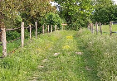
Une partie de la balade se fait sur la chaussée Brunehaut, l'ancienne voie romaine reliant Senlis à Soisson. Cette trace a été réalisée en associant les circuits n° 3 et n° 4 proposés par l'Office de Tourisme de Pierrefonds.
Positioning
Country:
France
Region :
Hauts-de-France
Department/Province :
Oise
Municipality :
Chelles
Location:
Unknown
Start:(Dec)
Start:(UTM)
502516 ; 5466720 (31U) N.
Comments
Trails nearby

Le Voliard


On foot
Easy
(1)
Pierrefonds,
Hauts-de-France,
Oise,
France

5.2 km | 6.4 km-effort
1h 27min
No

Rando couscous ATPC ARVAL 4/2/2024


Walking
Medium
(1)
Pierrefonds,
Hauts-de-France,
Oise,
France

9.6 km | 11.9 km-effort
2h 42min
Yes

Gorges du Han - ATPC ARVAL


Walking
Very easy
(1)
Vieux-Moulin,
Hauts-de-France,
Oise,
France

13.2 km | 16 km-effort
2h 42min
Yes

Le Mont-Collet


On foot
Easy
Trosly-Breuil,
Hauts-de-France,
Oise,
France

4.9 km | 6.6 km-effort
1h 29min
Yes

Les-hameaux-de-Montigny


On foot
Easy
Montigny-Lengrain,
Hauts-de-France,
Aisne,
France

9.3 km | 11.4 km-effort
2h 35min
Yes

Gorges du Han


Walking
Very easy
(1)
Vieux-Moulin,
Hauts-de-France,
Oise,
France

11.5 km | 13.8 km-effort
2h 42min
Yes

en forêt de Compiègne_30_la Tournante sous le Mont Saint-Mard


Walking
Very difficult
Pierrefonds,
Hauts-de-France,
Oise,
France

17.8 km | 22 km-effort
4h 41min
Yes

en forêt de Compiègne_27_la Tournante sur la Côte de Roilaye


Walking
Very difficult
Saint-Étienne-Roilaye,
Hauts-de-France,
Oise,
France

3.8 km | 4.9 km-effort
1h 5min
Yes

en forêt de Compiègne_26_la Grotte des Ramoneurs_Tournantes de la Queue de Sa...


Walking
Difficult
Vieux-Moulin,
Hauts-de-France,
Oise,
France

16.1 km | 18.6 km-effort
5h 28min
Yes


 SityTrail


