![](/images/other/stat-length.png)
![Trail Mountain bike Nogent-sur-Marne - De Paris à Meaux via les bords de Marne - Photo](https://media.geolcdn.com/t/1900/400/ext.pjpeg?maxdim=2&url=https%3A%2F%2Fservices.sitytrail.com%2FGeolivesWS%2FDownloadMedia.ashx%3FTrailID%3D106513%26Media%3D11066_1.jpg)
De Paris à Meaux via les bords de Marne
tracegps
User
![Length](/images/other/stat-length.png)
![Max alt](https://static1.geolcdn.com/siteimages/upload/files/1508320355ic_sort_altitude_max_24dp.png)
![Uphill gradient](https://static1.geolcdn.com/siteimages/upload/files/1508320355ic_sort_den_pos_24dp.png)
![Km-Effort](/images/other/stat-length.png)
![Min alt](https://static1.geolcdn.com/siteimages/upload/files/1508320355ic_sort_altitude_min_24dp.png)
![Downhill gradient](https://static1.geolcdn.com/siteimages/upload/files/1508320355ic_sort_den_neg_24dp.png)
![Boucle](https://static1.geolcdn.com/siteimages/upload/files/16400158638029165_repeat_loop_refresh_sync_direction_icon.png)
![Mountain bike](https://static1.geolcdn.com/sitytour/trail-icons/202.png)
6h00
Difficulty : Medium
![Scan this QR Code to open this trail in the SityTrail application](https://capi.geolives.com/qq0zvz2zws4bq2lad0pu/sitytour/trails/106513/qr.png?size=200)
FREE GPS app for hiking
About
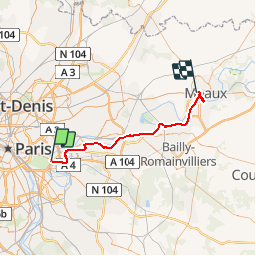
Trail Mountain bike of 48 km to be discovered at Ile-de-France, Val-de-Marne, Nogent-sur-Marne. This trail is proposed by tracegps.
Description
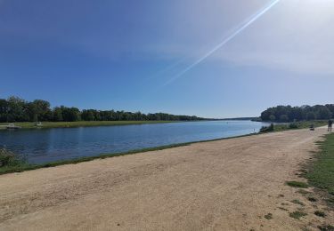
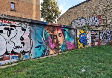
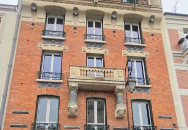
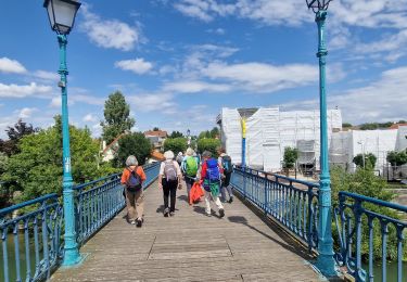
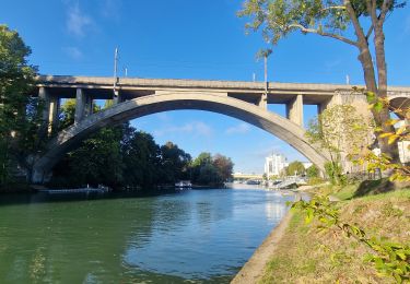
Balade sympathique le long de la Marne. La version par l'Ourq est peut être un peu plus sympathique. Celle-ci a l'avantage de longer le chemin de fer (en cas de pépin on peut faire un retour anticipé). Le circuit est reconstitué de mémoire et il peut y avoir quelques inexactitudes. Départ du RER A Nogent sur Marne, on rejoint la Marne et on la longe jusqu'à Neuilly sur Marne. Ici il doit être possible de couper par le canal de Chelles. Mais nous continuons le long de la Marne (rive gauche). Nous passons par une ancienne chocolaterie et à proximité de la base de plein air de Torcy (pique-nique possible). Lorsque l'on arrive dans la zone d'activité de la Courtillière, le long de la Marne n'est pas toujours praticable, il peut être nécessaire de passer par les rues à l'intérieur. On continue jusqu'a Chalifert. A ce stade il est possible de continuer le long de la Marne. Nous prenons un raccourci le long du canal de Meaux. La jonction se fait via un passage souterrain qui n'est pas très praticable. Il faut passer par dessus une colline (c'est le seul relief de la balade ;)). Il ne reste plus qu'à longer le canal jusqu'à Meaux (attention à ne pas prendre le canal du Grand Morin). On arrive en face de Meaux plage et du Parc du Patis. Si vous n'êtes pas trop fatigué, vous pouvez faire un petit détour avant de rejoindre la gare. Le train de Meaux arrive à gare de l'Est.
Positioning
Comments
Trails nearby
![Trail Walking Chennevières-sur-Marne - J 18 12 km Pont de Chennevières - Photo](https://media.geolcdn.com/t/375/260/6347577b-7c01-4d78-a0ab-c4e201132c35.jpg&format=jpg&maxdim=2)
![Walking Walking](https://static1.geolcdn.com/sitytour/trail-icons/101.png)
Walking
![](/images/other/stat-length.png)
![](https://static1.geolcdn.com/siteimages/upload/files/16400158638029165_repeat_loop_refresh_sync_direction_icon.png)
![Trail Walking Paris - Rando à thème : Georges Brassens - Parcours complet - Photo](https://media.geolcdn.com/t/375/260/dd7b2106-cdfc-45d2-b882-21cd74d02774.jpg&format=jpg&maxdim=2)
![Walking Walking](https://static1.geolcdn.com/sitytour/trail-icons/101.png)
Walking
![](/images/other/stat-length.png)
![](https://static1.geolcdn.com/siteimages/upload/files/16400158638029165_repeat_loop_refresh_sync_direction_icon.png)
![Trail Walking Neuilly-Plaisance - Neuilly Plaisance gare Rer sortie Bords de Marne/ Base Nautique Vaires sur Marne - Photo](https://media.geolcdn.com/t/375/260/3fb9e5a2-0030-4f1a-a960-e880d0c7625d.jpg&format=jpg&maxdim=2)
![Walking Walking](https://static1.geolcdn.com/sitytour/trail-icons/101.png)
Walking
![](/images/other/stat-length.png)
![](https://static1.geolcdn.com/siteimages/upload/files/16400158638029165_repeat_loop_refresh_sync_direction_icon.png)
![Trail Walking Paris - DP75-07 De Maraîchers au carrefour Daumesnil - Hecto-Malot - Photo](https://media.geolcdn.com/t/375/260/f01e2afd-b4ca-46d4-a57e-1d08cf143cbf.jpg&format=jpg&maxdim=2)
![Walking Walking](https://static1.geolcdn.com/sitytour/trail-icons/101.png)
Walking
![](/images/other/stat-length.png)
![](https://static1.geolcdn.com/siteimages/upload/files/16400158638029165_repeat_loop_refresh_sync_direction_icon.png)
![Trail Walking Saint-Maur-des-Fossés - 2025-01-08_16h55m46_de saint maur des fossés à école véterinaire au bord de la marne - Photo](https://media.geolcdn.com/t/375/260/ext.jpg?maxdim=2&url=https%3A%2F%2Fstatic1.geolcdn.com%2Fsiteimages%2Fupload%2Ffiles%2F1553511878bg_sport_marche.png)
![Walking Walking](https://static1.geolcdn.com/sitytour/trail-icons/101.png)
Walking
![](/images/other/stat-length.png)
![](https://static1.geolcdn.com/siteimages/upload/files/16400158638029165_repeat_loop_refresh_sync_direction_icon.png)
![Trail Walking Vincennes - Vincennes parcours architectural - Photo](https://media.geolcdn.com/t/375/260/5abdfb6b-f8e3-406a-a199-f0f63635a14c.jpg&format=jpg&maxdim=2)
![Walking Walking](https://static1.geolcdn.com/sitytour/trail-icons/101.png)
Walking
![](/images/other/stat-length.png)
![](https://static1.geolcdn.com/siteimages/upload/files/16400158638029165_repeat_loop_refresh_sync_direction_icon.png)
![Trail Walking Vincennes - Parcours street art Vincennes au 18/10/2024 - Photo](https://media.geolcdn.com/t/375/260/417378cf-603b-415f-a769-d28d8227e90e.jpg&format=jpg&maxdim=2)
![Walking Walking](https://static1.geolcdn.com/sitytour/trail-icons/101.png)
Walking
![](/images/other/stat-length.png)
![](https://static1.geolcdn.com/siteimages/upload/files/16400158638029165_repeat_loop_refresh_sync_direction_icon.png)
![Trail Walking Saint-Maur-des-Fossés - Randopolitain les bords de Marne 18 km - Photo](https://media.geolcdn.com/t/375/260/1f0cf9d1-3287-43b2-b3a1-db1ac230c6c3.jpg&format=jpg&maxdim=2)
![Walking Walking](https://static1.geolcdn.com/sitytour/trail-icons/101.png)
Walking
![](/images/other/stat-length.png)
![](https://static1.geolcdn.com/siteimages/upload/files/16400158638029165_repeat_loop_refresh_sync_direction_icon.png)
![Trail On foot Champigny-sur-Marne - Sur les bords de Marne - Photo](https://media.geolcdn.com/t/375/260/0848a8c4-6d65-4224-9dca-3686da6f2272.jpg&format=jpg&maxdim=2)
![On foot On foot](https://static1.geolcdn.com/sitytour/trail-icons/100.png)
On foot
![](/images/other/stat-length.png)
![](https://static1.geolcdn.com/siteimages/upload/files/16400158638029165_repeat_loop_refresh_sync_direction_icon.png)