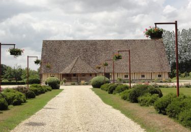
9.8 km | 11 km-effort
ouville l'abbaye
© OpenStreetMap contributors
Walking
1h33
Difficulty : Easy
Length
6.3 km
Max alt
162 m
Uphill gradient
59 m
Km-Effort
7.1 km
Min alt
131 m
Downhill gradient
61 m
Boucle
Yes
Creation date :
2019-01-15 18:14:33.043
Updated on :
2019-01-15 18:14:33.043
1h33
Difficulty : Easy
FREE GPS app for hiking
About
Trail Walking of 6.3 km to be discovered at Normandy, Seine-Maritime, Ouville-l'Abbaye. This trail is proposed by nicole.reine@wanadoo.fr.
Description
départ de la mairie
Positioning
Country:
France
Region :
Normandy
Department/Province :
Seine-Maritime
Municipality :
Ouville-l'Abbaye
Location:
Unknown
Start:(Dec)
Start:(UTM)
345633 ; 5506861 (31U) N.
Comments
Trails nearby
Au Détours des Châteaux de Saint-Martin-aux-Arbres
On foot
Easy
Motteville,
Normandy,
Seine-Maritime,
France
2h 29min
Yes
La voie romaine
On foot
Easy
Étoutteville,
Normandy,
Seine-Maritime,
France
7.2 km | 8.2 km-effort
1h 51min
Yes
Tour d'Yerville
On foot
Easy
Yerville,
Normandy,
Seine-Maritime,
France
8 km | 8.7 km-effort
1h 58min
Yes
OUVILLE L'ABBAYE
Walking
Medium
Ouville-l'Abbaye,
Normandy,
Seine-Maritime,
France
10.4 km | 11.7 km-effort
2h 39min
Yes
Le Château de Galleville
Walking
Medium
Étalleville,
Normandy,
Seine-Maritime,
France
12 km | 14 km-effort
3h 10min
Yes
rando AM août Etaleville
Walking
Very easy
Étalleville,
Normandy,
Seine-Maritime,
France
11.8 km | 13.8 km-effort
17min
Yes
rando 7 juillet #M
Walking
Very easy
Criquetot-sur-Ouville,
Normandy,
Seine-Maritime,
France
6.3 km | 6.9 km-effort
1h 41min
Yes
rando 7 juillet matin
Walking
Very easy
Étalleville,
Normandy,
Seine-Maritime,
France
11 km | 12.9 km-effort
2h 58min
Yes