Trail Walking Vézins-de-Lévézou - Pic du Pal  - Plateau du Lévézou - Gleyzenove - Photo

Pic du Pal - Plateau du Lévézou - Gleyzenove

 tracegps
tracegps

User

© OpenStreetMap contributors
Length
Length
22 km
Max alt
Max alt
1146 m
Uphill gradient
Uphill gradient
609 m
Km-Effort
Km-Effort  
30 km
Min alt
Min alt
852 m
Downhill gradient
Downhill gradient
607 m
Boucle
Boucle
Yes
Creation date :
2014-12-10 00:00:00.0
Updated on :
2014-12-10 00:00:00.0

(0 Reviews)

Walking
Walking
6h00
Difficulty : Difficult

Scan this QR Code to open this trail in the SityTrail application

FREE GPS app for hiking

Logo SityTrail SityTrail

IGN / Geographical institutes

Download SityTrail from the App Store Download SityTrail from Google Play

Logo SityTrail SityTrail World

The world is yours!

Download SityTrail from the App Store Download SityTrail from Google Play Download SityTrail on Huawei AppGallery

About

Trail Walking of 22 km to be discovered at Occitania, Aveyron, Vézins-de-Lévézou. This trail is proposed by tracegps.

Description

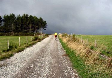
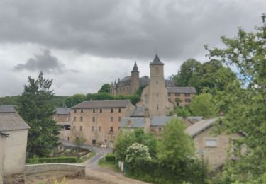
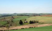
Départ du Village Gleyzenove (3 kms au Sud de Vezins du Levezou). Se diriger à l'Ouest jusqu'à Belvezet, le Lac et Laclau, avant d'accéder au Puech du Pal (1155m). Superbe panorama sur la Vallée de l'Aveyron, Causse Sévéragais et à l'horizon les Monts de l'Aubrac et du Cantal. Arriver à Vézins par Maison Neuve, visiter ce charmant village du Lévézou, à 950m d'altitude avec son très beau Château (photo). Terminer le parcours par Le Combal et le hameau Frontin.

Elevation profile

Photos

Positioning

Country:
France
Region :
Occitania
Department/Province :
Aveyron
Municipality :
Vézins-de-Lévézou
Location:
Unknown
Start:(UTM)
495908 ; 4900847 (31T) N.

Trails nearby

Trail Mountain bike Vézins-de-Lévézou - Tour des Monts du Lévézou - Photo
Mountain bike
tracegps

Mountain bike

Very difficult
(2)
Vézins-de-Lévézou, Occitania, Aveyron, France
92 km | 120 km-effort
11h 0min
Yes
Trail Walking Vézins-de-Lévézou - Autour de VEZINS PIC DU PAL La Clau VEZINS - Photo
Walking
Dominique48

Walking

Medium
Vézins-de-Lévézou, Occitania, Aveyron, France
14.6 km | 19.9 km-effort
4h 25min
Yes
Trail Other activity Vézins-de-Lévézou - gleyzeunove - Photo
Other activity
Mas12

Other activity

Difficult
Vézins-de-Lévézou, Occitania, Aveyron, France
20 km | 27 km-effort
3h 26min
Yes
Trail Walking Saint-Léons - st leon. la glene - Photo
Walking
colber

Walking

Very easy
Saint-Léons, Occitania, Aveyron, France
13.5 km | 17.6 km-effort
3h 16min
Yes
Trail Walking Saint-Léons - st leon. la glene - Photo
Walking
colber

Walking

Very easy
Saint-Léons, Occitania, Aveyron, France
13.5 km | 17.6 km-effort
3h 16min
Yes
Trail Walking Vézins-de-Lévézou - la clau - Photo
Walking
leglisemichel

Walking

Medium
Vézins-de-Lévézou, Occitania, Aveyron, France
8 km | 11 km-effort
1h 58min
Yes
Trail Walking Vézins-de-Lévézou - vezins le pal-viaur - Photo
Walking
Frayssinet

Walking

Medium
Vézins-de-Lévézou, Occitania, Aveyron, France
21 km | 0 m-effort
5h 35min
Yes
Trail Walking Vézins-de-Lévézou - lesserac  - Photo
Walking
dusty3466

Walking

Medium
Vézins-de-Lévézou, Occitania, Aveyron, France
6.9 km | 8.7 km-effort
2h 9min
Yes
Trail On foot Vézins-de-Lévézou - Puech du Pal - Photo
On foot
ZITO12

On foot

Easy
Vézins-de-Lévézou, Occitania, Aveyron, France
15.7 km | 21 km-effort
Unknown
Yes


Close
My subscriptions