Trail Mountain bike Taurignan-Vieux - Espace VTT FFC Couserans-Volvestre en Pyrénées - Circuit de la plaine du Salat n°18 - Photo

Espace VTT FFC Couserans-Volvestre en Pyrénées - Circuit de la plaine du Salat n°18

 tracegps
tracegps

User

© OpenStreetMap contributors
Length
Length
13.6 km
Max alt
Max alt
392 m
Uphill gradient
Uphill gradient
81 m
Km-Effort
Km-Effort  
14.7 km
Min alt
Min alt
351 m
Downhill gradient
Downhill gradient
80 m
Boucle
Boucle
Yes
Creation date :
2014-12-10 00:00:00.0
Updated on :
2014-12-10 00:00:00.0

(1 Reviews)

Mountain bike
Mountain bike
1h00
Difficulty : Easy

Scan this QR Code to open this trail in the SityTrail application

FREE GPS app for hiking

Logo SityTrail SityTrail

IGN / Geographical institutes

Download SityTrail from the App Store Download SityTrail from Google Play

Logo SityTrail SityTrail World

The world is yours!

Download SityTrail from the App Store Download SityTrail from Google Play Download SityTrail on Huawei AppGallery

About

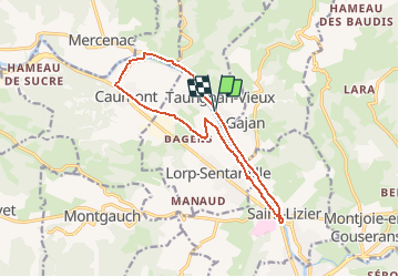
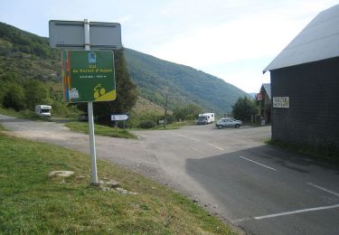
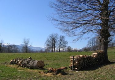
Trail Mountain bike of 13.6 km to be discovered at Occitania, Ariège, Taurignan-Vieux. This trail is proposed by tracegps.

Description

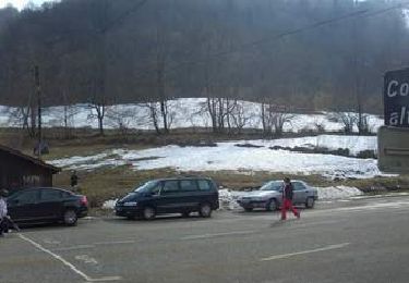
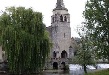
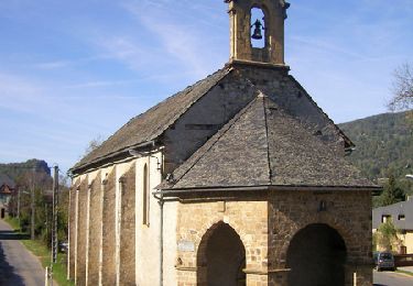
Espace VTT FFC Couserans-Volvestre en Pyrénées - Circuit de la plaine du Salat n°18 Circuit officiel labellisé par la Fédération Française de Cyclisme. Une balade familiale très facile empruntant principalement des portions routières ou de larges chemins agricoles. Ce circuit longe le Salat avec, en point de mire, l’un des plus beaux village de France : Saint-Lizier. Renseignements ; • Office de Tourisme Volvestre Couserans Place de l’Espy 09230 SAINTE-CROIX VOLVESTRE - Tél. 05 61 04 60 55 // Fax 05 61 66 27 98 - ot.volvestre.ariegeois (at) wanadoo.fr • Office de Tourisme de Saint-Lizier - Place Notre dame 09190 SAINT-LIZIER - Tél. 05 61 96 77 77 - ot.saintlizier (at) wanadoo.fr

Elevation profile

Photos

Positioning

Country:
France
Region :
Occitania
Department/Province :
Ariège
Municipality :
Taurignan-Vieux
Location:
Unknown
Start:(UTM)
346348 ; 4765392 (31T) N.

Comments

Please log in to post a review or rate the element


Trails nearby

Trail Walking Montjoie-en-Couserans - Tour du Montcaliver - Photo
Walking
FelixDucos

Walking

Very easy
(1)
Montjoie-en-Couserans, Occitania, Ariège, France
5.2 km | 8.5 km-effort
1h 16min
Yes
Trail Walking Saint-Lizier - 2023 09 20 CHEMIN du PIÉMONT PYRÉNÉEN - 13ème étape : Saint-Lizier - Moulis - Castillon-en-Couserans - Aragon - Aicazein - Orgibet - St Lary - Portet-d’Aspet - Photo
Walking
LEGUE

Walking

Difficult
Saint-Lizier, Occitania, Ariège, France
35 km | 46 km-effort
10h 59min
No
Trail Walking Saint-Girons - St girons la cascade d Aubert  - Photo
Walking
GUIDE
viaul

Walking

Medium
Saint-Girons, Occitania, Ariège, France
11.9 km | 17.7 km-effort
3h 3min
Yes
Trail Cycle Saint-Girons - Col de Latrape - St-Girons - Photo
Cycle
tracegps

Cycle

Difficult
Saint-Girons, Occitania, Ariège, France
82 km | 106 km-effort
4h 48min
Yes
Trail Cycle Saint-Girons - Voie de Piémont - St-Girons - Photo
Cycle
tracegps

Cycle

Medium
Saint-Girons, Occitania, Ariège, France
36 km | 43 km-effort
2h 0min
Yes
Trail Cycle Saint-Girons - Vallée du Salat - St-Girons - Photo
Cycle
tracegps

Cycle

Difficult
Saint-Girons, Occitania, Ariège, France
102 km | 137 km-effort
6h 0min
Yes
Trail Cycle Saint-Girons - Circuit de La Bellongue - St-Girons - Photo
Cycle
tracegps

Cycle

Difficult
Saint-Girons, Occitania, Ariège, France
89 km | 112 km-effort
5h 0min
Yes
Trail Walking Montjoie-en-Couserans - A M 2012-08-16 Tuc de Montcalivert - Photo
Walking
Toune73

Walking

Very easy
(2)
Montjoie-en-Couserans, Occitania, Ariège, France
4 km | 6.9 km-effort
1h 29min
Yes
Trail Mountain bike Caumont - Espace VTT FFC Couserans-Volvestre en Pyrénées - Sentier de Gèle n°20 - Photo
Mountain bike
tracegps

Mountain bike

Very difficult
Caumont, Occitania, Ariège, France
17.1 km | 22 km-effort
1h 45min
Yes


Close
My subscriptions