


14.7 km | 21 km-effort


User


FREE GPS app for hiking
 SityTrail
IGN / Geographical institutes
SityTrail World
The world is yours!
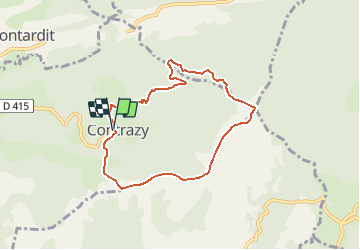
Trail Mountain bike of 7.3 km to be discovered at Occitania, Ariège, Contrazy. This trail is proposed by tracegps.
Espace VTT FFC Couserans-Volvestre en Pyrénées - Sentier du Bout de la Forêt n°07 Circuit officiel labellisé par la Fédération Française de Cyclisme. Un circuit court et sportif avec un splendide cheminement sur les crêtes les plus hautes du canton qui vous offriront une vue fabuleuse sur la chaîne pyrénéenne et une mosaïque de paysages d’autant plus savoureuse à l’automne et au printemps. Renseignements ; • Office de Tourisme Volvestre Couserans Place de l’Espy 09230 SAINTE-CROIX VOLVESTRE - Tél. 05 61 04 60 55 // Fax 05 61 66 27 98 - ot.volvestre.ariegeois (at) wanadoo.fr • Office de Tourisme de Saint-Lizier - Place Notre dame 09190 SAINT-LIZIER - Tél. 05 61 96 77 77 - ot.saintlizier (at) wanadoo.fr


Equestrian
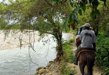
Equestrian

Walking
Walking
Walking
