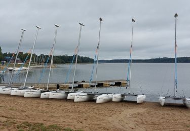
Trail Mountain bike Taupont - Vélo promenade n°7 - Taupont - Hélléan - Photo

Vélo promenade n°7 - Taupont - Hélléan

 tracegps
tracegps

User

© OpenStreetMap contributors
Length
Length
33 km
Max alt
Max alt
86 m
Uphill gradient
Uphill gradient
381 m
Km-Effort
Km-Effort  
38 km
Min alt
Min alt
26 m
Downhill gradient
Downhill gradient
381 m
Boucle
Boucle
Yes
Creation date :
2014-12-10 00:00:00.0
Updated on :
2014-12-10 00:00:00.0

(0 Reviews)

Mountain bike
Mountain bike
3h45
Difficulty : Difficult

Scan this QR Code to open this trail in the SityTrail application

FREE GPS app for hiking

Logo SityTrail SityTrail

IGN / Geographical institutes

Download SityTrail from the App Store Download SityTrail from Google Play

Logo SityTrail SityTrail World

The world is yours!

Download SityTrail from the App Store Download SityTrail from Google Play Download SityTrail on Huawei AppGallery

About

Trail Mountain bike of 33 km to be discovered at Brittany, Morbihan, Taupont. This trail is proposed by tracegps.

Description

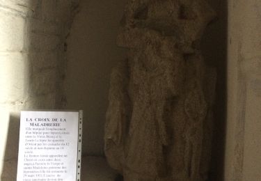
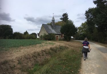
Point de départ : Église de Taupont (coordonnées GPS : 02°26’22’’O / 47°57’30’’N) - Distance : 35km (3h45) – niveau soutenu A voir en chemin : 1. La chapelle Saint Etienne de Crémenan (17ème siècle): elle a été restaurée dans les années 1990 selon des techniques anciennes. En 1996, la couverture de la chapelle et de son clocheton ont été remplacés. 15 modèles d’ardoises de grandeur différente ont été utilisés. 2. La chapelle de Saint Maudé : elle a été édifiée en 1431 à l’emplacement où furent enterrés les chevaliers tués lors du combat des Trente. Ses vitraux contemporains, réalisés par Olivier Debré, ainsi que ses sculptures de style flamboyant lui donnent un charme tout particulier. 3. Le château de Loyat : également appelé le château aux cent fenêtres, il est un héritage du siècle de Louis XV1 classé aux monuments historiques. Le parc forestier ainsi que les jardins se visitent. Renseignez vous ! 4. La chapelle de Quelneuc (13ème siècle) : Mathurin et Gildas sont les deux saints vénérés et priés dans cette chapelle, appelée d’ailleurs chapelle saint Mathurin. Elle remplaçait très certainement un précédent sanctuaire car le nom de Quelneuc signifie chapelle neuve. Points 1 et 4 : informations tirées de l’ouvrage de Paul Gilles « Au pays de Ploërmel, Taupont » Contact : Office de tourisme de Ploërmel « Terres de légendes » - Tel : 02 97 74 02 70 – Email : accueil (at) tourisme-ploermel.com

Elevation profile

Positioning

Country:
France
Region :
Brittany
Department/Province :
Morbihan
Municipality :
Taupont
Location:
Unknown
Start:(UTM)
541764 ; 5311924 (30T) N.

Trails nearby

Trail Walking Taupont - GR_37_CG_41_Taupont_Josselin_20221015 - Photo
Walking
patrickdanilo

Walking

Very difficult
Taupont, Brittany, Morbihan, France
21 km | 25 km-effort
5h 18min
No
Trail Walking Ploërmel - LAC AU DUC (56) - Photo
Walking
0010Jacem.1957

Walking

Very easy
Ploërmel, Brittany, Morbihan, France
14.6 km | 16.1 km-effort
2h 42min
Yes
Trail Mountain bike Ploërmel - 56-ploermel_vtt_josselin_46kmD450m - Photo
Mountain bike
SyMA

Mountain bike

Medium
Ploërmel, Brittany, Morbihan, France
47 km | 53 km-effort
4h 1min
Yes
Trail Walking Ploërmel - la ville bouquet - Photo
Walking
motardfou.dgs

Walking

Easy
Ploërmel, Brittany, Morbihan, France
10.1 km | 11.8 km-effort
2h 27min
No
Trail Other activity Taupont - taupins - Photo
Other activity
bourdet

Other activity

Very easy
Taupont, Brittany, Morbihan, France
21 km | 24 km-effort
5h 59min
No
Trail Nordic walking Loyat - 2018-10-25 TOUR DU LAC AU DUC - Photo
Nordic walking
rousseau.mich

Nordic walking

Very easy
Loyat, Brittany, Morbihan, France
16.9 km | 18.3 km-effort
3h 48min
Yes
Trail Nordic walking Taupont - 2018-09-30 TAUPONT CHEMIN DES CHAPELLES - Photo
Nordic walking
rousseau.mich

Nordic walking

Very easy
Taupont, Brittany, Morbihan, France
11.5 km | 13 km-effort
2h 36min
Yes
Trail Walking Ploërmel - 2017-11-01 LA CHATOULLETTE - Photo
Walking
rousseau.mich

Walking

Easy
Ploërmel, Brittany, Morbihan, France
5 km | 6.5 km-effort
1h 21min
Yes
Trail Walking Guillac - lA croix des AnglaiS - Photo
Walking
shadow

Walking

Easy
Guillac, Brittany, Morbihan, France
6.4 km | 7.6 km-effort
1h 40min
Yes


Close
My subscriptions