![](/images/other/stat-length.png)
![Trail Mountain bike Bozouls - Roquelaure au départ de Bozouls - Photo](https://media.geolcdn.com/t/1900/400/ext.pjpeg?maxdim=2&url=https%3A%2F%2Fservices.sitytrail.com%2FGeolivesWS%2FDownloadMedia.ashx%3FTrailID%3D106345%26Media%3D10807_4.jpg)
Roquelaure au départ de Bozouls
tracegps
User
![Length](/images/other/stat-length.png)
![Max alt](https://static1.geolcdn.com/siteimages/upload/files/1508320355ic_sort_altitude_max_24dp.png)
![Uphill gradient](https://static1.geolcdn.com/siteimages/upload/files/1508320355ic_sort_den_pos_24dp.png)
![Km-Effort](/images/other/stat-length.png)
![Min alt](https://static1.geolcdn.com/siteimages/upload/files/1508320355ic_sort_altitude_min_24dp.png)
![Downhill gradient](https://static1.geolcdn.com/siteimages/upload/files/1508320355ic_sort_den_neg_24dp.png)
![Boucle](https://static1.geolcdn.com/siteimages/upload/files/16400158638029165_repeat_loop_refresh_sync_direction_icon.png)
![Mountain bike](https://static1.geolcdn.com/sitytour/trail-icons/202.png)
4h19
Difficulty : Difficult
![Scan this QR Code to open this trail in the SityTrail application](https://capi.geolives.com/qq0zvz2zws4bq2lad0pu/sitytour/trails/106345/qr.png?size=200)
FREE GPS app for hiking
About
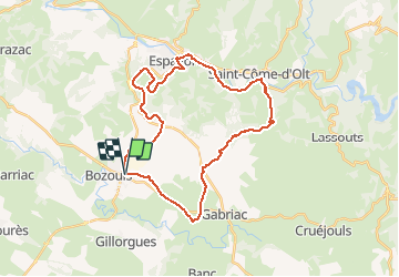
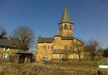
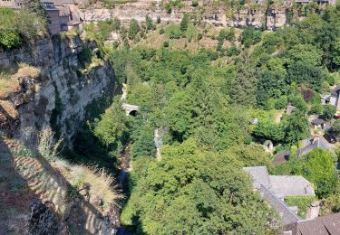
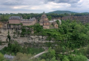
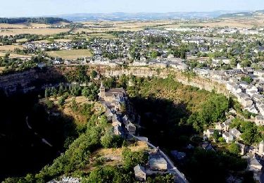
Trail Mountain bike of 33 km to be discovered at Occitania, Aveyron, Bozouls. This trail is proposed by tracegps.
Description
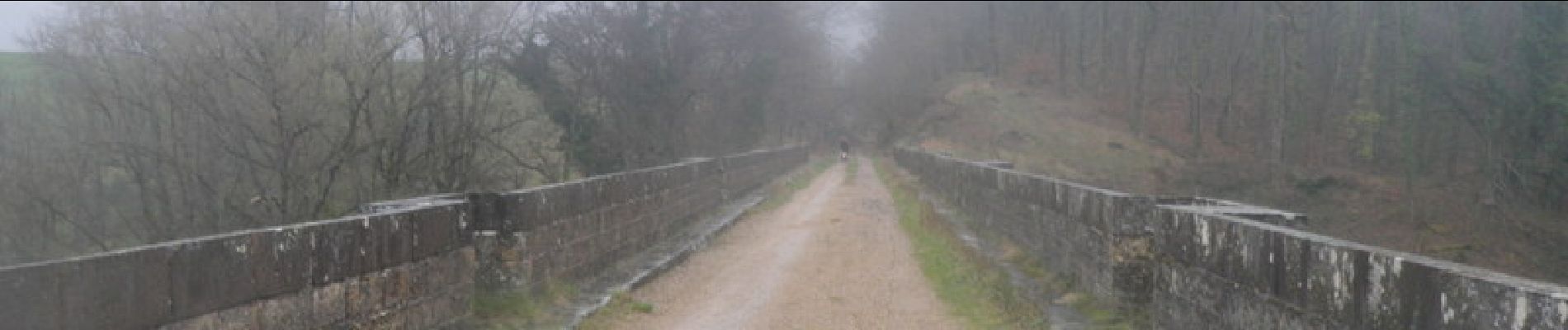
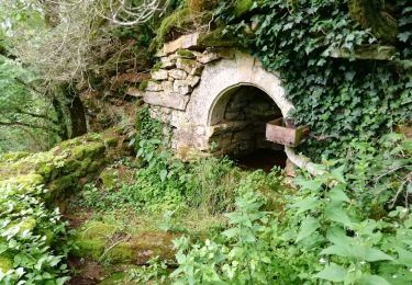
Le départ peut être fait d'Espalion aussi. Sur une partie vous roulerez sur une ancienne voie ferrée transformée en piste cyclable. Prévoir une lampe pour la traversée de tunnels dont un qui fait plus de 500 mètres de long en courbe. Une 2ème partie très technique vous obligera à porter le vtt dans les montées et dans certaines parties de la descente de Roquelaure. Balade à éviter en cas de pluie car extrêmement glissante. Bonne balade !
Positioning
Comments
Trails nearby
![Trail Walking Bozouls - Trou de Bozouls - Photo](https://media.geolcdn.com/t/375/260/ext.jpg?maxdim=2&url=https%3A%2F%2Fstatic1.geolcdn.com%2Fsiteimages%2Fupload%2Ffiles%2F1553511878bg_sport_marche.png)
![Walking Walking](https://static1.geolcdn.com/sitytour/trail-icons/101.png)
Walking
![](/images/other/stat-length.png)
![](https://static1.geolcdn.com/siteimages/upload/files/16400158638029165_repeat_loop_refresh_sync_direction_icon.png)
![Trail On foot Bozouls - De Bozouls à Rodelle - Photo](https://media.geolcdn.com/t/375/260/66d69220-9bbc-4663-b00f-c4b699fabe9e.jpeg&format=jpg&maxdim=2)
![On foot On foot](https://static1.geolcdn.com/sitytour/trail-icons/100.png)
On foot
![](/images/other/stat-length.png)
![](https://static1.geolcdn.com/siteimages/upload/files/16400158638029165_repeat_loop_refresh_sync_direction_icon.png)
![Walking Walking](https://static1.geolcdn.com/sitytour/trail-icons/101.png)
Walking
![](/images/other/stat-length.png)
![](https://static1.geolcdn.com/siteimages/upload/files/16400158638029165_repeat_loop_refresh_sync_direction_icon.png)
![Trail On foot Bozouls - BARRIAC / CARCUAC - Photo](https://media.geolcdn.com/t/375/260/bc0beb3d-ff65-476a-9036-ac117c703050.jpg&format=jpg&maxdim=2)
![On foot On foot](https://static1.geolcdn.com/sitytour/trail-icons/100.png)
On foot
![](/images/other/stat-length.png)
![](https://static1.geolcdn.com/siteimages/upload/files/16400158638029165_repeat_loop_refresh_sync_direction_icon.png)
![Trail Walking Bozouls - Horizons et Clochers du Rouergue - Gillorgues - Photo](https://media.geolcdn.com/t/375/260/ext.jpg?maxdim=2&url=https%3A%2F%2Fservices.sitytrail.com%2FGeolivesWS%2FDownloadMedia.ashx%3FTrailID%3D118794%26Media%3D13001_3.jpg)
![Walking Walking](https://static1.geolcdn.com/sitytour/trail-icons/101.png)
Walking
![](/images/other/stat-length.png)
![](https://static1.geolcdn.com/siteimages/upload/files/16400158638029165_repeat_loop_refresh_sync_direction_icon.png)
![Trail Walking Bozouls - Bozouls - Photo](https://media.geolcdn.com/t/375/260/10ed50db-8a0d-4207-a992-84c05341f3f1.jpg&format=jpg&maxdim=2)
![Walking Walking](https://static1.geolcdn.com/sitytour/trail-icons/101.png)
![Trail Walking Bozouls - Le tour du trou de Bizoul - Photo](https://media.geolcdn.com/t/375/260/4e72b031-faa1-4a85-a141-a5a945a90b8d.jpg&format=jpg&maxdim=2)
![Walking Walking](https://static1.geolcdn.com/sitytour/trail-icons/101.png)
Walking
![](/images/other/stat-length.png)
![](https://static1.geolcdn.com/siteimages/upload/files/16400158638029165_repeat_loop_refresh_sync_direction_icon.png)
![Trail Walking Bozouls - Le site géologique de Bozouls - Photo](https://media.geolcdn.com/t/375/260/233a96fc-16b9-4e34-989d-cf9dd41d925a.jpg&format=jpg&maxdim=2)
![Walking Walking](https://static1.geolcdn.com/sitytour/trail-icons/101.png)
Walking
![](/images/other/stat-length.png)
![](https://static1.geolcdn.com/siteimages/upload/files/16400158638029165_repeat_loop_refresh_sync_direction_icon.png)
![Trail Walking Bozouls - Circuit des passerelles à Bozouls - Photo](https://media.geolcdn.com/t/375/260/1db994d2-4983-4d3f-9e68-37cad86e1e34.jpg&format=jpg&maxdim=2)
![Walking Walking](https://static1.geolcdn.com/sitytour/trail-icons/101.png)
Walking
![](/images/other/stat-length.png)
![](https://static1.geolcdn.com/siteimages/upload/files/16400158638029165_repeat_loop_refresh_sync_direction_icon.png)