Trail Walking Courgoul - Le chemin des bergères et le Plateau d'Ussel - Courgoul - Photo

Le chemin des bergères et le Plateau d'Ussel - Courgoul

 tracegps
tracegps

User

© OpenStreetMap contributors
Length
Length
14.5 km
Max alt
Max alt
1038 m
Uphill gradient
Uphill gradient
597 m
Km-Effort
Km-Effort  
22 km
Min alt
Min alt
594 m
Downhill gradient
Downhill gradient
597 m
Boucle
Boucle
Yes
Creation date :
2014-12-10 00:00:00.0
Updated on :
2014-12-10 00:00:00.0

(0 Reviews)

Walking
Walking
5h00
Difficulty : Difficult

Scan this QR Code to open this trail in the SityTrail application

FREE GPS app for hiking

Logo SityTrail SityTrail

IGN / Geographical institutes

Download SityTrail from the App Store Download SityTrail from Google Play

Logo SityTrail SityTrail World

The world is yours!

Download SityTrail from the App Store Download SityTrail from Google Play Download SityTrail on Huawei AppGallery

About

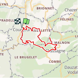
Trail Walking of 14.5 km to be discovered at Auvergne-Rhône-Alpes, Puy-de-Dôme, Courgoul. This trail is proposed by tracegps.

Description

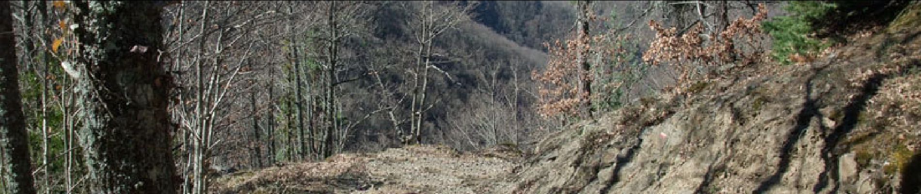
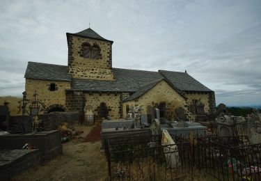
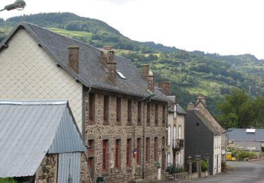
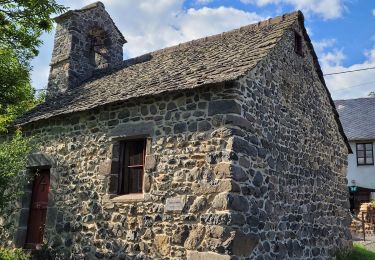
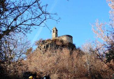
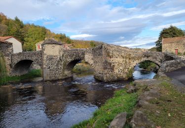
Du fond des gorges de Courgoul on monte par un beau chemin à travers bois de feuillus jusqu'au plateau d'Ussel et le village de Chassagne. De là, on aperçoit à travers les arbres la discrète mais pourtant célèbre abbaye de Mégemont. Au sommet du mamelon d'Ussel (cote 1030), le panorama est exceptionnel sur la Chaîne des Puys, les villages d'Olloix et Montaigut, le pic Brionnet avec au sommet la petite chapelle N.D. du Mont Carmel et bien d'autres lieux... Au retour, sur les pentes, houx et broussailles occupent les "paillats", anciennes surfaces cultivées en étages. Sur le versant Ouest de Courgoul, certains ont fait l'objet de réhabilitation.

Elevation profile

Photos

Points of interest

Point of interest Courgoul - départ - Photo
tracegps
COURGOUL 

Positioning

Country:
France
Region :
Auvergne-Rhône-Alpes
Department/Province :
Puy-de-Dôme
Municipality :
Courgoul
Location:
Unknown
Start:(UTM)
503079 ; 5040145 (31T) N.

Trails nearby

Trail On foot Dauzat-sur-Vodable - Dauzat-sur-Vodable - Photo
On foot
GUIDE+

On foot

Easy
Dauzat-sur-Vodable, Auvergne-Rhône-Alpes, Puy-de-Dôme, France
10 km | 14.7 km-effort
3h 20min
Yes
Trail On foot Saint-Diéry - Le Cheix - Photo
On foot
GUIDE+

On foot

Easy
Saint-Diéry, Auvergne-Rhône-Alpes, Puy-de-Dôme, France
4.8 km | 6.6 km-effort
1h 30min
Yes
Trail On foot Valbeleix - Le Plateau de la Chavade et la Roche Nite - Photo
On foot
GUIDE+

On foot

Medium
Valbeleix, Auvergne-Rhône-Alpes, Puy-de-Dôme, France
15.1 km | 23 km-effort
5h 18min
Yes
Trail On foot Saurier - Le Pic de Brionnet - Photo
On foot
GUIDE+

On foot

Easy
(1)
Saurier, Auvergne-Rhône-Alpes, Puy-de-Dôme, France
4.2 km | 7.8 km-effort
1h 46min
No
Trail Walking Courgoul - Les-Gorges-de-Courgoul-Marcenat_T - Photo
Walking
force

Walking

Very difficult
Courgoul, Auvergne-Rhône-Alpes, Puy-de-Dôme, France
12.7 km | 21 km-effort
3h 36min
Yes
Trail Walking Saint-Diéry - St_Diery_Mont_Carmel - Photo
Walking
GUIDE
jagarnier

Walking

Difficult
Saint-Diéry, Auvergne-Rhône-Alpes, Puy-de-Dôme, France
16.8 km | 27 km-effort
5h 0min
Yes
Trail On foot Saint-Diéry - Cotteuge - Photo
On foot
GUIDE+

On foot

Easy
Saint-Diéry, Auvergne-Rhône-Alpes, Puy-de-Dôme, France
7.4 km | 13 km-effort
2h 57min
Yes
Trail On foot Chassagne - Le Plateau d'Ussel - Photo
On foot
GUIDE+

On foot

Easy
Chassagne, Auvergne-Rhône-Alpes, Puy-de-Dôme, France
6.4 km | 9 km-effort
2h 2min
Yes
Trail Walking Saurier - Saurier-Brionnet_T - Photo
Walking
force

Walking

Difficult
Saurier, Auvergne-Rhône-Alpes, Puy-de-Dôme, France
9.5 km | 14.3 km-effort
3h 6min
Yes


Close
My subscriptions