![](/images/other/stat-length.png)
![Trail Mountain bike Agneaux - Le tour de Saint Lô en VTT - Photo](https://media.geolcdn.com/t/1900/400/ext.pjpeg?maxdim=2&url=https%3A%2F%2Fstatic1.geolcdn.com%2Fsiteimages%2Fupload%2Ffiles%2F1524743154velo.jpg)
Le tour de Saint Lô en VTT
tracegps
User
![Length](/images/other/stat-length.png)
Length
44 km
![Max alt](https://static1.geolcdn.com/siteimages/upload/files/1508320355ic_sort_altitude_max_24dp.png)
Max alt
138 m
![Uphill gradient](https://static1.geolcdn.com/siteimages/upload/files/1508320355ic_sort_den_pos_24dp.png)
Uphill gradient
758 m
![Km-Effort](/images/other/stat-length.png)
Km-Effort
54 km
![Min alt](https://static1.geolcdn.com/siteimages/upload/files/1508320355ic_sort_altitude_min_24dp.png)
Min alt
3 m
![Downhill gradient](https://static1.geolcdn.com/siteimages/upload/files/1508320355ic_sort_den_neg_24dp.png)
Downhill gradient
765 m
![Boucle](https://static1.geolcdn.com/siteimages/upload/files/16400158638029165_repeat_loop_refresh_sync_direction_icon.png)
Boucle
Yes
Creation date :
2014-12-10 00:00:00.0
Updated on :
2014-12-10 00:00:00.0
![Mountain bike](https://static1.geolcdn.com/sitytour/trail-icons/202.png)
3h00
Difficulty : Difficult
![Scan this QR Code to open this trail in the SityTrail application](https://capi.geolives.com/qq0zvz2zws4bq2lad0pu/sitytour/trails/106222/qr.png?size=200)
FREE GPS app for hiking
About
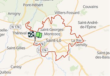
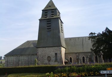
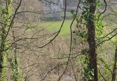
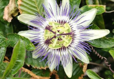
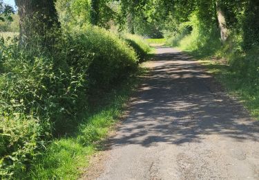
Trail Mountain bike of 44 km to be discovered at Normandy, Manche, Agneaux. This trail is proposed by tracegps.
Description
Circuit qui fait le tour de Saint-Lo, agréable, beaucoup de chemin, aucun portage mais quelques bonnes montées surtout par leur longueur.
Positioning
Country:
France
Region :
Normandy
Department/Province :
Manche
Municipality :
Agneaux
Location:
Unknown
Start:(Dec)
Start:(UTM)
636260 ; 5441738 (30U) N.
Comments
Trails nearby
![Trail Mountain bike Saint-Gilles - Balade St-Gillaise - St-Gilles - Photo](https://media.geolcdn.com/t/375/260/ext.jpg?maxdim=2&url=https%3A%2F%2Fservices.sitytrail.com%2FGeolivesWS%2FDownloadMedia.ashx%3FTrailID%3D172838%26Media%3D14279_6.jpg)
![Mountain bike Mountain bike](https://static1.geolcdn.com/sitytour/trail-icons/202.png)
Balade St-Gillaise - St-Gilles
Mountain bike
Medium
(1)
Saint-Gilles,
Normandy,
Manche,
France
![](/images/other/stat-length.png)
23 km | 28 km-effort
2h 30min
![](https://static1.geolcdn.com/siteimages/upload/files/16400158638029165_repeat_loop_refresh_sync_direction_icon.png)
Yes
![Trail Walking Saint-Gilles - St Gilles Château de Canisy - Photo](https://media.geolcdn.com/t/375/260/db5febae-3142-43c2-8a06-1e780b067eee.jpg&format=jpg&maxdim=2)
![Walking Walking](https://static1.geolcdn.com/sitytour/trail-icons/101.png)
St Gilles Château de Canisy
Walking
Very easy
Saint-Gilles,
Normandy,
Manche,
France
![](/images/other/stat-length.png)
9 km | 10.7 km-effort
2h 26min
![](https://static1.geolcdn.com/siteimages/upload/files/16400158638029165_repeat_loop_refresh_sync_direction_icon.png)
Yes
![Trail Mountain bike Agneaux - L'Agnelaise 2014 - Agneaux - Photo](https://media.geolcdn.com/t/375/260/ext.jpg?maxdim=2&url=https%3A%2F%2Fservices.sitytrail.com%2FGeolivesWS%2FDownloadMedia.ashx%3FTrailID%3D317800%26Media%3D17129_4.jpg)
![Mountain bike Mountain bike](https://static1.geolcdn.com/sitytour/trail-icons/202.png)
L'Agnelaise 2014 - Agneaux
Mountain bike
Difficult
Agneaux,
Normandy,
Manche,
France
![](/images/other/stat-length.png)
44 km | 52 km-effort
3h 0min
![](https://static1.geolcdn.com/siteimages/upload/files/16400158638029165_repeat_loop_refresh_sync_direction_icon.png)
Yes
![Trail Walking Canisy - Le circuit Jean Follain - Canisy - Photo](https://media.geolcdn.com/t/375/260/ext.jpg?maxdim=2&url=https%3A%2F%2Fservices.sitytrail.com%2FGeolivesWS%2FDownloadMedia.ashx%3FTrailID%3D129872%26Media%3D13437_5.jpg)
![Walking Walking](https://static1.geolcdn.com/sitytour/trail-icons/101.png)
Le circuit Jean Follain - Canisy
Walking
Medium
Canisy,
Normandy,
Manche,
France
![](/images/other/stat-length.png)
9.2 km | 10.9 km-effort
2h 19min
![](https://static1.geolcdn.com/siteimages/upload/files/16400158638029165_repeat_loop_refresh_sync_direction_icon.png)
Yes
![Trail Walking Saint-Lô - Saint-Lô - La Vire et le Falaise - Photo](https://media.geolcdn.com/t/375/260/a4b62c59-4242-4d9f-b094-dbf8b73d474c.jpg&format=jpg&maxdim=2)
![Walking Walking](https://static1.geolcdn.com/sitytour/trail-icons/101.png)
Saint-Lô - La Vire et le Falaise
Walking
Easy
Saint-Lô,
Normandy,
Manche,
France
![](/images/other/stat-length.png)
5.4 km | 6.6 km-effort
1h 20min
![](https://static1.geolcdn.com/siteimages/upload/files/16400158638029165_repeat_loop_refresh_sync_direction_icon.png)
Yes
![Trail Walking Saint-Lô - BALLADE 2 JUIN - Photo](https://media.geolcdn.com/t/375/260/26c1ed40-ed31-4507-bef7-09f3441ee504.jpg&format=jpg&maxdim=2)
![Walking Walking](https://static1.geolcdn.com/sitytour/trail-icons/101.png)
BALLADE 2 JUIN
Walking
Very easy
Saint-Lô,
Normandy,
Manche,
France
![](/images/other/stat-length.png)
3.1 km | 3.7 km-effort
51min
![](https://static1.geolcdn.com/siteimages/upload/files/16400158638029165_repeat_loop_refresh_sync_direction_icon.png)
Yes
![Trail Walking Saint-Lô - Ballade 2 juin 2020 - Photo](https://media.geolcdn.com/t/375/260/0f66b39a-8cca-4e3f-ad8a-3abe33dff7b7.jpg&format=jpg&maxdim=2)
![Walking Walking](https://static1.geolcdn.com/sitytour/trail-icons/101.png)
Ballade 2 juin 2020
Walking
Very easy
Saint-Lô,
Normandy,
Manche,
France
![](/images/other/stat-length.png)
3.6 km | 4.2 km-effort
1h 2min
![](https://static1.geolcdn.com/siteimages/upload/files/16400158638029165_repeat_loop_refresh_sync_direction_icon.png)
Yes
![Trail Walking Saint-Lô - Ballade - Photo](https://media.geolcdn.com/t/375/260/0bb29947-3bff-4454-861d-57fdbde00341.jpg&format=jpg&maxdim=2)
![Walking Walking](https://static1.geolcdn.com/sitytour/trail-icons/101.png)
![Trail Walking Saint-Lô - Le Hutrel 27 ai 2020 - Photo](https://media.geolcdn.com/t/375/260/e03ee600-a6e3-4abf-99c3-6fe0b8bda48f.jpg&format=jpg&maxdim=2)
![Walking Walking](https://static1.geolcdn.com/sitytour/trail-icons/101.png)
Le Hutrel 27 ai 2020
Walking
Very easy
Saint-Lô,
Normandy,
Manche,
France
![](/images/other/stat-length.png)
2.3 km | 2.9 km-effort
48min
![](https://static1.geolcdn.com/siteimages/upload/files/16400158638029165_repeat_loop_refresh_sync_direction_icon.png)
Yes