![](/images/other/stat-length.png)
![Trail Mountain bike Vougy - VTT en Pays de Charlieu : Vougy, Saint-Hilaire-sous-Charlieu, Villers, Jarnosse, Boyer et Nandax - Photo](https://media.geolcdn.com/t/1900/400/ext.pjpeg?maxdim=2&url=https%3A%2F%2Fservices.sitytrail.com%2FGeolivesWS%2FDownloadMedia.ashx%3FTrailID%3D106184%26Media%3D10461_6.jpg)
VTT en Pays de Charlieu : Vougy, Saint-Hilaire-sous-Charlieu, Villers, Jarnosse, Boyer et Nandax
tracegps
User
![Length](/images/other/stat-length.png)
![Max alt](https://static1.geolcdn.com/siteimages/upload/files/1508320355ic_sort_altitude_max_24dp.png)
![Uphill gradient](https://static1.geolcdn.com/siteimages/upload/files/1508320355ic_sort_den_pos_24dp.png)
![Km-Effort](/images/other/stat-length.png)
![Min alt](https://static1.geolcdn.com/siteimages/upload/files/1508320355ic_sort_altitude_min_24dp.png)
![Downhill gradient](https://static1.geolcdn.com/siteimages/upload/files/1508320355ic_sort_den_neg_24dp.png)
![Boucle](https://static1.geolcdn.com/siteimages/upload/files/16400158638029165_repeat_loop_refresh_sync_direction_icon.png)
![Mountain bike](https://static1.geolcdn.com/sitytour/trail-icons/202.png)
3h00
Difficulty : Medium
![Scan this QR Code to open this trail in the SityTrail application](https://capi.geolives.com/qq0zvz2zws4bq2lad0pu/sitytour/trails/106184/qr.png?size=200)
FREE GPS app for hiking
About
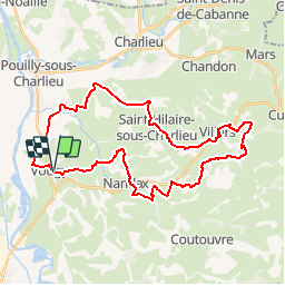
Trail Mountain bike of 36 km to be discovered at Auvergne-Rhône-Alpes, Loire, Vougy. This trail is proposed by tracegps.
Description
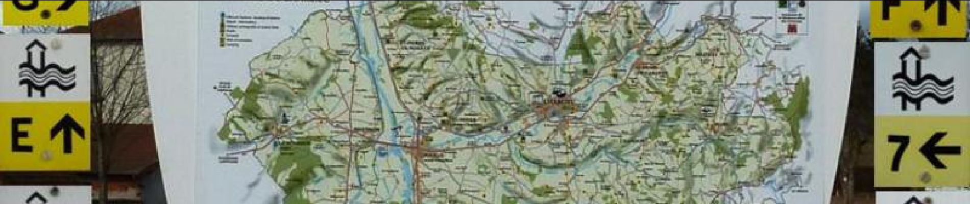
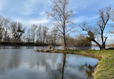
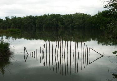
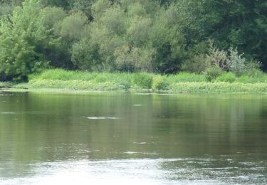
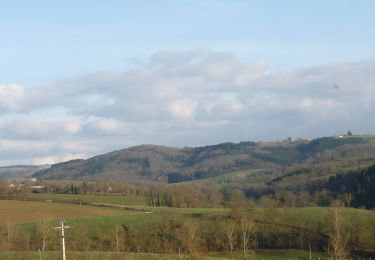
Parking et départ : du panneau (photo N°1) entre le gymnase et l'église de Vougy. Cette balade vous fera traverser les villages de Vougy, Saint-Hilaire-sous-Charlieu, Villers, Jarnosse, Boyer et Nandax. Tout au long de ce très beau parcours vous découvrirez les paysages verdoyants et vallonnés du pays de Charlieu ainsi que ses nombreux châteaux. Belles vues sur les monts de la Madeleine et les contreforts boisés des Monts du Beaujolais. Aucune difficulté majeure pour les VTTistes qui ont une pratique régulière de la discipline. Pour les pratiquants occasionnels, cette boucle est à faire de préférence par temps sec car ce fabuleux terrain de jeux reste assez gras hors période estivale. Le balisage "Chemins du Pays de Charlieu" est de 4 types : 1) Promenades (vert et blanc) : N°1 à N°4 ; 2) Circuits (jaune et blanc) : N° 1 à N°9 ; 3) Liaisons (jaune et blanc) : Lettres de A à I ; 4) Tour du Pays (jaune et rouge ) : 104,5 km Pour ce parcours VTT, vous prendrez dans l'ordre : N°7, Lettre G, Lettre E, N°6, N°2 (vert et blanc), Lettre F et N°7. Topoguide : Chemins du Pays de Charlieu (Livret-guide du randonneur). Disponible à l'OT/SI de Charlieu.
Positioning
Comments
Trails nearby
![Trail Walking Pouilly-sous-Charlieu - Randonnée de Pouilly sous Charlieu - Photo](https://media.geolcdn.com/t/375/260/159d7a86-ecbb-473b-966d-b54a206d0ece.jpg&format=jpg&maxdim=2)
![Walking Walking](https://static1.geolcdn.com/sitytour/trail-icons/101.png)
Walking
![](/images/other/stat-length.png)
![](https://static1.geolcdn.com/siteimages/upload/files/16400158638029165_repeat_loop_refresh_sync_direction_icon.png)
![Trail Mountain bike Roanne - SityTrail - VTT autour de Charlieu - Photo](https://media.geolcdn.com/t/375/260/ext.jpg?maxdim=2&url=https%3A%2F%2Fstatic1.geolcdn.com%2Fsiteimages%2Fupload%2Ffiles%2F1524743154velo.jpg)
![Mountain bike Mountain bike](https://static1.geolcdn.com/sitytour/trail-icons/202.png)
Mountain bike
![](/images/other/stat-length.png)
![](https://static1.geolcdn.com/siteimages/upload/files/16400158638029165_repeat_loop_refresh_sync_direction_icon.png)
![Trail Walking Briennon - rando à partir du port de Brienon - Photo](https://media.geolcdn.com/t/375/260/d863d571-e4ba-4b70-be45-d7c122d31658.jpg&format=jpg&maxdim=2)
![Walking Walking](https://static1.geolcdn.com/sitytour/trail-icons/101.png)
Walking
![](/images/other/stat-length.png)
![](https://static1.geolcdn.com/siteimages/upload/files/16400158638029165_repeat_loop_refresh_sync_direction_icon.png)
![Trail Walking Briennon - Briennon : du canal aux pâturages - Photo](https://media.geolcdn.com/t/375/260/0d7cdef7-7100-4df3-84f9-4910815ee490.jpg&format=jpg&maxdim=2)
![Walking Walking](https://static1.geolcdn.com/sitytour/trail-icons/101.png)
Walking
![](/images/other/stat-length.png)
![](https://static1.geolcdn.com/siteimages/upload/files/16400158638029165_repeat_loop_refresh_sync_direction_icon.png)
![Trail Walking Vougy - Vougy : Pouilly-sous-Charlieu et rives de Loire - Photo](https://media.geolcdn.com/t/375/260/c2d8c570-3285-462c-b38d-5ea3974f6f71.jpg&format=jpg&maxdim=2)
![Walking Walking](https://static1.geolcdn.com/sitytour/trail-icons/101.png)
Walking
![](/images/other/stat-length.png)
![](https://static1.geolcdn.com/siteimages/upload/files/16400158638029165_repeat_loop_refresh_sync_direction_icon.png)
![Trail Walking Saint-Hilaire-sous-Charlieu - St-Hilaire-sous-Charlieu : grand couvert - Photo](https://media.geolcdn.com/t/375/260/07e18aa0-102d-43f8-8028-d218a47b1ce3.jpg&format=jpg&maxdim=2)
![Walking Walking](https://static1.geolcdn.com/sitytour/trail-icons/101.png)
Walking
![](/images/other/stat-length.png)
![](https://static1.geolcdn.com/siteimages/upload/files/16400158638029165_repeat_loop_refresh_sync_direction_icon.png)
![Walking Walking](https://static1.geolcdn.com/sitytour/trail-icons/101.png)
Walking
![](/images/other/stat-length.png)
![](https://static1.geolcdn.com/siteimages/upload/files/16400158638029165_repeat_loop_refresh_sync_direction_icon.png)
![Mountain bike Mountain bike](https://static1.geolcdn.com/sitytour/trail-icons/202.png)
Mountain bike
![](/images/other/stat-length.png)
![](https://static1.geolcdn.com/siteimages/upload/files/16400158638029165_repeat_loop_refresh_sync_direction_icon.png)
![Mountain bike Mountain bike](https://static1.geolcdn.com/sitytour/trail-icons/202.png)
Mountain bike
![](/images/other/stat-length.png)
![](https://static1.geolcdn.com/siteimages/upload/files/16400158638029165_repeat_loop_refresh_sync_direction_icon.png)