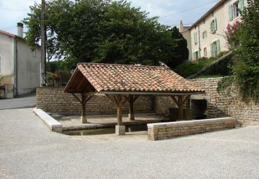
11 km | 12.6 km-effort
Circuit de La roche ruffin à la Liborlière - Pamproux
tracegps
User
Length
9.4 km
Max alt
126 m
Uphill gradient
113 m
Km-Effort
10.9 km
Min alt
82 m
Downhill gradient
111 m
Boucle
Yes
Creation date :
2014-12-10 00:00:00.0
Updated on :
2014-12-10 00:00:00.0
2h25
Difficulty : Medium
FREE GPS app for hiking
About
Trail Walking of 9.4 km to be discovered at New Aquitaine, Deux-Sèvres, Pamproux. This trail is proposed by tracegps.
Description
Circuit proposé par la commune de Pamproux. Départ de l’église de Pamproux.
Positioning
Country:
France
Region :
New Aquitaine
Department/Province :
Deux-Sèvres
Municipality :
Pamproux
Location:
Unknown
Start:(Dec)
Start:(UTM)
726300 ; 5142184 (30T) N.
Comments
Trails nearby
Circuit de la feuille de vigne - Pamproux
Walking
Medium
(1)
Pamproux,
New Aquitaine,
Deux-Sèvres,
France
2h 45min
Yes
Circuit de la feuille de vigne
Walking
Easy
Pamproux,
New Aquitaine,
Deux-Sèvres,
France
11 km | 12.6 km-effort
2h 47min
Yes
Circuit de La roche ruffin à la Liborlière
Walking
Very easy
Pamproux,
New Aquitaine,
Deux-Sèvres,
France
9.4 km | 10.9 km-effort
2h 25min
Yes
Zevtt - My La Mothe St Héray
Mountain bike
Difficult
La Mothe-Saint-Héray,
New Aquitaine,
Deux-Sèvres,
France
54 km | 66 km-effort
3h 30min
Yes
Zevtt - La Mothe St Héray VTT 41km
Mountain bike
Medium
La Mothe-Saint-Héray,
New Aquitaine,
Deux-Sèvres,
France
41 km | 51 km-effort
2h 30min
Yes
202405-12
Walking
Easy
La Mothe-Saint-Héray,
New Aquitaine,
Deux-Sèvres,
France
4 km | 4.3 km-effort
57min
No
2022-08-12 La Dame de Chambrille
Walking
Medium
La Mothe-Saint-Héray,
New Aquitaine,
Deux-Sèvres,
France
9.3 km | 11.1 km-effort
2h 31min
Yes
79 BOUGON La Pierre Levée
Walking
Easy
Bougon,
New Aquitaine,
Deux-Sèvres,
France
11.8 km | 13.4 km-effort
2h 56min
Yes
202405-12 bis
Walking
Easy
La Mothe-Saint-Héray,
New Aquitaine,
Deux-Sèvres,
France
846 m | 869 m-effort
11min
No