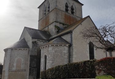
8.1 km | 9 km-effort
averdon 14.6
murph
User
Length
14.6 km
Max alt
118 m
Uphill gradient
116 m
Km-Effort
16.2 km
Min alt
91 m
Downhill gradient
118 m
Boucle
Yes
Creation date :
2019-01-15 17:55:42.538
Updated on :
2019-12-22 15:17:36.962
3h07
Difficulty : Easy
FREE GPS app for hiking
About
Trail Walking of 14.6 km to be discovered at Centre-Loire Valley, Loir-et-Cher, Averdon. This trail is proposed by murph.
Positioning
Country:
France
Region :
Centre-Loire Valley
Department/Province :
Loir-et-Cher
Municipality :
Averdon
Location:
Unknown
Start:(Dec)
Start:(UTM)
371793 ; 5282174 (31T) N.
Comments
Trails nearby
Site naturel et archéologique de la Grande Pierre et Vitain
Walking
Medium
Marolles,
Centre-Loire Valley,
Loir-et-Cher,
France
2h 2min
Yes
Randonnée de Saint Notaire, reconnaissance BBR
Walking
Very easy
Saint-Bohaire,
Centre-Loire Valley,
Loir-et-Cher,
France
14.5 km | 16.7 km-effort
3h 2min
Yes
St Bohaire AD
Walking
Easy
Saint-Bohaire,
Centre-Loire Valley,
Loir-et-Cher,
France
17 km | 19.2 km-effort
3h 41min
No
Marolles loir et chet
Walking
Very easy
Marolles,
Centre-Loire Valley,
Loir-et-Cher,
France
10.1 km | 11 km-effort
2h 29min
Yes
Averdon
Walking
Averdon,
Centre-Loire Valley,
Loir-et-Cher,
France
14.3 km | 15.8 km-effort
3h 13min
Yes
St Bohaire
Walking
Saint-Bohaire,
Centre-Loire Valley,
Loir-et-Cher,
France
14.4 km | 16.5 km-effort
3h 14min
Yes
averdon bbr
Walking
Easy
Averdon,
Centre-Loire Valley,
Loir-et-Cher,
France
13.5 km | 15.1 km-effort
1h 13min
Yes
Maroilles- Réserve naturelle
Walking
Medium
Marolles,
Centre-Loire Valley,
Loir-et-Cher,
France
6.3 km | 7 km-effort
1h 47min
Yes
maroilles
Walking
Medium
Marolles,
Centre-Loire Valley,
Loir-et-Cher,
France
8 km | 8.7 km-effort
1h 52min
No