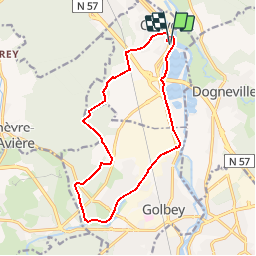
![](/images/other/stat-length.png)
![Trail Mountain bike Chavelot - Espace VTT FFC Chemins du Pays d'Epinal, Coeur des Vosges - circuit n°84 - La Grande Haie - Photo](https://media.geolcdn.com/t/1900/400/ext.pjpeg?maxdim=2&url=https%3A%2F%2Fservices.sitytrail.com%2FGeolivesWS%2FDownloadMedia.ashx%3FTrailID%3D105943%26Media%3D9985_2.jpg)
Espace VTT FFC Chemins du Pays d'Epinal, Coeur des Vosges - circuit n°84 - La Grande Haie
tracegps
User
![Length](/images/other/stat-length.png)
![Max alt](https://static1.geolcdn.com/siteimages/upload/files/1508320355ic_sort_altitude_max_24dp.png)
![Uphill gradient](https://static1.geolcdn.com/siteimages/upload/files/1508320355ic_sort_den_pos_24dp.png)
![Km-Effort](/images/other/stat-length.png)
![Min alt](https://static1.geolcdn.com/siteimages/upload/files/1508320355ic_sort_altitude_min_24dp.png)
![Downhill gradient](https://static1.geolcdn.com/siteimages/upload/files/1508320355ic_sort_den_neg_24dp.png)
![Boucle](https://static1.geolcdn.com/siteimages/upload/files/16400158638029165_repeat_loop_refresh_sync_direction_icon.png)
![Mountain bike](https://static1.geolcdn.com/sitytour/trail-icons/202.png)
1h10
Difficulty : Medium
![Scan this QR Code to open this trail in the SityTrail application](https://capi.geolives.com/qq0zvz2zws4bq2lad0pu/sitytour/trails/105943/qr.png?size=200)
FREE GPS app for hiking
About
Trail Mountain bike of 14.2 km to be discovered at Grand Est, Vosges, Chavelot. This trail is proposed by tracegps.
Description
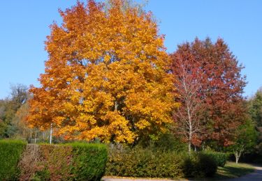
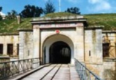
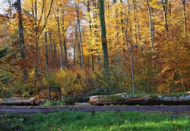
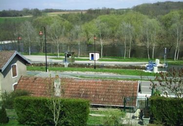
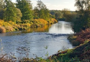
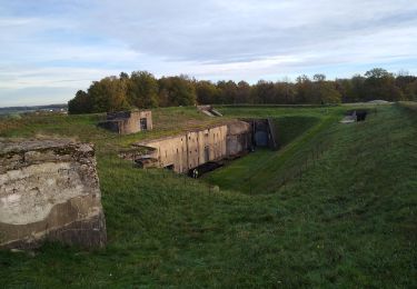
Espace VTT FFC Chemins du Pays d'Epinal, Cœur des Vosges - circuit n°84 - La Grande Haie Circuit officiel labellisé par la Fédération Française de Cyclisme. Depuis le port d’Épinal, vous rejoignez le lac de Bouzey par le canal des Vosges. Pour revenir vers la Cité des Images, vous empruntez un chemin forestier qui vous permet de découvrir une ancienne poudrière et les fameuses roches d’Olima.
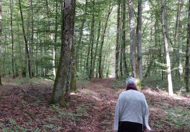
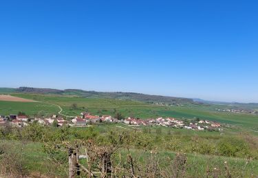
Positioning
Comments
Trails nearby
![Trail sport Épinal - Golbey - Photo](https://media.geolcdn.com/t/375/260/ext.jpg?maxdim=2&url=https%3A%2F%2Fsecurestorage.geolives.com%2Fsitytour%2Ftrail-bg%2Fdefault.jpg)
![Trail Walking Capavenir-Vosges - Forêt Domevre - Photo](https://media.geolcdn.com/t/375/260/e54c4b23-692e-40c6-8220-ebc7918a39ed.jpg&format=jpg&maxdim=2)
![Walking Walking](https://static1.geolcdn.com/sitytour/trail-icons/101.png)
Walking
![](/images/other/stat-length.png)
![](https://static1.geolcdn.com/siteimages/upload/files/16400158638029165_repeat_loop_refresh_sync_direction_icon.png)
![Trail Electric bike Capavenir-Vosges - autour de Thaon - Photo](https://media.geolcdn.com/t/375/260/99330e46-7a7b-4e45-a19b-0f88fd22b536.jpg&format=jpg&maxdim=2)
![Electric bike Electric bike](https://static1.geolcdn.com/sitytour/trail-icons/205.png)
Electric bike
![](/images/other/stat-length.png)
![](https://static1.geolcdn.com/siteimages/upload/files/16400158638029165_repeat_loop_refresh_sync_direction_icon.png)
![Trail Walking Capavenir-Vosges - marche pop Thaon - Photo](https://media.geolcdn.com/t/375/260/a5d90113-a3c8-4b54-8274-dced14e2b420.jpg&format=jpg&maxdim=2)
![Walking Walking](https://static1.geolcdn.com/sitytour/trail-icons/101.png)
Walking
![](/images/other/stat-length.png)
![](https://static1.geolcdn.com/siteimages/upload/files/16400158638029165_repeat_loop_refresh_sync_direction_icon.png)
![Trail Walking Uxegney - Circuit d''Uxegney - Photo](https://media.geolcdn.com/t/375/260/ext.jpg?maxdim=2&url=https%3A%2F%2Fservices.sitytrail.com%2FGeolivesWS%2FDownloadMedia.ashx%3FTrailID%3D215267%26Media%3D15526_1.jpg)
![Walking Walking](https://static1.geolcdn.com/sitytour/trail-icons/101.png)
Walking
![](/images/other/stat-length.png)
![](https://static1.geolcdn.com/siteimages/upload/files/16400158638029165_repeat_loop_refresh_sync_direction_icon.png)
![Trail Walking Domèvre-sur-Avière - Circuit de Domèvre sur Avière - Photo](https://media.geolcdn.com/t/375/260/ext.jpg?maxdim=2&url=https%3A%2F%2Fservices.sitytrail.com%2FGeolivesWS%2FDownloadMedia.ashx%3FTrailID%3D214905%26Media%3D15462_1.jpg)
![Walking Walking](https://static1.geolcdn.com/sitytour/trail-icons/101.png)
Walking
![](/images/other/stat-length.png)
![](https://static1.geolcdn.com/siteimages/upload/files/16400158638029165_repeat_loop_refresh_sync_direction_icon.png)
![Trail Mountain bike Chavelot - Espace VTT FFC Chemins du Coeur des Vosges - circuit n°83 - La Nivallée - Photo](https://media.geolcdn.com/t/375/260/ext.jpg?maxdim=2&url=https%3A%2F%2Fservices.sitytrail.com%2FGeolivesWS%2FDownloadMedia.ashx%3FTrailID%3D104407%26Media%3D7641_1.jpg)
![Mountain bike Mountain bike](https://static1.geolcdn.com/sitytour/trail-icons/202.png)
Mountain bike
![](/images/other/stat-length.png)
![](https://static1.geolcdn.com/siteimages/upload/files/16400158638029165_repeat_loop_refresh_sync_direction_icon.png)
![Trail Walking Capavenir-Vosges - thaon0 - Photo](https://media.geolcdn.com/t/375/260/cec3205f-c62c-4fc1-b2a1-15356ccf23a0.jpg&format=jpg&maxdim=2)
![Walking Walking](https://static1.geolcdn.com/sitytour/trail-icons/101.png)
Walking
![](/images/other/stat-length.png)
![](https://static1.geolcdn.com/siteimages/upload/files/16400158638029165_repeat_loop_refresh_sync_direction_icon.png)
![Trail Walking Uxegney - rando des forts - Photo](https://media.geolcdn.com/t/375/260/28622f95-692a-477b-b218-b6492ebef1a4.jpg&format=jpg&maxdim=2)
![Walking Walking](https://static1.geolcdn.com/sitytour/trail-icons/101.png)
Walking
![](/images/other/stat-length.png)
![](https://static1.geolcdn.com/siteimages/upload/files/16400158638029165_repeat_loop_refresh_sync_direction_icon.png)