![](/images/other/stat-length.png)
![Trail Walking Saint-Dier-d'Auvergne - Des Ribes au Miodet - Saint Dier d'Auvergne - Photo](https://media.geolcdn.com/t/1900/400/ext.pjpeg?maxdim=2&url=https%3A%2F%2Fservices.sitytrail.com%2FGeolivesWS%2FDownloadMedia.ashx%3FTrailID%3D105898%26Media%3D9891_2.jpg)
Des Ribes au Miodet - Saint Dier d'Auvergne
tracegps
User
![Length](/images/other/stat-length.png)
Length
12.5 km
![Max alt](https://static1.geolcdn.com/siteimages/upload/files/1508320355ic_sort_altitude_max_24dp.png)
Max alt
542 m
![Uphill gradient](https://static1.geolcdn.com/siteimages/upload/files/1508320355ic_sort_den_pos_24dp.png)
Uphill gradient
245 m
![Km-Effort](/images/other/stat-length.png)
Km-Effort
15.8 km
![Min alt](https://static1.geolcdn.com/siteimages/upload/files/1508320355ic_sort_altitude_min_24dp.png)
Min alt
438 m
![Downhill gradient](https://static1.geolcdn.com/siteimages/upload/files/1508320355ic_sort_den_neg_24dp.png)
Downhill gradient
250 m
![Boucle](https://static1.geolcdn.com/siteimages/upload/files/16400158638029165_repeat_loop_refresh_sync_direction_icon.png)
Boucle
Yes
Creation date :
2014-12-10 00:00:00.0
Updated on :
2014-12-10 00:00:00.0
![Walking](https://static1.geolcdn.com/sitytour/trail-icons/101.png)
3h00
Difficulty : Medium
![Scan this QR Code to open this trail in the SityTrail application](https://capi.geolives.com/qq0zvz2zws4bq2lad0pu/sitytour/trails/105898/qr.png?size=200)
FREE GPS app for hiking
About
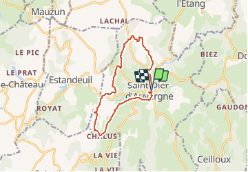
Trail Walking of 12.5 km to be discovered at Auvergne-Rhône-Alpes, Puy-de-Dôme, Saint-Dier-d'Auvergne. This trail is proposed by tracegps.
Description
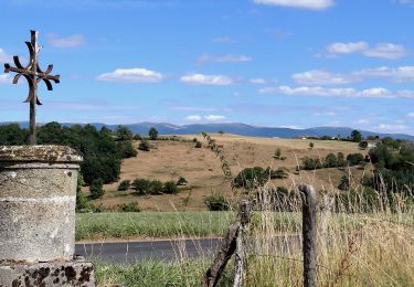
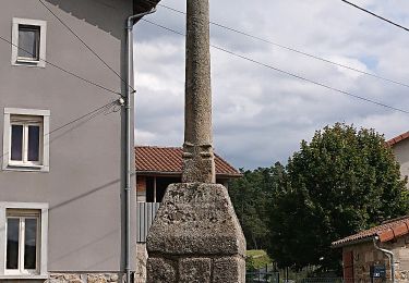
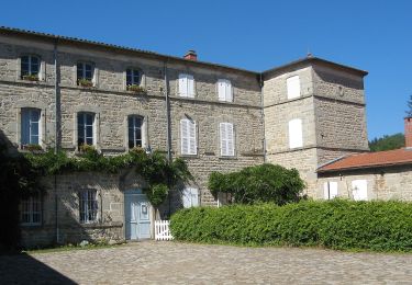
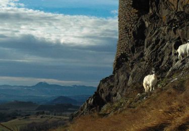
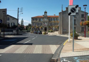
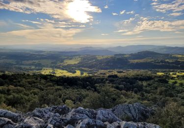
Départ près de l'église fortifiée de Saint Dier d'Auvergne. Belle balade en Livradois sur un terrain très varié et sans difficulté.
Positioning
Country:
France
Region :
Auvergne-Rhône-Alpes
Department/Province :
Puy-de-Dôme
Municipality :
Saint-Dier-d'Auvergne
Location:
Unknown
Start:(Dec)
Start:(UTM)
537622 ; 5058164 (31T) N.
Comments
Trails nearby
![Trail Walking Saint-Jean-des-Ollières - St_Jean_Ollieres_Garde - Photo](https://media.geolcdn.com/t/375/260/ce0781ac-efe1-49f5-bff0-4f8f5a6e7638.jpg&format=jpg&maxdim=2)
![Walking Walking](https://static1.geolcdn.com/sitytour/trail-icons/101.png)
St_Jean_Ollieres_Garde
Walking
Medium
(2)
Saint-Jean-des-Ollières,
Auvergne-Rhône-Alpes,
Puy-de-Dôme,
France
![](/images/other/stat-length.png)
12.3 km | 17.1 km-effort
3h 26min
![](https://static1.geolcdn.com/siteimages/upload/files/16400158638029165_repeat_loop_refresh_sync_direction_icon.png)
Yes
![Trail Walking Domaize - Domaize_Ronde_Fruits - Photo](https://media.geolcdn.com/t/375/260/f4a9ee34-bc35-4d34-92f2-e24618419a1f.jpg&format=jpg&maxdim=2)
![Walking Walking](https://static1.geolcdn.com/sitytour/trail-icons/101.png)
Domaize_Ronde_Fruits
Walking
Medium
(1)
Domaize,
Auvergne-Rhône-Alpes,
Puy-de-Dôme,
France
![](/images/other/stat-length.png)
10.9 km | 15 km-effort
3h 15min
![](https://static1.geolcdn.com/siteimages/upload/files/16400158638029165_repeat_loop_refresh_sync_direction_icon.png)
Yes
![Trail On foot Saint-Jean-des-Ollières - [Itinéraire] Le pic de la Garde - Photo](https://media.geolcdn.com/t/375/260/ext.jpg?maxdim=2&url=https%3A%2F%2Fstatic1.geolcdn.com%2Fsiteimages%2Fupload%2Ffiles%2F1545311037marcheuse_200dpi.jpg)
![On foot On foot](https://static1.geolcdn.com/sitytour/trail-icons/100.png)
[Itinéraire] Le pic de la Garde
On foot
Easy
(1)
Saint-Jean-des-Ollières,
Auvergne-Rhône-Alpes,
Puy-de-Dôme,
France
![](/images/other/stat-length.png)
12.2 km | 16.8 km-effort
3h 48min
![](https://static1.geolcdn.com/siteimages/upload/files/16400158638029165_repeat_loop_refresh_sync_direction_icon.png)
Yes
![Trail On foot Ceilloux - Le Chemin du Bost - Photo](https://media.geolcdn.com/t/375/260/ba816805-0ba6-4be0-9595-fd3279994b1d.jpeg&format=jpg&maxdim=2)
![On foot On foot](https://static1.geolcdn.com/sitytour/trail-icons/100.png)
Le Chemin du Bost
On foot
Easy
Ceilloux,
Auvergne-Rhône-Alpes,
Puy-de-Dôme,
France
![](/images/other/stat-length.png)
8.3 km | 11.1 km-effort
2h 31min
![](https://static1.geolcdn.com/siteimages/upload/files/16400158638029165_repeat_loop_refresh_sync_direction_icon.png)
Yes
![Trail On foot Saint-Dier-d'Auvergne - Des Ribes au Miodet - Photo](https://media.geolcdn.com/t/375/260/3eaf22db-7235-4d7c-b6de-2e786297c48d.jpeg&format=jpg&maxdim=2)
![On foot On foot](https://static1.geolcdn.com/sitytour/trail-icons/100.png)
Des Ribes au Miodet
On foot
Easy
Saint-Dier-d'Auvergne,
Auvergne-Rhône-Alpes,
Puy-de-Dôme,
France
![](/images/other/stat-length.png)
11.4 km | 14.6 km-effort
3h 19min
![](https://static1.geolcdn.com/siteimages/upload/files/16400158638029165_repeat_loop_refresh_sync_direction_icon.png)
Yes
![Trail On foot Mauzun - Le Chateau de Mauzun - Photo](https://media.geolcdn.com/t/375/260/be6d961c-dee8-4c97-a23a-1073ebeca283.jpeg&format=jpg&maxdim=2)
![On foot On foot](https://static1.geolcdn.com/sitytour/trail-icons/100.png)
Le Chateau de Mauzun
On foot
Easy
Mauzun,
Auvergne-Rhône-Alpes,
Puy-de-Dôme,
France
![](/images/other/stat-length.png)
8.4 km | 11.6 km-effort
2h 37min
![](https://static1.geolcdn.com/siteimages/upload/files/16400158638029165_repeat_loop_refresh_sync_direction_icon.png)
No
![Trail On foot Saint-Jean-des-Ollières - Le Pic de la Garde - Photo](https://media.geolcdn.com/t/375/260/37c6e52b-d429-4f79-ab40-81ca434effbe.jpeg&format=jpg&maxdim=2)
![On foot On foot](https://static1.geolcdn.com/sitytour/trail-icons/100.png)
Le Pic de la Garde
On foot
Easy
Saint-Jean-des-Ollières,
Auvergne-Rhône-Alpes,
Puy-de-Dôme,
France
![](/images/other/stat-length.png)
11.7 km | 16.4 km-effort
3h 42min
![](https://static1.geolcdn.com/siteimages/upload/files/16400158638029165_repeat_loop_refresh_sync_direction_icon.png)
Yes
![Trail Walking Saint-Jean-des-Ollières - Saint-Jean-des-Ollières_Pic-de-la-Garde_T - Photo](https://media.geolcdn.com/t/375/260/c8ffecc3-4bf2-4c03-99d1-b0343eccec70.jpg&format=jpg&maxdim=2)
![Walking Walking](https://static1.geolcdn.com/sitytour/trail-icons/101.png)
Saint-Jean-des-Ollières_Pic-de-la-Garde_T
Walking
Difficult
Saint-Jean-des-Ollières,
Auvergne-Rhône-Alpes,
Puy-de-Dôme,
France
![](/images/other/stat-length.png)
12.7 km | 17.3 km-effort
4h 13min
![](https://static1.geolcdn.com/siteimages/upload/files/16400158638029165_repeat_loop_refresh_sync_direction_icon.png)
Yes
![Walking Walking](https://static1.geolcdn.com/sitytour/trail-icons/101.png)
Mauzun_Chateau
Walking
Medium
Mauzun,
Auvergne-Rhône-Alpes,
Puy-de-Dôme,
France
![](/images/other/stat-length.png)
8.9 km | 12.2 km-effort
2h 45min
![](https://static1.geolcdn.com/siteimages/upload/files/16400158638029165_repeat_loop_refresh_sync_direction_icon.png)
Yes