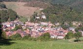

Traversée des Vosges - de Ste Marie aux Mines à le Devin

tracegps
User

Length
15.8 km

Max alt
1057 m

Uphill gradient
1068 m

Km-Effort
28 km

Min alt
387 m

Downhill gradient
511 m
Boucle
No
Creation date :
2014-12-10 00:00:00.0
Updated on :
2014-12-10 00:00:00.0
4h30
Difficulty : Difficult

FREE GPS app for hiking
About
Trail Walking of 15.8 km to be discovered at Grand Est, Haut-Rhin, Sainte-Marie-aux-Mines. This trail is proposed by tracegps.
Description
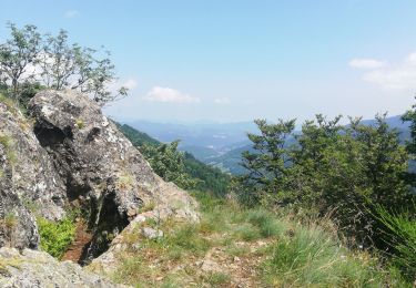
Beaucoup de dénivelé pour cette étape par la Côte d'Echery, l'Arbre de la Liberté, le Col du Pré de Raves et le Col des Bagenelles.
Positioning
Country:
France
Region :
Grand Est
Department/Province :
Haut-Rhin
Municipality :
Sainte-Marie-aux-Mines
Location:
Unknown
Start:(Dec)
Start:(UTM)
364600 ; 5344995 (32U) N.
Comments
Trails nearby
2020-06-20 Marche Tete du Violu Col de Ste Marie


Walking
Very easy
Sainte-Marie-aux-Mines,
Grand Est,
Haut-Rhin,
France

14.1 km | 21 km-effort
4h 14min
Yes
2019-11-03 WE Aubure Taennchel


Horseback riding
Very easy
Aubure,
Grand Est,
Haut-Rhin,
France

27 km | 41 km-effort
7h 45min
Yes
2019-11-02 WE Aubure Brezouard


Horseback riding
Very easy
Aubure,
Grand Est,
Haut-Rhin,
France

25 km | 39 km-effort
5h 57min
Yes
la croix de Ribeauvillé


Walking
Medium
Sainte-Marie-aux-Mines,
Grand Est,
Haut-Rhin,
France

12.5 km | 18.1 km-effort
6h 2min
Yes

Circuit Alsace Vosges Aubure Orbey Et Cigognes


Horseback riding
Difficult
Aubure,
Grand Est,
Haut-Rhin,
France

30 km | 44 km-effort
5h 44min
No
taenichel


Walking
Medium
Sainte-Marie-aux-Mines,
Grand Est,
Haut-Rhin,
France

13.3 km | 19.1 km-effort
5h 26min
Yes
Col du Haut de Ribeauvillé - Rochers des Géants (Rother n°31)


Walking
Medium
Sainte-Marie-aux-Mines,
Grand Est,
Haut-Rhin,
France

15.3 km | 22 km-effort
3h 56min
Yes
rocher des chèvred


Walking
Difficult
(2)
Sainte-Marie-aux-Mines,
Grand Est,
Haut-Rhin,
France

8.9 km | 13.3 km-effort
2h 40min
Yes
col Sainte Marie aux mines


Walking
Very difficult
Gemaingoutte,
Grand Est,
Vosges,
France

14.5 km | 22 km-effort
4h 20min
Yes


 SityTrail


