Trail Mountain bike Saint-Sauveur-le-Vicomte - Les trois Monts - Saint Sauveur le Vicomte - Photo

Les trois Monts - Saint Sauveur le Vicomte

 tracegps
tracegps

User

© OpenStreetMap contributors
Length
Length
37 km
Max alt
Max alt
126 m
Uphill gradient
Uphill gradient
506 m
Km-Effort
Km-Effort  
44 km
Min alt
Min alt
3 m
Downhill gradient
Downhill gradient
510 m
Boucle
Boucle
Yes
Creation date :
2014-12-10 00:00:00.0
Updated on :
2014-12-10 00:00:00.0

(0 Reviews)

Mountain bike
Mountain bike
3h00
Difficulty : Difficult

Scan this QR Code to open this trail in the SityTrail application

FREE GPS app for hiking

Logo SityTrail SityTrail

IGN / Geographical institutes

Download SityTrail from the App Store Download SityTrail from Google Play

Logo SityTrail SityTrail World

The world is yours!

Download SityTrail from the App Store Download SityTrail from Google Play Download SityTrail on Huawei AppGallery

About

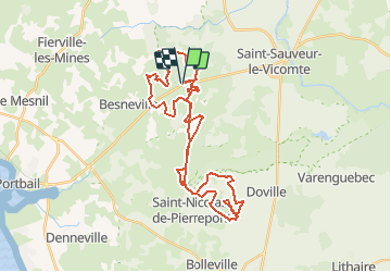
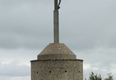
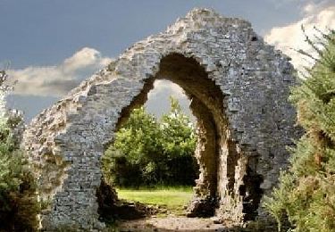
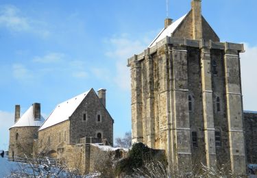
Trail Mountain bike of 37 km to be discovered at Normandy, Manche, Saint-Sauveur-le-Vicomte. This trail is proposed by tracegps.

Description

Départ de la forêt de Saint Sauveur le Vicomte , montée sur le mont de Besneville puis direction le mont de Doville pour une nouvelle ascension, et enfin retour par la voie verte jusqu'au mont de Taillepied pour une dernière petite montée avant de rejoindre le point de départ.

Elevation profile

Positioning

Country:
France
Region :
Normandy
Department/Province :
Manche
Municipality :
Saint-Sauveur-le-Vicomte
Location:
Unknown
Start:(UTM)
602095 ; 5470200 (30U) N.

Trails nearby

Trail Walking Doville - Boucle du Mont de Doville - Photo
Walking
prv

Walking

Very easy
(1)
Doville, Normandy, Manche, France
12.1 km | 14.7 km-effort
2h 32min
Yes
Trail Walking Doville - doville le 21 /09/2019 - Photo
Walking
jmp76700

Walking

Very easy
(1)
Doville, Normandy, Manche, France
10.8 km | 13.4 km-effort
3h 20min
No
Trail Walking Saint-Sauveur-le-Vicomte - St Sauveur Besneville boucle - Photo
Walking
GUIDE
chessyca

Walking

Easy
Saint-Sauveur-le-Vicomte, Normandy, Manche, France
13.2 km | 15.5 km-effort
3h 21min
Yes
Trail Walking Canville-la-Rocque - Canville la rocque - Photo
Walking
Marie-Claire-mcp

Walking

Medium
Canville-la-Rocque, Normandy, Manche, France
9.1 km | 10.2 km-effort
2h 19min
Yes
Trail Walking Besneville - Besneville  - Photo
Walking
PatRando

Walking

Medium
Besneville, Normandy, Manche, France
11.7 km | 13.7 km-effort
2h 25min
No
Trail Walking Saint-Sauveur-le-Vicomte - 20240614-St-Sauveur-le-Vicomte  - Photo
Walking
doudet

Walking

Easy
Saint-Sauveur-le-Vicomte, Normandy, Manche, France
3.8 km | 4.4 km-effort
1h 58min
Yes
Trail Walking Doville - Mont doville  - Photo
Walking
joelinou

Walking

Difficult
Doville, Normandy, Manche, France
12.5 km | 15.1 km-effort
3h 37min
No
Trail Walking Doville - Pédestre - Promenade et Randonnée Le Mont de Doville - Photo
Walking
neoroll44

Walking

Medium
Doville, Normandy, Manche, France
11.3 km | 14 km-effort
3h 10min
Yes
Trail Mountain bike Saint-Sauveur-le-Vicomte - Balade dans le canton de Barbey d''Aurevilly - St Sauveur le Vicomte  - Photo
Mountain bike
tracegps

Mountain bike

Medium
Saint-Sauveur-le-Vicomte, Normandy, Manche, France
34 km | 40 km-effort
2h 30min
Yes


Close
My subscriptions