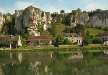
Trail Walking Brosses - Brosses et ses fées - Photo
 tracegps
tracegps

User

© OpenStreetMap contributors
Length
Length
10.4 km
Max alt
Max alt
284 m
Uphill gradient
Uphill gradient
229 m
Km-Effort
Km-Effort  
13.4 km
Min alt
Min alt
165 m
Downhill gradient
Downhill gradient
228 m
Boucle
Boucle
Yes
Creation date :
2014-12-10 00:00:00.0
Updated on :
2014-12-10 00:00:00.0

(0 Reviews)

Walking
Walking
2h49
Difficulty : Medium

Scan this QR Code to open this trail in the SityTrail application

FREE GPS app for hiking

Logo SityTrail SityTrail

IGN / Geographical institutes

Download SityTrail from the App Store Download SityTrail from Google Play

Logo SityTrail SityTrail World

The world is yours!

Download SityTrail from the App Store Download SityTrail from Google Play Download SityTrail on Huawei AppGallery

About

Trail Walking of 10.4 km to be discovered at Bourgogne-Franche-Comté, Yonne, Brosses. This trail is proposed by tracegps.

Description

Ce petit village mentionné au 12ème sous le nom de: "BROCIA" contraction des mots "bois" et "braçu" (marécage) voulait dire "marécage occupé par des bois" ; ces deux noms sont la forme latine adaptée à la prononciation gauloise. Brosses le bas était sans doute un marécage, ce qui explique la construction en hauteur de l'église et le détournement du rû. (source G. Ducros) . Création monastique du XII et XIII siècle, il relevait en 1221 de l'abbaye de Pontigny, puis de la cure de Châtel-Censoir en 1460. Coseigneurie à la Révolution. Village séparé en 2 parties, formé de plusieurs hameaux. Vestiges d'un château fort entouré d'une enceinte quadrangulaire, en bordure du Bois-Taché. Nombreux tumulus dans les environs de Brosses.

Elevation profile

Positioning

Country:
France
Region :
Bourgogne-Franche-Comté
Department/Province :
Yonne
Municipality :
Brosses
Location:
Unknown
Start:(UTM)
552052 ; 5264884 (31T) N.

Trails nearby

Trail Walking Merry-sur-Yonne - BMF-140823 - Vincelles-RocherSaussois - Photo
Walking
randodan

Walking

Easy
Merry-sur-Yonne, Bourgogne-Franche-Comté, Yonne, France
14.6 km | 18.3 km-effort
4h 0min
Yes
Trail Walking Châtel-Censoir - CC n 4 - Photo
Walking
lacazen

Walking

Châtel-Censoir, Bourgogne-Franche-Comté, Yonne, France
5.1 km | 7 km-effort
2h 20min
Yes
Trail Walking Châtel-Censoir - CC N 3 - Photo
Walking
lacazen

Walking

Châtel-Censoir, Bourgogne-Franche-Comté, Yonne, France
7.4 km | 8.7 km-effort
2h 38min
Yes
Trail Walking Châtel-Censoir - CC 2023 - Photo
Walking
lacazen

Walking

Very easy
Châtel-Censoir, Bourgogne-Franche-Comté, Yonne, France
3.2 km | 4 km-effort
1h 11min
No
Trail Mountain bike Brosses - Grall VTT  - Photo
Mountain bike
monnot

Mountain bike

Easy
Brosses, Bourgogne-Franche-Comté, Yonne, France
13.6 km | 15.8 km-effort
1h 35min
Yes
Trail Walking Arcy-sur-Cure - Arctique reel - Photo
Walking
GUIDE
VANDERPUTTENMi

Walking

Very easy
Arcy-sur-Cure, Bourgogne-Franche-Comté, Yonne, France
10.6 km | 14 km-effort
3h 41min
No
Trail Walking Saint-Moré - La Jarrie - Grottes de Arcy sur Cure - Photo
Walking
GUIDE
VANDERPUTTENMi

Walking

Medium
Saint-Moré, Bourgogne-Franche-Comté, Yonne, France
9.8 km | 12.8 km-effort
2h 41min
No
Trail Walking Montillot - La Charbonnière - Photo
Walking
tracegps

Walking

Medium
(1)
Montillot, Bourgogne-Franche-Comté, Yonne, France
6.2 km | 7.2 km-effort
2h 0min
Yes
Trail Walking Brosses - De Brosses à Vaudonjon - Photo
Walking
tracegps

Walking

Medium
Brosses, Bourgogne-Franche-Comté, Yonne, France
15.3 km | 19.7 km-effort
4h 0min
Yes


Close
My subscriptions