![](/images/other/stat-length.png)
![Trail Mountain bike Renaison - Raid Nature 42 - Circuit VTT du parcours sportif - Photo](https://media.geolcdn.com/t/1900/400/ext.pjpeg?maxdim=2&url=https%3A%2F%2Fservices.sitytrail.com%2FGeolivesWS%2FDownloadMedia.ashx%3FTrailID%3D105654%26Media%3D9461_6.jpg)
Raid Nature 42 - Circuit VTT du parcours sportif
tracegps
User
![Length](/images/other/stat-length.png)
![Max alt](https://static1.geolcdn.com/siteimages/upload/files/1508320355ic_sort_altitude_max_24dp.png)
![Uphill gradient](https://static1.geolcdn.com/siteimages/upload/files/1508320355ic_sort_den_pos_24dp.png)
![Km-Effort](/images/other/stat-length.png)
![Min alt](https://static1.geolcdn.com/siteimages/upload/files/1508320355ic_sort_altitude_min_24dp.png)
![Downhill gradient](https://static1.geolcdn.com/siteimages/upload/files/1508320355ic_sort_den_neg_24dp.png)
![Boucle](https://static1.geolcdn.com/siteimages/upload/files/16400158638029165_repeat_loop_refresh_sync_direction_icon.png)
![Mountain bike](https://static1.geolcdn.com/sitytour/trail-icons/202.png)
3h00
Difficulty : Very difficult
![Scan this QR Code to open this trail in the SityTrail application](https://capi.geolives.com/qq0zvz2zws4bq2lad0pu/sitytour/trails/105654/qr.png?size=200)
FREE GPS app for hiking
About
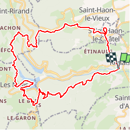
Trail Mountain bike of 25 km to be discovered at Auvergne-Rhône-Alpes, Loire, Renaison. This trail is proposed by tracegps.
Description
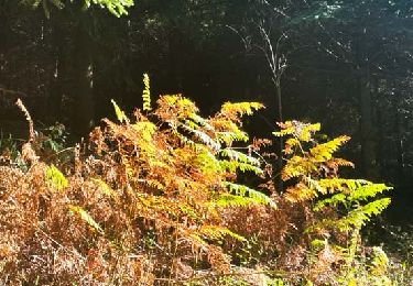
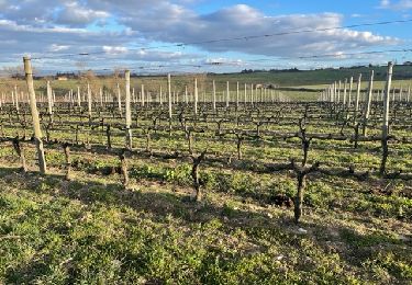
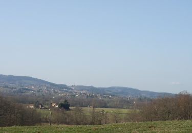
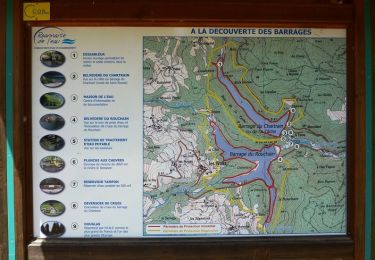
Renaison (42370) Parking gratuit : Salle ERA (à côté du stade). Chaque année au mois de septembre, la Loire est le théâtre d’un des plus beaux raids sportifs de France. Aventure et sensations fortes lors de cette compétition sportive qui se déroule par équipe de 3 et sans assistance. Après Chalmazel, Le Bessat, Saint-Victor-sur-Loire et Saint-Just-Saint-Rambert, pour sa 5ème édition, le Raid Nature 42 s'est déroulé à Renaison le dimanche 19 septembre 2010. Le Raid Nature 42 est organisé par le CDOS Loire et les comités départementaux de course d'orientation, cyclisme, athlétisme, sarbacane, tir à l'arc et montagne escalade, avec le soutien du Conseil général dans le cadre de la promotion des sports de pleine nature dans la Loire. Deux courses proposées : le parcours découverte (court) et le parcours sportif (long). Cette trace est le circuit VTT du parcours sportif (long).
Positioning
Comments
Trails nearby
![Trail Walking Renaison - Renaison : d’un barrage à l’autre - Photo](https://media.geolcdn.com/t/375/260/0c55d59a-831c-4f21-8687-c1695b3393b5.jpg&format=jpg&maxdim=2)
![Walking Walking](https://static1.geolcdn.com/sitytour/trail-icons/101.png)
Walking
![](/images/other/stat-length.png)
![](https://static1.geolcdn.com/siteimages/upload/files/16400158638029165_repeat_loop_refresh_sync_direction_icon.png)
![Trail Walking Renaison - Saint-Haon-le-Châtel : Pardières - Photo](https://media.geolcdn.com/t/375/260/20289c32-20c2-4e09-8385-a8087ad95771.jpg&format=jpg&maxdim=2)
![Walking Walking](https://static1.geolcdn.com/sitytour/trail-icons/101.png)
Walking
![](/images/other/stat-length.png)
![](https://static1.geolcdn.com/siteimages/upload/files/16400158638029165_repeat_loop_refresh_sync_direction_icon.png)
![Trail Walking Arcon - Arcon: Roche Corbière-Quatre Murs - Photo](https://media.geolcdn.com/t/375/260/f084a593-c8ab-4485-bad9-4355d9e9f1a8.jpg&format=jpg&maxdim=2)
![Walking Walking](https://static1.geolcdn.com/sitytour/trail-icons/101.png)
Walking
![](/images/other/stat-length.png)
![](https://static1.geolcdn.com/siteimages/upload/files/16400158638029165_repeat_loop_refresh_sync_direction_icon.png)
![Trail Walking Ouches - Ouches : de la plaine à la côte roannaise - Photo](https://media.geolcdn.com/t/375/260/6b9e8121-0a01-4791-9e45-beccd7d62b78.jpg&format=jpg&maxdim=2)
![Walking Walking](https://static1.geolcdn.com/sitytour/trail-icons/101.png)
Walking
![](/images/other/stat-length.png)
![](https://static1.geolcdn.com/siteimages/upload/files/16400158638029165_repeat_loop_refresh_sync_direction_icon.png)
![Trail Walking Saint-André-d'Apchon - St-André-d'Apchon-Rocher de Bellevue - Photo](https://media.geolcdn.com/t/375/260/8e975bfa-15cb-4d0f-9f11-d5beb6ba5a25.jpg&format=jpg&maxdim=2)
![Walking Walking](https://static1.geolcdn.com/sitytour/trail-icons/101.png)
Walking
![](/images/other/stat-length.png)
![](https://static1.geolcdn.com/siteimages/upload/files/16400158638029165_repeat_loop_refresh_sync_direction_icon.png)
![Walking Walking](https://static1.geolcdn.com/sitytour/trail-icons/101.png)
Walking
![](/images/other/stat-length.png)
![](https://static1.geolcdn.com/siteimages/upload/files/16400158638029165_repeat_loop_refresh_sync_direction_icon.png)
![Walking Walking](https://static1.geolcdn.com/sitytour/trail-icons/101.png)
Walking
![](/images/other/stat-length.png)
![](https://static1.geolcdn.com/siteimages/upload/files/16400158638029165_repeat_loop_refresh_sync_direction_icon.png)
![Trail Mountain bike Renaison - Boucle autour de la Faille du Rouchain - Renaison (les barrages) - Photo](https://media.geolcdn.com/t/375/260/ext.jpg?maxdim=2&url=https%3A%2F%2Fservices.sitytrail.com%2FGeolivesWS%2FDownloadMedia.ashx%3FTrailID%3D318016%26Media%3D17472_6.jpg)
![Mountain bike Mountain bike](https://static1.geolcdn.com/sitytour/trail-icons/202.png)
Mountain bike
![](/images/other/stat-length.png)
![](https://static1.geolcdn.com/siteimages/upload/files/16400158638029165_repeat_loop_refresh_sync_direction_icon.png)
![Trail Mountain bike Renaison - Boucle autour de la Faille de La Tâche - Renaison (les barrages) - Photo](https://media.geolcdn.com/t/375/260/ext.jpg?maxdim=2&url=https%3A%2F%2Fservices.sitytrail.com%2FGeolivesWS%2FDownloadMedia.ashx%3FTrailID%3D318015%26Media%3D17471_6.jpg)
![Mountain bike Mountain bike](https://static1.geolcdn.com/sitytour/trail-icons/202.png)
Mountain bike
![](/images/other/stat-length.png)
![](https://static1.geolcdn.com/siteimages/upload/files/16400158638029165_repeat_loop_refresh_sync_direction_icon.png)