Trail Mountain bike Guebwiller - Espace VTT - FFC Région de Guebwiller - n°01 - Circuit d'Issenheim  - Photo

Espace VTT - FFC Région de Guebwiller - n°01 - Circuit d'Issenheim

 tracegps
tracegps

User

© OpenStreetMap contributors
Length
Length
11.6 km
Max alt
Max alt
294 m
Uphill gradient
Uphill gradient
116 m
Km-Effort
Km-Effort  
13.1 km
Min alt
Min alt
244 m
Downhill gradient
Downhill gradient
115 m
Boucle
Boucle
Yes
Creation date :
2014-12-10 00:00:00.0
Updated on :
2014-12-10 00:00:00.0

(0 Reviews)

Mountain bike
Mountain bike
45m
Difficulty : Easy

Scan this QR Code to open this trail in the SityTrail application

FREE GPS app for hiking

Logo SityTrail SityTrail

IGN / Geographical institutes

Download SityTrail from the App Store Download SityTrail from Google Play

Logo SityTrail SityTrail World

The world is yours!

Download SityTrail from the App Store Download SityTrail from Google Play Download SityTrail on Huawei AppGallery

About

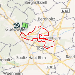
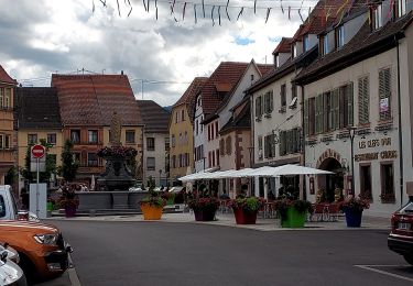
Trail Mountain bike of 11.6 km to be discovered at Grand Est, Haut-Rhin, Guebwiller. This trail is proposed by tracegps.

Description

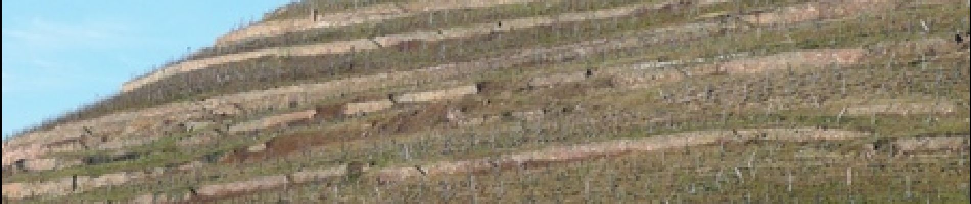
Espace VTT - FFC Région de Guebwiller - n°01 - Circuit d’Issenheim Circuit officiel labellisé par la Fédération Française de Cyclisme. Ce circuit familial vous permet de découvrir la partie basse de la ville de Guebwiller ainsi que la commune d’Issenheim, en traversant la forêt de l’Oberwald et en longeant la rivière Lauch. Retour par le vignoble classé Grand cru Saering. La localité d’Issenheim a succédé à un établissement gallo-romain. Possédé tout d’abord par l’abbaye de Murbach, ensuite donné en fief aux Habsbourg, puis aux Hus, elle devient le siège d’une seigneurie, englobant Merxheim, Ostein, Raedersheim et Oberhergheim. Fondation au XIIIème siècle d’un couvent d’antonites, religieux spécialisés dans le traitement du « feu Saint-Antoine » ; les antonites, en majorité italiens, étaient lettrés et amis des arts : c’est pour eux que fut exécuté en 1517 le célèbre retable d’Issenheim de Mathias Grünenwald (musée Unterlinden de Colmar). Elle passe à Mazarin en 1659, puis à ses héritiers les Valentinois et enfin aux Grimaldi de Monaco. Topo guide VTT en vente à l’Office du Tourisme de Guebwiller-Soultz et les Pays du Florival - Antenne de Guebwiller - 71 Rue de la République - 68500 – Guebwiller Tel. : 03 89 76 10 63 - Fax :03 89 76 52 72

Elevation profile

Photos

Positioning

Country:
France
Region :
Grand Est
Department/Province :
Haut-Rhin
Municipality :
Guebwiller
Location:
Unknown
Start:(UTM)
366747 ; 5307509 (32T) N.

Trails nearby

Trail Mountain bike Guebwiller - P4  Circuits du Florival 2021   - Photo
Mountain bike
duchaine.nicolas

Mountain bike

Medium
(1)
Guebwiller, Grand Est, Haut-Rhin, France
40 km | 53 km-effort
4h 31min
No
Trail Walking Murbach - Rando du 01/08/2024 - Photo
Walking
boubou68

Walking

Very difficult
Murbach, Grand Est, Haut-Rhin, France
18.9 km | 30 km-effort
5h 53min
Yes
Trail Walking Soultz-Haut-Rhin - Rando Marcheurs..04/04_2025 - Photo
Walking
boubou68

Walking

Very difficult
Soultz-Haut-Rhin, Grand Est, Haut-Rhin, France
21 km | 35 km-effort
4h 42min
Yes
Trail Walking Jungholtz - Rando Retrouvailles...01/03/2024.par Jean Marc - Photo
Walking
boubou68

Walking

Very difficult
Jungholtz, Grand Est, Haut-Rhin, France
11.3 km | 19.2 km-effort
1h 35min
Yes
Trail Walking Murbach - Murbach - Photo
Walking
oscar1

Walking

Difficult
Murbach, Grand Est, Haut-Rhin, France
15.4 km | 25 km-effort
4h 25min
Yes
Trail Walking Soultz-Haut-Rhin - Rando avec 0mar et Mouloud..18/02/2023 - Photo
Walking
boubou68

Walking

Very difficult
Soultz-Haut-Rhin, Grand Est, Haut-Rhin, France
12 km | 20 km-effort
3h 9min
Yes
Trail Road bike Issenheim - EXT-65 Issenheim-01 - Photo
Road bike
GUIDE
Specialized77

Road bike

Easy
Issenheim, Grand Est, Haut-Rhin, France
65 km | 73 km-effort
3h 54min
Yes
Trail Walking Orschwihr - Boucle pour Soultzmatt - Photo
Walking
GuyVachet

Walking

Medium
Orschwihr, Grand Est, Haut-Rhin, France
12.4 km | 16.5 km-effort
4h 4min
Yes
Trail Walking Soultz-Haut-Rhin - Wuenheim -  Kohlschlag  (18/03/2021) - Photo
Walking
Richard68500

Walking

Medium
Soultz-Haut-Rhin, Grand Est, Haut-Rhin, France
15.9 km | 26 km-effort
4h 8min
Yes


Close
My subscriptions