


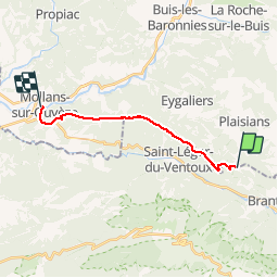

19.1 km | 30 km-effort

User


FREE GPS app for hiking
 SityTrail
IGN / Geographical institutes
SityTrail World
The world is yours!
Trail Walking of 13.1 km to be discovered at Auvergne-Rhône-Alpes, Drôme, Plaisians. This trail is proposed by tracegps.
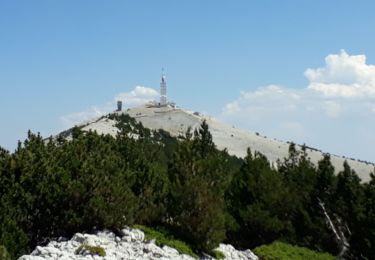
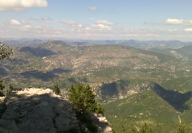
De temps à autre nous faisons des randonnées en ligne, c’est le cas aujourd’hui, la mise en œuvre est un peu plus délicate, car il faut prévoir un transport approprié, cette fois ci ce sera en autobus, il nous déposera au départ, Col de Fontaube au SE de Buis les Baronnies, et frontière administrative entre le Vaucluse et la Drôme, le périple empruntera toute la partie sommitale de la « Montagne de Bluye », nom étrange, mais au dire des érudits de la région, on doit ce nom, tiré du patois local, à la teinte de la montagne le soir au coucher du soleil, ce qui signifie Bleue. La fin de cette marche se fera dans le village de « Mollans » qui détermine la fin de cette montagne au cap 288° azimut par rapport au col du départ ! Sortez vos « TOP 25 » et vos boussoles ! Le soleil est de la partie, à peine un peu de vent, tout juste pour ne pas transpirer dans la montée vers la crête de la montagne, où là nous ferons des montagnes russes, sur des pistes de véhicules tout terrains, puis sur des sentiers biens tracés, entre buis et chênes verts, toujours au-dessus de la vallée du « Derbous » puis après son confluent avec l’Ouvèze au-dessus de celle-ci, avec vue imposante sur Buis les baronnies, Pierrelongue et puis Mollans et si l’on se retourne à 180° l’imposant et omniprésent Ventoux couvert de neige, spectacle inouï et imprenable ! Au milieu du massif, sur une petite prairie nous pique-niquerons, face au Ventoux, puis nous entamerons la longue descente vers Mollans, avec pierres qui roulent sous les souliers et rendent les appuis délicats et mettent à rude épreuve l’équilibre et les muscles jambiers. Puis c’est l’arrivée sur la place de l’ancienne gare de Mollans où nous attend sagement le bus qui nous ramène à Buis ! Clément Malbois


Walking

Walking
Walking

Walking
Walking
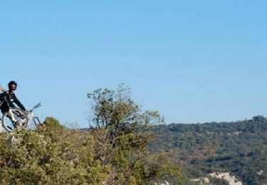
Mountain bike
Walking

Walking
Walking