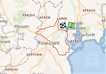
![](/images/other/stat-length.png)
![Trail Mountain bike La Forêt-Fouesnant - Fouesnant circuit VTT n°15 - Photo](https://media.geolcdn.com/t/1900/400/ext.pjpeg?maxdim=2&url=https%3A%2F%2Fstatic1.geolcdn.com%2Fsiteimages%2Fupload%2Ffiles%2F1524743154velo.jpg)
Fouesnant circuit VTT n°15
tracegps
User
![Length](/images/other/stat-length.png)
Length
11.6 km
![Max alt](https://static1.geolcdn.com/siteimages/upload/files/1508320355ic_sort_altitude_max_24dp.png)
Max alt
69 m
![Uphill gradient](https://static1.geolcdn.com/siteimages/upload/files/1508320355ic_sort_den_pos_24dp.png)
Uphill gradient
157 m
![Km-Effort](/images/other/stat-length.png)
Km-Effort
13.7 km
![Min alt](https://static1.geolcdn.com/siteimages/upload/files/1508320355ic_sort_altitude_min_24dp.png)
Min alt
0 m
![Downhill gradient](https://static1.geolcdn.com/siteimages/upload/files/1508320355ic_sort_den_neg_24dp.png)
Downhill gradient
158 m
![Boucle](https://static1.geolcdn.com/siteimages/upload/files/16400158638029165_repeat_loop_refresh_sync_direction_icon.png)
Boucle
Yes
Creation date :
2014-12-10 00:00:00.0
Updated on :
2014-12-10 00:00:00.0
![Mountain bike](https://static1.geolcdn.com/sitytour/trail-icons/202.png)
1h30
Difficulty : Medium
![Scan this QR Code to open this trail in the SityTrail application](https://capi.geolives.com/qq0zvz2zws4bq2lad0pu/sitytour/trails/105339/qr.png?size=200)
FREE GPS app for hiking
About
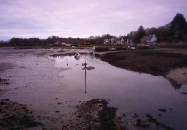
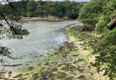
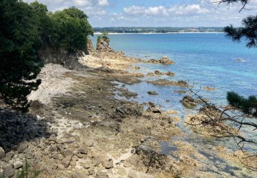
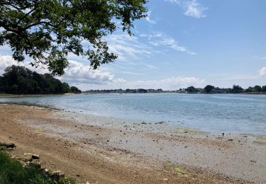
Trail Mountain bike of 11.6 km to be discovered at Brittany, Finistère, La Forêt-Fouesnant. This trail is proposed by tracegps.
Description
Circuit n°15 des rando VTT du pays de Quimper. Pas grand intérêt touristique mais il faut acheter le livre à l'office de tourisme.
Positioning
Country:
France
Region :
Brittany
Department/Province :
Finistère
Municipality :
La Forêt-Fouesnant
Location:
Unknown
Start:(Dec)
Start:(UTM)
426007 ; 5306020 (30T) N.
Comments
Trails nearby
![Trail Walking Fouesnant - De Beg Meil à Concarneau - Photo](https://media.geolcdn.com/t/375/260/ext.jpg?maxdim=2&url=https%3A%2F%2Fmedia.geolcdn.com%2Ff%2Fc435d3fb-721e-4af1-a29b-5e7ba8927772.jpg)
![Walking Walking](https://static1.geolcdn.com/sitytour/trail-icons/101.png)
De Beg Meil à Concarneau
Walking
Very difficult
Fouesnant,
Brittany,
Finistère,
France
![](/images/other/stat-length.png)
28 km | 31 km-effort
7h 1min
![](https://static1.geolcdn.com/siteimages/upload/files/16400158638029165_repeat_loop_refresh_sync_direction_icon.png)
No
![Trail Walking Fouesnant - Fouesnant - Photo](https://media.geolcdn.com/t/375/260/ext.jpg?maxdim=2&url=https%3A%2F%2Fservices.sitytrail.com%2FGeolivesWS%2FDownloadMedia.ashx%3FTrailID%3D670602%26Media%3Dfix__20141221100329.jpg)
![Walking Walking](https://static1.geolcdn.com/sitytour/trail-icons/101.png)
![Trail Walking Fouesnant - baie autour de cap coz vers fouebant Penfoulick - Photo](https://media.geolcdn.com/t/375/260/ext.jpg?maxdim=2&url=https%3A%2F%2Fmedia.geolcdn.com%2Ff%2F36d7fa5f-f3d2-42ab-8c5a-5f51ef0fb088.jpg)
![Walking Walking](https://static1.geolcdn.com/sitytour/trail-icons/101.png)
baie autour de cap coz vers fouebant Penfoulick
Walking
Medium
Fouesnant,
Brittany,
Finistère,
France
![](/images/other/stat-length.png)
5.6 km | 6.5 km-effort
1h 31min
![](https://static1.geolcdn.com/siteimages/upload/files/16400158638029165_repeat_loop_refresh_sync_direction_icon.png)
No
![Trail sport Fouesnant - BOT CONAN - Photo](https://media.geolcdn.com/t/375/260/ext.jpg?maxdim=2&url=https%3A%2F%2Fmedia.geolcdn.com%2Ff%2Fdfc2877a-a206-4d33-8164-ddfd4ac42cd5.jpg)
![Trail Walking Concarneau - Sables blancs anse ST jean - Photo](https://media.geolcdn.com/t/375/260/ext.jpg?maxdim=2&url=https%3A%2F%2Fmedia.geolcdn.com%2Ff%2F908c46e0-8ba5-4ec6-bd7a-81926b678317.jpg)
![Walking Walking](https://static1.geolcdn.com/sitytour/trail-icons/101.png)
Sables blancs anse ST jean
Walking
Easy
Concarneau,
Brittany,
Finistère,
France
![](/images/other/stat-length.png)
4.9 km | 5.5 km-effort
2h 11min
![](https://static1.geolcdn.com/siteimages/upload/files/16400158638029165_repeat_loop_refresh_sync_direction_icon.png)
Yes
![Trail Walking Fouesnant - 20211121 Beg meil - Photo](https://media.geolcdn.com/t/375/260/ext.jpg?maxdim=2&url=https%3A%2F%2Fmedia.geolcdn.com%2Ff%2Fb0b3226e-6f3f-4009-93e5-0fee8c452cb9.jpg)
![Walking Walking](https://static1.geolcdn.com/sitytour/trail-icons/101.png)
20211121 Beg meil
Walking
Medium
Fouesnant,
Brittany,
Finistère,
France
![](/images/other/stat-length.png)
6.8 km | 7.4 km-effort
2h 20min
![](https://static1.geolcdn.com/siteimages/upload/files/16400158638029165_repeat_loop_refresh_sync_direction_icon.png)
Yes
![Trail Hybrid bike Fouesnant - Beg Meil. Benodet - Photo](https://media.geolcdn.com/t/375/260/ext.jpg?maxdim=2&url=https%3A%2F%2Fmedia.geolcdn.com%2Ff%2F3037be7c-eb59-4910-a31a-48e84236e33b.jpg)
![Hybrid bike Hybrid bike](https://static1.geolcdn.com/sitytour/trail-icons/203.png)
Beg Meil. Benodet
Hybrid bike
Difficult
Fouesnant,
Brittany,
Finistère,
France
![](/images/other/stat-length.png)
37 km | 40 km-effort
2h 54min
![](https://static1.geolcdn.com/siteimages/upload/files/16400158638029165_repeat_loop_refresh_sync_direction_icon.png)
Yes
![Trail Walking Fouesnant - de Kerbader à Mousterlin - Photo](https://media.geolcdn.com/t/375/260/ext.jpg?maxdim=2&url=https%3A%2F%2Fservices.sitytrail.com%2FGeolivesWS%2FDownloadMedia.ashx%3FTrailID%3D415711%26Media%3Dfix__20150503160543.jpg)
![Walking Walking](https://static1.geolcdn.com/sitytour/trail-icons/101.png)
de Kerbader à Mousterlin
Walking
Easy
Fouesnant,
Brittany,
Finistère,
France
![](/images/other/stat-length.png)
7.5 km | 7.8 km-effort
1h 49min
![](https://static1.geolcdn.com/siteimages/upload/files/16400158638029165_repeat_loop_refresh_sync_direction_icon.png)
Yes
![Trail Walking La Forêt-Fouesnant - forêt fouesnant - vieux port - Photo](https://media.geolcdn.com/t/375/260/ext.jpg?maxdim=2&url=https%3A%2F%2Fservices.sitytrail.com%2FGeolivesWS%2FDownloadMedia.ashx%3FTrailID%3D198673%26Media%3D20130616165337.jpg)
![Walking Walking](https://static1.geolcdn.com/sitytour/trail-icons/101.png)
forêt fouesnant - vieux port
Walking
Very easy
La Forêt-Fouesnant,
Brittany,
Finistère,
France
![](/images/other/stat-length.png)
8.7 km | 9.8 km-effort
1h 58min
![](https://static1.geolcdn.com/siteimages/upload/files/16400158638029165_repeat_loop_refresh_sync_direction_icon.png)
Yes