![](/images/other/stat-length.png)
![Trail Walking Foncine-le-Bas - Foncine-le-bas, Les Planches enMontagne - Photo](https://media.geolcdn.com/t/1900/400/ext.pjpeg?maxdim=2&url=https%3A%2F%2Fservices.sitytrail.com%2FGeolivesWS%2FDownloadMedia.ashx%3FTrailID%3D1053204%26Media%3Dfix__20180912112148.jpg)
Foncine-le-bas, Les Planches enMontagne
nicolibris
User
![Length](/images/other/stat-length.png)
Length
6 km
![Max alt](https://static1.geolcdn.com/siteimages/upload/files/1508320355ic_sort_altitude_max_24dp.png)
Max alt
844 m
![Uphill gradient](https://static1.geolcdn.com/siteimages/upload/files/1508320355ic_sort_den_pos_24dp.png)
Uphill gradient
149 m
![Km-Effort](/images/other/stat-length.png)
Km-Effort
8 km
![Min alt](https://static1.geolcdn.com/siteimages/upload/files/1508320355ic_sort_altitude_min_24dp.png)
Min alt
721 m
![Downhill gradient](https://static1.geolcdn.com/siteimages/upload/files/1508320355ic_sort_den_neg_24dp.png)
Downhill gradient
149 m
![Boucle](https://static1.geolcdn.com/siteimages/upload/files/16400158638029165_repeat_loop_refresh_sync_direction_icon.png)
Boucle
Yes
Creation date :
2019-01-15 17:25:34.951
Updated on :
2019-01-15 17:25:34.951
![Walking](https://static1.geolcdn.com/sitytour/trail-icons/101.png)
1h43
Difficulty : Easy
![Scan this QR Code to open this trail in the SityTrail application](https://capi.geolives.com/qq0zvz2zws4bq2lad0pu/sitytour/trails/1053204/qr.png?size=200)
FREE GPS app for hiking
About
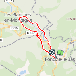
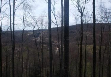
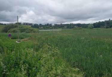
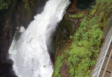
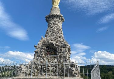
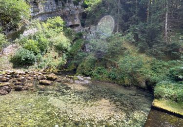
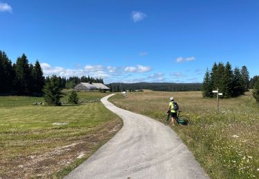
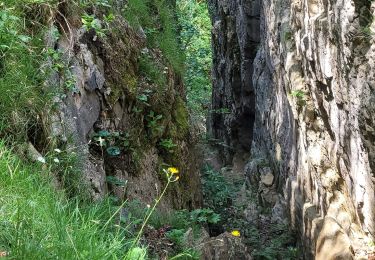
Trail Walking of 6 km to be discovered at Bourgogne-Franche-Comté, Jura, Foncine-le-Bas. This trail is proposed by nicolibris.
Description
Jolie boucle - une partie de la promenade emprunte la Tram'Jurasienne (passage sous un tunnel prendre éventuellement une lampe de poche)
Positioning
Country:
France
Region :
Bourgogne-Franche-Comté
Department/Province :
Jura
Municipality :
Foncine-le-Bas
Location:
Unknown
Start:(Dec)
Start:(UTM)
272725 ; 5169159 (32T) N.
Comments
Trails nearby
![Trail Walking Les Planches-en-Montagne - Gorges de la Saine - Les Planches en Montagne - Photo](https://media.geolcdn.com/t/375/260/ext.jpg?maxdim=2&url=https%3A%2F%2Fservices.sitytrail.com%2FGeolivesWS%2FDownloadMedia.ashx%3FTrailID%3D317645%26Media%3D16918_6.jpg)
![Walking Walking](https://static1.geolcdn.com/sitytour/trail-icons/101.png)
Gorges de la Saine - Les Planches en Montagne
Walking
Easy
(4)
Les Planches-en-Montagne,
Bourgogne-Franche-Comté,
Jura,
France
![](/images/other/stat-length.png)
6.1 km | 8.1 km-effort
2h 30min
![](https://static1.geolcdn.com/siteimages/upload/files/16400158638029165_repeat_loop_refresh_sync_direction_icon.png)
Yes
![Trail Walking Les Planches-en-Montagne - à la découverte de la languette - Photo](https://media.geolcdn.com/t/375/260/ext.jpg?maxdim=2&url=https%3A%2F%2Fservices.sitytrail.com%2FGeolivesWS%2FDownloadMedia.ashx%3FTrailID%3D200298%26Media%3D20130624123522.jpg)
![Walking Walking](https://static1.geolcdn.com/sitytour/trail-icons/101.png)
à la découverte de la languette
Walking
Very easy
(2)
Les Planches-en-Montagne,
Bourgogne-Franche-Comté,
Jura,
France
![](/images/other/stat-length.png)
2.3 km | 2.7 km-effort
41min
![](https://static1.geolcdn.com/siteimages/upload/files/16400158638029165_repeat_loop_refresh_sync_direction_icon.png)
Yes
![Trail Walking Les Planches-en-Montagne - Les planches en Montagne - Saine et langouette - Photo](https://media.geolcdn.com/t/375/260/ext.jpg?maxdim=2&url=https%3A%2F%2Fstatic1.geolcdn.com%2Fsiteimages%2Fupload%2Ffiles%2F1553511878bg_sport_marche.png)
![Walking Walking](https://static1.geolcdn.com/sitytour/trail-icons/101.png)
Les planches en Montagne - Saine et langouette
Walking
Medium
(4)
Les Planches-en-Montagne,
Bourgogne-Franche-Comté,
Jura,
France
![](/images/other/stat-length.png)
10.1 km | 13.5 km-effort
3h 2min
![](https://static1.geolcdn.com/siteimages/upload/files/16400158638029165_repeat_loop_refresh_sync_direction_icon.png)
Yes
![Trail Walking Les Planches-en-Montagne - Gorges Langouette et Malvaux 12.7.24 - Photo](https://media.geolcdn.com/t/375/260/5229ff7e-7e8e-4a2f-8edc-aba23199d13a.jpg&format=jpg&maxdim=2)
![Walking Walking](https://static1.geolcdn.com/sitytour/trail-icons/101.png)
Gorges Langouette et Malvaux 12.7.24
Walking
Easy
Les Planches-en-Montagne,
Bourgogne-Franche-Comté,
Jura,
France
![](/images/other/stat-length.png)
10.2 km | 13.6 km-effort
2h 45min
![](https://static1.geolcdn.com/siteimages/upload/files/16400158638029165_repeat_loop_refresh_sync_direction_icon.png)
Yes
![Trail Walking Les Planches-en-Montagne - Les Planches en Montagne Gorges de la Langouette - Photo](https://media.geolcdn.com/t/375/260/1f52f0ef-fc18-46a5-850c-a8206c37ca75.jpg&format=jpg&maxdim=2)
![Walking Walking](https://static1.geolcdn.com/sitytour/trail-icons/101.png)
Les Planches en Montagne Gorges de la Langouette
Walking
Medium
Les Planches-en-Montagne,
Bourgogne-Franche-Comté,
Jura,
France
![](/images/other/stat-length.png)
10.8 km | 14.8 km-effort
3h 5min
![](https://static1.geolcdn.com/siteimages/upload/files/16400158638029165_repeat_loop_refresh_sync_direction_icon.png)
Yes
![Trail Walking Foncine-le-Haut - Circuit Creux Maldru - Photo](https://media.geolcdn.com/t/375/260/c5572b14-7842-4c9a-a4fb-45327348d69a.jpg&format=jpg&maxdim=2)
![Walking Walking](https://static1.geolcdn.com/sitytour/trail-icons/101.png)
Circuit Creux Maldru
Walking
Foncine-le-Haut,
Bourgogne-Franche-Comté,
Jura,
France
![](/images/other/stat-length.png)
14.7 km | 20 km-effort
5h 32min
![](https://static1.geolcdn.com/siteimages/upload/files/16400158638029165_repeat_loop_refresh_sync_direction_icon.png)
Yes
![Trail Mountain bike Foncine-le-Haut - Jura 2 - Photo](https://media.geolcdn.com/t/375/260/8eab54f3-443c-4436-ad02-6f2dcf41b1ff.jpg&format=jpg&maxdim=2)
![Mountain bike Mountain bike](https://static1.geolcdn.com/sitytour/trail-icons/202.png)
Jura 2
Mountain bike
Very difficult
Foncine-le-Haut,
Bourgogne-Franche-Comté,
Jura,
France
![](/images/other/stat-length.png)
37 km | 46 km-effort
4h 20min
![](https://static1.geolcdn.com/siteimages/upload/files/16400158638029165_repeat_loop_refresh_sync_direction_icon.png)
No
![Trail Mountain bike Foncine-le-Haut - Jura 1 - Photo](https://media.geolcdn.com/t/375/260/eb748db3-1e12-4544-bd9f-6a30da2eb7e1.jpg&format=jpg&maxdim=2)
![Mountain bike Mountain bike](https://static1.geolcdn.com/sitytour/trail-icons/202.png)
Jura 1
Mountain bike
Difficult
Foncine-le-Haut,
Bourgogne-Franche-Comté,
Jura,
France
![](/images/other/stat-length.png)
32 km | 40 km-effort
4h 45min
![](https://static1.geolcdn.com/siteimages/upload/files/16400158638029165_repeat_loop_refresh_sync_direction_icon.png)
Yes
![Trail Walking Les Planches-en-Montagne - la languette - Photo](https://media.geolcdn.com/t/375/260/d7f09bac-b1c2-40d4-8f82-eb3ef82a986e.jpg&format=jpg&maxdim=2)
![Walking Walking](https://static1.geolcdn.com/sitytour/trail-icons/101.png)
la languette
Walking
Medium
Les Planches-en-Montagne,
Bourgogne-Franche-Comté,
Jura,
France
![](/images/other/stat-length.png)
15.4 km | 21 km-effort
6h 15min
![](https://static1.geolcdn.com/siteimages/upload/files/16400158638029165_repeat_loop_refresh_sync_direction_icon.png)
Yes