![](/images/other/stat-length.png)
![Trail Mountain bike Ribeauvillé - Espace VTT FFC Val d'Argent - Circuit n°8 - Le tertre de la Fille Morte - Photo](https://media.geolcdn.com/t/1900/400/ext.pjpeg?maxdim=2&url=https%3A%2F%2Fservices.sitytrail.com%2FGeolivesWS%2FDownloadMedia.ashx%3FTrailID%3D105190%26Media%3D8822_1.jpg)
Espace VTT FFC Val d'Argent - Circuit n°8 - Le tertre de la Fille Morte
tracegps
User
![Length](/images/other/stat-length.png)
![Max alt](https://static1.geolcdn.com/siteimages/upload/files/1508320355ic_sort_altitude_max_24dp.png)
![Uphill gradient](https://static1.geolcdn.com/siteimages/upload/files/1508320355ic_sort_den_pos_24dp.png)
![Km-Effort](/images/other/stat-length.png)
![Min alt](https://static1.geolcdn.com/siteimages/upload/files/1508320355ic_sort_altitude_min_24dp.png)
![Downhill gradient](https://static1.geolcdn.com/siteimages/upload/files/1508320355ic_sort_den_neg_24dp.png)
![Boucle](https://static1.geolcdn.com/siteimages/upload/files/16400158638029165_repeat_loop_refresh_sync_direction_icon.png)
![Mountain bike](https://static1.geolcdn.com/sitytour/trail-icons/202.png)
2h00
Difficulty : Difficult
![Scan this QR Code to open this trail in the SityTrail application](https://capi.geolives.com/qq0zvz2zws4bq2lad0pu/sitytour/trails/105190/qr.png?size=200)
FREE GPS app for hiking
About
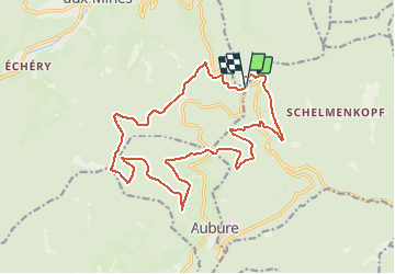
Trail Mountain bike of 18.5 km to be discovered at Grand Est, Haut-Rhin, Ribeauvillé. This trail is proposed by tracegps.
Description
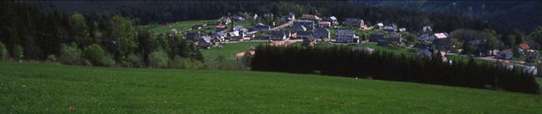
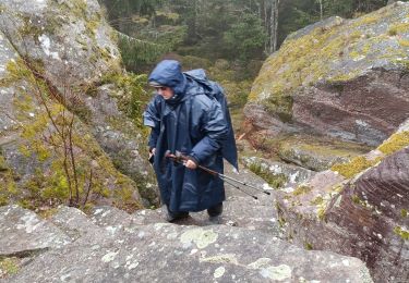
Espace VTT FFC Val d'Argent - Circuit n°8 - Le tertre de la Fille Morte Circuit officiel labellisé par la Fédération Française de Cyclisme. Départ du Col du Haut de Ribeauvillé, parking à 100m (742m). Ce circuit s’adresse particulièrement aux vététistes à la recherche d’un circuit assez court et qui concentre une bonne dose de difficultés physiques et techniques. Les profils du parcours demandent à plusieurs reprises des efforts intenses et soutenus. Ce circuit se déroule en bonne partie sur la charmante commune d’Aubure, la plus haute d’Alsace. Il offre notamment des points de vue vers la plaine d’Alsace.
Positioning
Comments
Trails nearby
![Trail Walking Ribeauvillé - 2023-08-26 Marche Ribeauville Taennchel - Photo](https://media.geolcdn.com/t/375/260/74d8ac69-de70-4d04-a080-288de3ed9a04.jpg&format=jpg&maxdim=2)
![Walking Walking](https://static1.geolcdn.com/sitytour/trail-icons/101.png)
Walking
![](/images/other/stat-length.png)
![](https://static1.geolcdn.com/siteimages/upload/files/16400158638029165_repeat_loop_refresh_sync_direction_icon.png)
![Trail Horseback riding Aubure - 2019-11-03 WE Aubure Taennchel - Photo](https://media.geolcdn.com/t/375/260/c26e7bc2-614c-4d3d-aa64-9841fd99c8a7.jpg&format=jpg&maxdim=2)
![Horseback riding Horseback riding](https://static1.geolcdn.com/sitytour/trail-icons/301.png)
Horseback riding
![](/images/other/stat-length.png)
![](https://static1.geolcdn.com/siteimages/upload/files/16400158638029165_repeat_loop_refresh_sync_direction_icon.png)
![Trail Horseback riding Aubure - 2019-11-02 WE Aubure Brezouard - Photo](https://media.geolcdn.com/t/375/260/5d69d4d4-e700-46e3-b109-02de2c2499c8.jpg&format=jpg&maxdim=2)
![Horseback riding Horseback riding](https://static1.geolcdn.com/sitytour/trail-icons/301.png)
Horseback riding
![](/images/other/stat-length.png)
![](https://static1.geolcdn.com/siteimages/upload/files/16400158638029165_repeat_loop_refresh_sync_direction_icon.png)
![Trail Walking Sainte-Marie-aux-Mines - la croix de Ribeauvillé - Photo](https://media.geolcdn.com/t/375/260/d5b1ea95-9e8b-4e75-bd59-dd918afbb44b.jpg&format=jpg&maxdim=2)
![Walking Walking](https://static1.geolcdn.com/sitytour/trail-icons/101.png)
Walking
![](/images/other/stat-length.png)
![](https://static1.geolcdn.com/siteimages/upload/files/16400158638029165_repeat_loop_refresh_sync_direction_icon.png)
![Trail sport Ribeauvillé - Grande verrerie - Rocher des Géants - Photo](https://media.geolcdn.com/t/375/260/30248580-5737-46ba-92f8-71cb1fb9f570.jpg&format=jpg&maxdim=2)
sport
![](/images/other/stat-length.png)
![](https://static1.geolcdn.com/siteimages/upload/files/16400158638029165_repeat_loop_refresh_sync_direction_icon.png)
![Trail Horseback riding Aubure - Circuit Alsace Vosges Aubure Orbey Et Cigognes - Photo](https://media.geolcdn.com/t/375/260/afad8878-23a0-4d83-b9b1-56130ab42de1.jpg&format=jpg&maxdim=2)
![Horseback riding Horseback riding](https://static1.geolcdn.com/sitytour/trail-icons/301.png)
Horseback riding
![](/images/other/stat-length.png)
![](https://static1.geolcdn.com/siteimages/upload/files/16400158638029165_repeat_loop_refresh_sync_direction_icon.png)
![Trail Walking Sainte-Marie-aux-Mines - taenichel - Photo](https://media.geolcdn.com/t/375/260/f89cec21-9478-4217-bf8a-15cadae40096.jpg&format=jpg&maxdim=2)
![Walking Walking](https://static1.geolcdn.com/sitytour/trail-icons/101.png)
Walking
![](/images/other/stat-length.png)
![](https://static1.geolcdn.com/siteimages/upload/files/16400158638029165_repeat_loop_refresh_sync_direction_icon.png)
![Trail Walking Aubure - Aubure rocher du tétras - Photo](https://media.geolcdn.com/t/375/260/4c6e9844-5150-479b-b524-d93ad5ebe923.jpg&format=jpg&maxdim=2)
![Walking Walking](https://static1.geolcdn.com/sitytour/trail-icons/101.png)
Walking
![](/images/other/stat-length.png)
![](https://static1.geolcdn.com/siteimages/upload/files/16400158638029165_repeat_loop_refresh_sync_direction_icon.png)
![Trail Walking Sainte-Marie-aux-Mines - Col du Haut de Ribeauvillé - Rochers des Géants (Rother n°31) - Photo](https://media.geolcdn.com/t/375/260/cfbc15a6-3f32-42dc-813b-8bce71fe94c9.jpg&format=jpg&maxdim=2)
![Walking Walking](https://static1.geolcdn.com/sitytour/trail-icons/101.png)
Walking
![](/images/other/stat-length.png)
![](https://static1.geolcdn.com/siteimages/upload/files/16400158638029165_repeat_loop_refresh_sync_direction_icon.png)