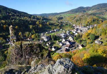
Trail Mountain bike Sainte-Marie-aux-Mines - Espace VTT FFC Val d'Argent - Circuit n°4 - Circuit des Abris - Photo

Espace VTT FFC Val d'Argent - Circuit n°4 - Circuit des Abris

 tracegps
tracegps

User

© OpenStreetMap contributors
Length
Length
18.1 km
Max alt
Max alt
1031 m
Uphill gradient
Uphill gradient
616 m
Km-Effort
Km-Effort  
26 km
Min alt
Min alt
688 m
Downhill gradient
Downhill gradient
616 m
Boucle
Boucle
Yes
Creation date :
2014-12-10 00:00:00.0
Updated on :
2014-12-10 00:00:00.0

(0 Reviews)

Mountain bike
Mountain bike
1h49
Difficulty : Difficult

Scan this QR Code to open this trail in the SityTrail application

FREE GPS app for hiking

Logo SityTrail SityTrail

IGN / Geographical institutes

Download SityTrail from the App Store Download SityTrail from Google Play

Logo SityTrail SityTrail World

The world is yours!

Download SityTrail from the App Store Download SityTrail from Google Play Download SityTrail on Huawei AppGallery

About

Trail Mountain bike of 18.1 km to be discovered at Grand Est, Haut-Rhin, Sainte-Marie-aux-Mines. This trail is proposed by tracegps.

Description

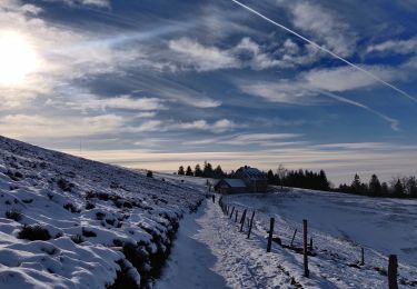
Espace VTT FFC Val d'Argent - Circuit n°4 - Circuit des Abris Circuit officiel labellisé par la Fédération Française de Cyclisme. Départ du Col des Bagenelles (903m) ou du Col de Sainte-Marie (772m). Ce superbe parcours offre de belles vues sur le vallon de la Petite Lièpvre et sur le hameau de St-Pierre-sur-l’Hâte. Ce circuit se déroule sur une ancienne ligne de front de la 1er Guerre Mondiale. En ouvrant l’œil, vous pourrez découvrir un certain nombre de vestiges de cette période agitée. Des visites guidées sont proposées par l’association Histoire et Patrimoine Militaire du Val d’Argent.

Elevation profile

Photos

Positioning

Country:
France
Region :
Grand Est
Department/Province :
Haut-Rhin
Municipality :
Sainte-Marie-aux-Mines
Location:
Unknown
Start:(UTM)
359838 ; 5339429 (32U) N.

Trails nearby

Trail Walking Le Bonhomme - Le Bonhomme - Circuit du village - Photo
Walking
GUIDE
Desrumaux

Walking

Easy
(1)
Le Bonhomme, Grand Est, Haut-Rhin, France
3 km | 5.3 km-effort
1h 30min
Yes
Trail Walking Sainte-Marie-aux-Mines - 2021-02-14 Marche Bagenelles Brezouard Fuste de Etoile - Photo
Walking
GUIDE
holtzv

Walking

Very difficult
Sainte-Marie-aux-Mines, Grand Est, Haut-Rhin, France
17.1 km | 27 km-effort
6h 6min
Yes
Trail Walking Lapoutroie - 2020-07-19 Marche Étang du Devin Col Calvaire Tête des Faux - Photo
Walking
GUIDE
holtzv

Walking

Very easy
Lapoutroie, Grand Est, Haut-Rhin, France
14.2 km | 22 km-effort
3h 27min
Yes
Trail Walking Ban-de-Laveline - 20130508 - Photo
Walking
pida

Walking

Very easy
(1)
Ban-de-Laveline, Grand Est, Vosges, France
7.6 km | 11.1 km-effort
2h 19min
Yes
Trail Walking Lapoutroie - 2024-07-24_18h02m57_230112363 - Photo
Walking
GUIDE
mumu.larandonneuse

Walking

Difficult
Lapoutroie, Grand Est, Haut-Rhin, France
10.3 km | 17.2 km-effort
3h 54min
Yes
Trail Walking Fréland - CVL - Rando 25/03/2024 - Col de Chamont - Photo
Walking
Hub6877

Walking

Medium
Fréland, Grand Est, Haut-Rhin, France
6.6 km | 9.5 km-effort
2h 15min
Yes
Trail On foot Sainte-Marie-aux-Mines - Le Haïcot - Le Petit Brézouard - Le Haïcot - Photo
On foot
patrickbeyrath

On foot

Easy
(2)
Sainte-Marie-aux-Mines, Grand Est, Haut-Rhin, France
7.1 km | 10.5 km-effort
2h 23min
Yes
Trail Walking Lapoutroie - rdpr G3 le bonhomme 230905 - Photo
Walking
GUIDE
stempfel52

Walking

Difficult
Lapoutroie, Grand Est, Haut-Rhin, France
11.6 km | 16.5 km-effort
4h 12min
Yes
Trail Walking Le Bonhomme - Le  Bonhomme-le Brézouard - Photo
Walking
oscar1

Walking

Medium
Le Bonhomme, Grand Est, Haut-Rhin, France
15 km | 26 km-effort
4h 34min
Yes


Close
My subscriptions