


6.9 km | 9.2 km-effort

User


FREE GPS app for hiking
 SityTrail
IGN / Geographical institutes
SityTrail World
The world is yours!
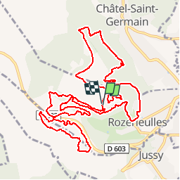
Trail Mountain bike of 14.9 km to be discovered at Grand Est, Moselle, Rozérieulles. This trail is proposed by tracegps.
Circuits des crapauds 2010 sur la commune de Rozérieulles (à côté de Metz) en Moselle. Course de 24h non-stop en équipe ou solitaire. 16km 400m de dénivellé.


Walking

Walking

Walking
On foot

On foot

On foot

On foot

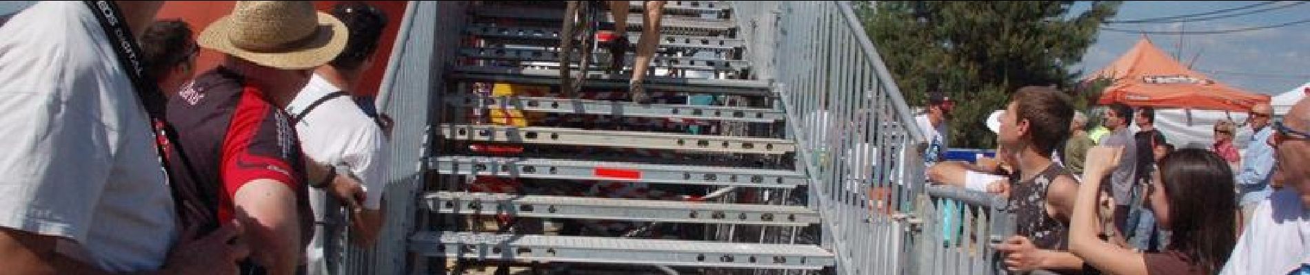
Mountain bike
On foot