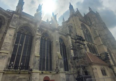
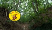
![](/images/other/stat-length.png)
![Trail Walking Montgé-en-Goële - MR_MONTGE-en-GOELE_5.3Km - Photo](https://media.geolcdn.com/t/1900/400/35addc96-117d-441b-96c3-8a9f60ce0ef4.jpg&format=pjpeg&maxdim=2)
MR_MONTGE-en-GOELE_5.3Km
GOELE RANDO
Randonner avec bonne humeur et convivialité. (Inscription réservée uniquement aux animateurs de GOËLE RANDO)
![Length](/images/other/stat-length.png)
Length
5.3 km
![Max alt](https://static1.geolcdn.com/siteimages/upload/files/1508320355ic_sort_altitude_max_24dp.png)
Max alt
209 m
![Uphill gradient](https://static1.geolcdn.com/siteimages/upload/files/1508320355ic_sort_den_pos_24dp.png)
Uphill gradient
109 m
![Km-Effort](/images/other/stat-length.png)
Km-Effort
6.8 km
![Min alt](https://static1.geolcdn.com/siteimages/upload/files/1508320355ic_sort_altitude_min_24dp.png)
Min alt
130 m
![Downhill gradient](https://static1.geolcdn.com/siteimages/upload/files/1508320355ic_sort_den_neg_24dp.png)
Downhill gradient
110 m
![Boucle](https://static1.geolcdn.com/siteimages/upload/files/16400158638029165_repeat_loop_refresh_sync_direction_icon.png)
Boucle
Yes
Creation date :
2019-03-04 12:57:30.586
Updated on :
2024-11-28 14:06:33.238
![Walking](https://static1.geolcdn.com/sitytour/trail-icons/101.png)
1h32
Difficulty : Medium
![Scan this QR Code to open this trail in the SityTrail application](https://capi.geolives.com/qq0zvz2zws4bq2lad0pu/sitytour/trails/1050481/qr.png?size=200)
FREE GPS app for hiking
About
Trail Walking of 5.3 km to be discovered at Ile-de-France, Seine-et-Marne, Montgé-en-Goële. This trail is proposed by GOELE RANDO.
Description
https://www.goelerando.fr/
DAMMARTIN en GOËLE 77
Positioning
Country:
France
Region :
Ile-de-France
Department/Province :
Seine-et-Marne
Municipality :
Montgé-en-Goële
Location:
Unknown
Start:(Dec)
Start:(UTM)
481608 ; 5432401 (31U) N.
Comments
Trails nearby
![Trail Walking Vinantes - SM_VINANTES_7.9Km - Photo](https://media.geolcdn.com/t/375/260/13298252-6192-4688-8560-e862227f2560.jpg&format=jpg&maxdim=2)
![Walking Walking](https://static1.geolcdn.com/sitytour/trail-icons/101.png)
SM_VINANTES_7.9Km
Walking
Medium
(5)
Vinantes,
Ile-de-France,
Seine-et-Marne,
France
![](/images/other/stat-length.png)
7.9 km | 8.9 km-effort
2h 1min
![](https://static1.geolcdn.com/siteimages/upload/files/16400158638029165_repeat_loop_refresh_sync_direction_icon.png)
Yes
![Trail On foot Saint-Mard - Formation SITY TRAIL_SAINT MARD - Photo](https://media.geolcdn.com/t/375/260/ba3d62a0-8f58-458e-9ed8-b3b717ccdf4f.jpg&format=jpg&maxdim=2)
![On foot On foot](https://static1.geolcdn.com/sitytour/trail-icons/100.png)
Formation SITY TRAIL_SAINT MARD
On foot
Very easy
(3)
Saint-Mard,
Ile-de-France,
Seine-et-Marne,
France
![](/images/other/stat-length.png)
3.6 km | 4.4 km-effort
Unknown
![](https://static1.geolcdn.com/siteimages/upload/files/16400158638029165_repeat_loop_refresh_sync_direction_icon.png)
Yes
![Trail Walking Cuisy - SM_CUISY_7Km - Photo](https://media.geolcdn.com/t/375/260/6ba8652c-8bb0-4a43-980a-678cd2edacc0.jpg&format=jpg&maxdim=2)
![Walking Walking](https://static1.geolcdn.com/sitytour/trail-icons/101.png)
SM_CUISY_7Km
Walking
Medium
(4)
Cuisy,
Ile-de-France,
Seine-et-Marne,
France
![](/images/other/stat-length.png)
7 km | 8.7 km-effort
2h 21min
![](https://static1.geolcdn.com/siteimages/upload/files/16400158638029165_repeat_loop_refresh_sync_direction_icon.png)
Yes
![Trail Walking Montgé-en-Goële - SityTrail - Montgé en Goële SuperMiniRando - Photo](https://media.geolcdn.com/t/375/260/512ace96-07d5-42e9-972d-de3ead1e1b12.jpg&format=jpg&maxdim=2)
![Walking Walking](https://static1.geolcdn.com/sitytour/trail-icons/101.png)
SityTrail - Montgé en Goële SuperMiniRando
Walking
Medium
(3)
Montgé-en-Goële,
Ile-de-France,
Seine-et-Marne,
France
![](/images/other/stat-length.png)
8 km | 9.7 km-effort
2h 12min
![](https://static1.geolcdn.com/siteimages/upload/files/16400158638029165_repeat_loop_refresh_sync_direction_icon.png)
Yes
![Trail Walking Vinantes - SM_VINANTES (par Montgé)_8.2Km - Photo](https://media.geolcdn.com/t/375/260/13298252-6192-4688-8560-e862227f2560.jpg&format=jpg&maxdim=2)
![Walking Walking](https://static1.geolcdn.com/sitytour/trail-icons/101.png)
SM_VINANTES (par Montgé)_8.2Km
Walking
Medium
(1)
Vinantes,
Ile-de-France,
Seine-et-Marne,
France
![](/images/other/stat-length.png)
8.1 km | 9.6 km-effort
2h 10min
![](https://static1.geolcdn.com/siteimages/upload/files/16400158638029165_repeat_loop_refresh_sync_direction_icon.png)
Yes
![Trail Walking Le Plessis-l'Évêque - MR_PLESSIS-L'EVEQUE_4.9Km - Photo](https://media.geolcdn.com/t/375/260/47f97308-fc93-4ea9-9c1c-fa82b0f1a452.jpg&format=jpg&maxdim=2)
![Walking Walking](https://static1.geolcdn.com/sitytour/trail-icons/101.png)
MR_PLESSIS-L'EVEQUE_4.9Km
Walking
Easy
(3)
Le Plessis-l'Évêque,
Ile-de-France,
Seine-et-Marne,
France
![](/images/other/stat-length.png)
4.9 km | 5.5 km-effort
1h 12min
![](https://static1.geolcdn.com/siteimages/upload/files/16400158638029165_repeat_loop_refresh_sync_direction_icon.png)
Yes
![Trail Walking Saint-Mard - Le tour du grand Paris via le GR1 Etape 9 Dammartin en Goele - Meaux - Photo](https://media.geolcdn.com/t/375/260/c2b9ac23-3f31-4bcb-a8f1-c9edbe9e7c1b.jpg&format=jpg&maxdim=2)
![Walking Walking](https://static1.geolcdn.com/sitytour/trail-icons/101.png)
Le tour du grand Paris via le GR1 Etape 9 Dammartin en Goele - Meaux
Walking
Medium
Saint-Mard,
Ile-de-France,
Seine-et-Marne,
France
![](/images/other/stat-length.png)
22 km | 26 km-effort
5h 43min
![](https://static1.geolcdn.com/siteimages/upload/files/16400158638029165_repeat_loop_refresh_sync_direction_icon.png)
No
![Trail Walking Montgé-en-Goële - Montgé en Goële SuperMiniRando - Photo](https://media.geolcdn.com/t/375/260/ext.jpg?maxdim=2&url=https%3A%2F%2Fstatic1.geolcdn.com%2Fsiteimages%2Fupload%2Ffiles%2F1553511878bg_sport_marche.png)
![Walking Walking](https://static1.geolcdn.com/sitytour/trail-icons/101.png)
Montgé en Goële SuperMiniRando
Walking
Easy
(1)
Montgé-en-Goële,
Ile-de-France,
Seine-et-Marne,
France
![](/images/other/stat-length.png)
8 km | 9.6 km-effort
1h 59min
![](https://static1.geolcdn.com/siteimages/upload/files/16400158638029165_repeat_loop_refresh_sync_direction_icon.png)
Yes
![Trail Walking Dammartin-en-Goële - Dammartin en Goële RC 2016 Grand parcours - Photo](https://media.geolcdn.com/t/375/260/ext.jpg?maxdim=2&url=https%3A%2F%2Fstatic1.geolcdn.com%2Fsiteimages%2Fupload%2Ffiles%2F1553511878bg_sport_marche.png)
![Walking Walking](https://static1.geolcdn.com/sitytour/trail-icons/101.png)
Dammartin en Goële RC 2016 Grand parcours
Walking
Easy
(2)
Dammartin-en-Goële,
Ile-de-France,
Seine-et-Marne,
France
![](/images/other/stat-length.png)
19.3 km | 22 km-effort
4h 51min
![](https://static1.geolcdn.com/siteimages/upload/files/16400158638029165_repeat_loop_refresh_sync_direction_icon.png)
Yes
Super
très bien