![](/images/other/stat-length.png)
![Trail Mountain bike Saint-Marcel-de-Félines - VTT - St Marcel de Félines, Néronde, Bussières, Ste Colombe sur Gand, St Just la Pendue - Photo](https://media.geolcdn.com/t/1900/400/ext.pjpeg?maxdim=2&url=https%3A%2F%2Fservices.sitytrail.com%2FGeolivesWS%2FDownloadMedia.ashx%3FTrailID%3D104913%26Media%3D8447_6.jpg)
VTT - St Marcel de Félines, Néronde, Bussières, Ste Colombe sur Gand, St Just la Pendue
tracegps
User
![Length](/images/other/stat-length.png)
![Max alt](https://static1.geolcdn.com/siteimages/upload/files/1508320355ic_sort_altitude_max_24dp.png)
![Uphill gradient](https://static1.geolcdn.com/siteimages/upload/files/1508320355ic_sort_den_pos_24dp.png)
![Km-Effort](/images/other/stat-length.png)
![Min alt](https://static1.geolcdn.com/siteimages/upload/files/1508320355ic_sort_altitude_min_24dp.png)
![Downhill gradient](https://static1.geolcdn.com/siteimages/upload/files/1508320355ic_sort_den_neg_24dp.png)
![Boucle](https://static1.geolcdn.com/siteimages/upload/files/16400158638029165_repeat_loop_refresh_sync_direction_icon.png)
![Mountain bike](https://static1.geolcdn.com/sitytour/trail-icons/202.png)
3h00
Difficulty : Difficult
![Scan this QR Code to open this trail in the SityTrail application](https://capi.geolives.com/qq0zvz2zws4bq2lad0pu/sitytour/trails/104913/qr.png?size=200)
FREE GPS app for hiking
About
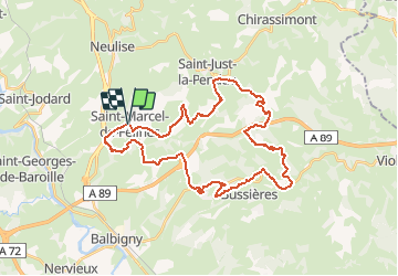
Trail Mountain bike of 38 km to be discovered at Auvergne-Rhône-Alpes, Loire, Saint-Marcel-de-Félines. This trail is proposed by tracegps.
Description
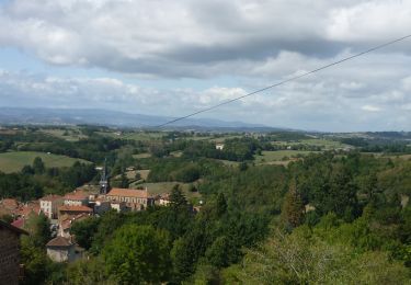
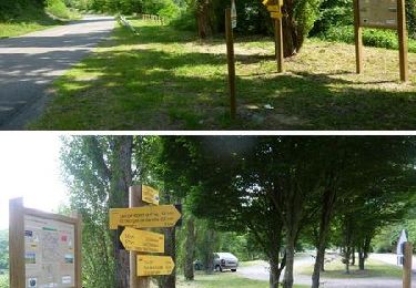
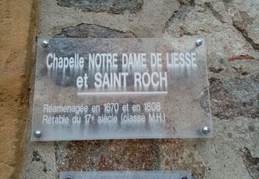
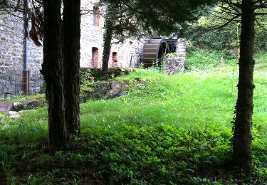
Parking gratuit et départ de la mairie. Le village est réputé pour sa randonnée pédestre du 1er mai rassemblant plusieurs centaines de participants et pour son riche patrimoine : château, église. Il a gardé le caractère d’un village d’antan. Le parcours se veut physique et technique, par conséquent il se destine exclusivement aux VTTistes confirmés qui ont une pratique régulière de ce sport. Ca monte, ça descend, ça monte ça descend… mais on se repose quand ??? Tout simplement de retour à la voiture, un peu fatigué mais tellement enthousiaste et émerveillé en repensant à cette belle balade, dans une nature sauvage, verte et boisée, aux dégringolades sur les singles tracks, aux chemins qui serpentent au bord des rivières où sans tendre l’oreille l’on perçoit le chant de l’eau qui dévale au creux des vallées encaissées !!! Situées dans la Loire entre Roanne, Lyon et St Etienne, les "Montagnes du Matin" (Monts du Lyonnais) tirent leur nom de leur situation géographique: de la "plaine du Forez", nos ancêtres voyaient le soleil se lever sur nos crêtes en silhouette, ils les baptisèrent "Montagne du Matin" face aux "Montagnes du Soir"... les "Monts du Forez" ! Topo-guides : "VTT des Montagnes du Matin" (nouvelle édition 2012) ; "Randonnée Pédestre des Montagnes du Matin" (54 circuits et 550 km de sentiers dans 29 communes) disponibles dans les OT/SI de la région (Balbigny, Feurs, Violay). Hors parcours, à voir tout proche, le "Château de La Roche" sur la Loire, les pieds dans l'eau (au pied du village de St Priest la Roche) ça vaut le détour ! Puis vers Roanne, le village de Villerest avec son barrage, son plan d'eau, sa plage, sa table d'orientation et le petit train des belvédères.
Positioning
Comments
Trails nearby
![Walking Walking](https://static1.geolcdn.com/sitytour/trail-icons/101.png)
Walking
![](/images/other/stat-length.png)
![](https://static1.geolcdn.com/siteimages/upload/files/16400158638029165_repeat_loop_refresh_sync_direction_icon.png)
![Trail Walking Balbigny - Autour des Gorges de la Loire - PR N° 2 : Le Funiculaire de Biesse - Les Chessieux - Photo](https://media.geolcdn.com/t/375/260/ext.jpg?maxdim=2&url=https%3A%2F%2Fservices.sitytrail.com%2FGeolivesWS%2FDownloadMedia.ashx%3FTrailID%3D215160%26Media%3D15762_6.jpg)
![Walking Walking](https://static1.geolcdn.com/sitytour/trail-icons/101.png)
Walking
![](/images/other/stat-length.png)
![](https://static1.geolcdn.com/siteimages/upload/files/16400158638029165_repeat_loop_refresh_sync_direction_icon.png)
![Trail Walking Pinay - Autour des Gorges de la Loire - GR Pays N° 5 : De la Digue à La Vourdiat - La Digue de Pinay - Photo](https://media.geolcdn.com/t/375/260/ext.jpg?maxdim=2&url=https%3A%2F%2Fservices.sitytrail.com%2FGeolivesWS%2FDownloadMedia.ashx%3FTrailID%3D215012%26Media%3D15578_6.jpg)
![Walking Walking](https://static1.geolcdn.com/sitytour/trail-icons/101.png)
Walking
![](/images/other/stat-length.png)
![](https://static1.geolcdn.com/siteimages/upload/files/16400158638029165_repeat_loop_refresh_sync_direction_icon.png)
![Trail Walking Néronde - Néronde - Pouilly les Feurs - Photo](https://media.geolcdn.com/t/375/260/ext.jpg?maxdim=2&url=https%3A%2F%2Fstatic1.geolcdn.com%2Fsiteimages%2Fupload%2Ffiles%2F1553511878bg_sport_marche.png)
![Walking Walking](https://static1.geolcdn.com/sitytour/trail-icons/101.png)
Walking
![](/images/other/stat-length.png)
![](https://static1.geolcdn.com/siteimages/upload/files/16400158638029165_repeat_loop_refresh_sync_direction_icon.png)
![Trail Walking Saint-Just-la-Pendue - St Just la Pendue, départ à la chapelle - Photo](https://media.geolcdn.com/t/375/260/d9e557db-285e-474a-a80e-c32ca6be6af3.jpg&format=jpg&maxdim=2)
![Walking Walking](https://static1.geolcdn.com/sitytour/trail-icons/101.png)
Walking
![](/images/other/stat-length.png)
![](https://static1.geolcdn.com/siteimages/upload/files/16400158638029165_repeat_loop_refresh_sync_direction_icon.png)
![Trail Walking Saint-Marcel-de-Félines - rando à partir de St Marcel les Felines - Photo](https://media.geolcdn.com/t/375/260/25de8710-609c-4277-bb5d-14bd81d5616d.jpg&format=jpg&maxdim=2)
![Walking Walking](https://static1.geolcdn.com/sitytour/trail-icons/101.png)
Walking
![](/images/other/stat-length.png)
![](https://static1.geolcdn.com/siteimages/upload/files/16400158638029165_repeat_loop_refresh_sync_direction_icon.png)
![Trail Walking Balbigny - Départ de Chessieu, PR2. funiculaire - Photo](https://media.geolcdn.com/t/375/260/57b0fbfe-9088-4ef9-b2c4-fddcd14b4b5d.jpg&format=jpg&maxdim=2)
![Walking Walking](https://static1.geolcdn.com/sitytour/trail-icons/101.png)
Walking
![](/images/other/stat-length.png)
![](https://static1.geolcdn.com/siteimages/upload/files/16400158638029165_repeat_loop_refresh_sync_direction_icon.png)
![Trail Walking Néronde - Neronde vers Chapelle Notre Damem - Photo](https://media.geolcdn.com/t/375/260/1736485a-ae7b-45e4-b3f7-5e95bea0e1e5.jpg&format=jpg&maxdim=2)
![Walking Walking](https://static1.geolcdn.com/sitytour/trail-icons/101.png)
Walking
![](/images/other/stat-length.png)
![](https://static1.geolcdn.com/siteimages/upload/files/16400158638029165_repeat_loop_refresh_sync_direction_icon.png)
![Trail Walking Saint-Marcel-de-Félines - St Marcel de Félines - Photo](https://media.geolcdn.com/t/375/260/ext.jpg?maxdim=2&url=https%3A%2F%2Fservices.sitytrail.com%2FGeolivesWS%2FDownloadMedia.ashx%3FTrailID%3D369342%26Media%3D20141007152007.jpg)
![Walking Walking](https://static1.geolcdn.com/sitytour/trail-icons/101.png)
Walking
![](/images/other/stat-length.png)
![](https://static1.geolcdn.com/siteimages/upload/files/16400158638029165_repeat_loop_refresh_sync_direction_icon.png)