
Circuit Haut Agenais 2 - Castelnaud de Gratecambe

tracegps
User

Length
43 km

Max alt
218 m

Uphill gradient
818 m

Km-Effort
54 km

Min alt
86 m

Downhill gradient
818 m
Boucle
Yes
Creation date :
2014-12-10 00:00:00.0
Updated on :
2014-12-10 00:00:00.0
3h00
Difficulty : Difficult

FREE GPS app for hiking
About
Trail Mountain bike of 43 km to be discovered at New Aquitaine, Lot-et-Garonne, Castelnaud-de-Gratecambe. This trail is proposed by tracegps.
Description
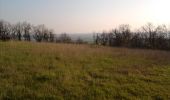
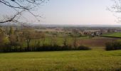
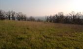
Départ du parking situé à coté du multiservice à Castelnaud de Gratecambe. Petite portion de route pour se mettre en jambe puis circuit agréable à travers les vergers. Attention par temps de pluie beaucoup d'ornières et sol glissant.
Positioning
Country:
France
Region :
New Aquitaine
Department/Province :
Lot-et-Garonne
Municipality :
Castelnaud-de-Gratecambe
Location:
Unknown
Start:(Dec)
Start:(UTM)
314635 ; 4929727 (31T) N.
Comments
Trails nearby
Castelnaud de Gratecambe - Cailladelles


Mountain bike
Difficult
(1)
Castelnaud-de-Gratecambe,
New Aquitaine,
Lot-et-Garonne,
France

17 km | 23 km-effort
1h 15min
Yes

Cancon, vers Moulinet, à la découverte du terroir


On foot
Easy
Cancon,
New Aquitaine,
Lot-et-Garonne,
France

16 km | 20 km-effort
4h 32min
Yes
Castelnaud de Gratecambe - Cailladelles


Equestrian
Difficult
Castelnaud-de-Gratecambe,
New Aquitaine,
Lot-et-Garonne,
France

17 km | 23 km-effort
2h 30min
Yes
Castelnaud de Gratecambe - Cailladelles


Walking
Difficult
Castelnaud-de-Gratecambe,
New Aquitaine,
Lot-et-Garonne,
France

17 km | 23 km-effort
3h 0min
Yes
Cancon vers Moulinet, à la découverte du terroir - Pays de la vallée du Lot


Equestrian
Difficult
Cancon,
New Aquitaine,
Lot-et-Garonne,
France

16.2 km | 20 km-effort
2h 49min
Yes
Cancon vers Moulinet, à la découverte du terroir - Pays de la vallée du Lot


Mountain bike
Difficult
Cancon,
New Aquitaine,
Lot-et-Garonne,
France

16.2 km | 20 km-effort
1h 40min
Yes
Cancon vers Moulinet, à la découverte du terroir - Pays de la vallée du Lot


Walking
Difficult
Cancon,
New Aquitaine,
Lot-et-Garonne,
France

16.2 km | 20 km-effort
4h 15min
Yes
Circuit VTT Haut Agenais - Castelnau de Grate Cambe


Mountain bike
Difficult
Castelnaud-de-Gratecambe,
New Aquitaine,
Lot-et-Garonne,
France

35 km | 45 km-effort
3h 0min
Yes

lacepede


Walking
Very easy
Beaugas,
New Aquitaine,
Lot-et-Garonne,
France

258 km | 302 km-effort
118h 57min
Yes


 SityTrail


