![](/images/other/stat-length.png)
![Trail Walking Thurins - Thurins - Rontalon - Monts du Lyonnais - Photo](https://media.geolcdn.com/t/1900/400/ext.pjpeg?maxdim=2&url=https%3A%2F%2Fstatic1.geolcdn.com%2Fsiteimages%2Fupload%2Ffiles%2F1553511878bg_sport_marche.png)
Thurins - Rontalon - Monts du Lyonnais
tracegps
User
![Length](/images/other/stat-length.png)
Length
10.6 km
![Max alt](https://static1.geolcdn.com/siteimages/upload/files/1508320355ic_sort_altitude_max_24dp.png)
Max alt
574 m
![Uphill gradient](https://static1.geolcdn.com/siteimages/upload/files/1508320355ic_sort_den_pos_24dp.png)
Uphill gradient
318 m
![Km-Effort](/images/other/stat-length.png)
Km-Effort
14.8 km
![Min alt](https://static1.geolcdn.com/siteimages/upload/files/1508320355ic_sort_altitude_min_24dp.png)
Min alt
324 m
![Downhill gradient](https://static1.geolcdn.com/siteimages/upload/files/1508320355ic_sort_den_neg_24dp.png)
Downhill gradient
318 m
![Boucle](https://static1.geolcdn.com/siteimages/upload/files/16400158638029165_repeat_loop_refresh_sync_direction_icon.png)
Boucle
Yes
Creation date :
2014-12-10 00:00:00.0
Updated on :
2014-12-10 00:00:00.0
![Walking](https://static1.geolcdn.com/sitytour/trail-icons/101.png)
2h19
Difficulty : Medium
![Scan this QR Code to open this trail in the SityTrail application](https://capi.geolives.com/qq0zvz2zws4bq2lad0pu/sitytour/trails/104809/qr.png?size=200)
FREE GPS app for hiking
About
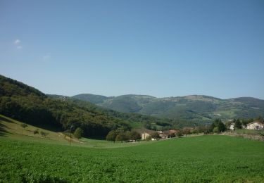
Trail Walking of 10.6 km to be discovered at Auvergne-Rhône-Alpes, Rhône, Thurins. This trail is proposed by tracegps.
Description
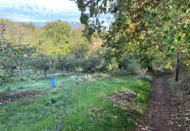
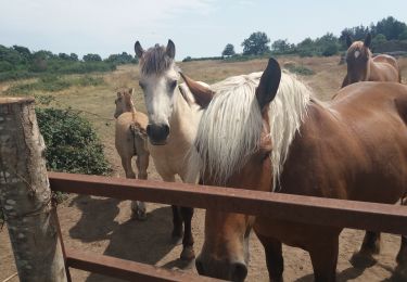
Balade entre Thurins et Rontalon (Balade des fruits rouges). 11 km - Parcours dans les forêts des Monts du Lyonnais, circuit botanique sur le retour entre Rontalon et Thurins.
Positioning
Country:
France
Region :
Auvergne-Rhône-Alpes
Department/Province :
Rhône
Municipality :
Thurins
Location:
Unknown
Start:(Dec)
Start:(UTM)
628685 ; 5059811 (31T) N.
Comments
Trails nearby
![Trail Walking Messimy - De Messimy au belvédère du Piragoy en boucle - Photo](https://media.geolcdn.com/t/375/260/4f6a03fe-103d-4ea3-ac7c-d9a11a0a7724.jpg&format=jpg&maxdim=2)
![Walking Walking](https://static1.geolcdn.com/sitytour/trail-icons/101.png)
De Messimy au belvédère du Piragoy en boucle
Walking
Easy
(1)
Messimy,
Auvergne-Rhône-Alpes,
Rhône,
France
![](/images/other/stat-length.png)
9.6 km | 13.6 km-effort
2h 31min
![](https://static1.geolcdn.com/siteimages/upload/files/16400158638029165_repeat_loop_refresh_sync_direction_icon.png)
Yes
![Trail Walking Thurins - tour du bois du baron - Photo](https://media.geolcdn.com/t/375/260/ext.jpg?maxdim=2&url=https%3A%2F%2Fservices.sitytrail.com%2FGeolivesWS%2FDownloadMedia.ashx%3FTrailID%3D548394%26Media%3Dfix__20160403153341.jpg)
![Walking Walking](https://static1.geolcdn.com/sitytour/trail-icons/101.png)
tour du bois du baron
Walking
Easy
(3)
Thurins,
Auvergne-Rhône-Alpes,
Rhône,
France
![](/images/other/stat-length.png)
7.4 km | 11.5 km-effort
1h 40min
![](https://static1.geolcdn.com/siteimages/upload/files/16400158638029165_repeat_loop_refresh_sync_direction_icon.png)
Yes
![Trail Mountain bike Messimy - monté technique - Photo](https://media.geolcdn.com/t/375/260/ext.jpg?maxdim=2&url=https%3A%2F%2Fstatic1.geolcdn.com%2Fsiteimages%2Fupload%2Ffiles%2F1524743154velo.jpg)
![Mountain bike Mountain bike](https://static1.geolcdn.com/sitytour/trail-icons/202.png)
monté technique
Mountain bike
Difficult
(1)
Messimy,
Auvergne-Rhône-Alpes,
Rhône,
France
![](/images/other/stat-length.png)
26 km | 41 km-effort
3h 15min
![](https://static1.geolcdn.com/siteimages/upload/files/16400158638029165_repeat_loop_refresh_sync_direction_icon.png)
Yes
![Trail Walking Yzeron - Yzeron - Les terres de Barmont - Photo](https://media.geolcdn.com/t/375/260/ext.jpg?maxdim=2&url=https%3A%2F%2Fstatic1.geolcdn.com%2Fsiteimages%2Fupload%2Ffiles%2F1553511878bg_sport_marche.png)
![Walking Walking](https://static1.geolcdn.com/sitytour/trail-icons/101.png)
Yzeron - Les terres de Barmont
Walking
Difficult
(1)
Yzeron,
Auvergne-Rhône-Alpes,
Rhône,
France
![](/images/other/stat-length.png)
11.3 km | 15.4 km-effort
2h 45min
![](https://static1.geolcdn.com/siteimages/upload/files/16400158638029165_repeat_loop_refresh_sync_direction_icon.png)
Yes
![Trail Walking Thurins - thurins la chap. château neuf st Laurent de vaux - Photo](https://media.geolcdn.com/t/375/260/f3d6c053-06d8-4319-9ba3-960eec1a724b.jpg&format=jpg&maxdim=2)
![Walking Walking](https://static1.geolcdn.com/sitytour/trail-icons/101.png)
thurins la chap. château neuf st Laurent de vaux
Walking
Very difficult
Thurins,
Auvergne-Rhône-Alpes,
Rhône,
France
![](/images/other/stat-length.png)
15.3 km | 24 km-effort
3h 37min
![](https://static1.geolcdn.com/siteimages/upload/files/16400158638029165_repeat_loop_refresh_sync_direction_icon.png)
Yes
![Trail Walking Messimy - messimy. thurins. soucieux en jarrest - Photo](https://media.geolcdn.com/t/375/260/671b857f-de41-42c9-86c8-35db977a224d.jpg&format=jpg&maxdim=2)
![Walking Walking](https://static1.geolcdn.com/sitytour/trail-icons/101.png)
messimy. thurins. soucieux en jarrest
Walking
Difficult
Messimy,
Auvergne-Rhône-Alpes,
Rhône,
France
![](/images/other/stat-length.png)
14 km | 17.2 km-effort
2h 58min
![](https://static1.geolcdn.com/siteimages/upload/files/16400158638029165_repeat_loop_refresh_sync_direction_icon.png)
Yes
![Trail Walking Brindas - de brindas à soucieux en jarrest - Photo](https://media.geolcdn.com/t/375/260/0437dd9e-577f-4074-95ce-afdcae6f044f.jpg&format=jpg&maxdim=2)
![Walking Walking](https://static1.geolcdn.com/sitytour/trail-icons/101.png)
de brindas à soucieux en jarrest
Walking
Very difficult
Brindas,
Auvergne-Rhône-Alpes,
Rhône,
France
![](/images/other/stat-length.png)
18 km | 21 km-effort
3h 52min
![](https://static1.geolcdn.com/siteimages/upload/files/16400158638029165_repeat_loop_refresh_sync_direction_icon.png)
Yes
![Trail On foot Vaugneray - Circuit du Capauduc - Photo](https://media.geolcdn.com/t/375/260/2fad17de-e3ff-4154-a54e-2b877983e049.jpeg&format=jpg&maxdim=2)
![On foot On foot](https://static1.geolcdn.com/sitytour/trail-icons/100.png)
Circuit du Capauduc
On foot
Medium
Vaugneray,
Auvergne-Rhône-Alpes,
Rhône,
France
![](/images/other/stat-length.png)
17.5 km | 25 km-effort
5h 45min
![](https://static1.geolcdn.com/siteimages/upload/files/16400158638029165_repeat_loop_refresh_sync_direction_icon.png)
Yes
![Trail On foot Yzeron - La Marmite du Diable - Photo](https://media.geolcdn.com/t/375/260/adaff439-7668-48a6-bae9-58355ae28789.jpeg&format=jpg&maxdim=2)
![On foot On foot](https://static1.geolcdn.com/sitytour/trail-icons/100.png)
La Marmite du Diable
On foot
Medium
Yzeron,
Auvergne-Rhône-Alpes,
Rhône,
France
![](/images/other/stat-length.png)
21 km | 30 km-effort
6h 55min
![](https://static1.geolcdn.com/siteimages/upload/files/16400158638029165_repeat_loop_refresh_sync_direction_icon.png)
Yes