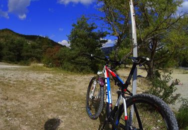
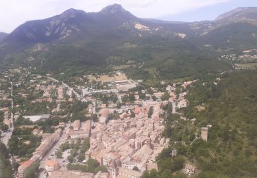
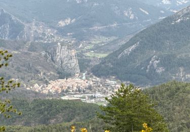
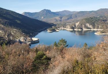
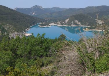
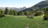
Trail Mountain bike Castellane - Grande Traversée des PréAlpes à VTT : Chaudanne - Stade de Neige de Vauplane - Photo

Grande Traversée des PréAlpes à VTT : Chaudanne - Stade de Neige de Vauplane

 tracegps
tracegps

User

© OpenStreetMap contributors
Length
Length
13.7 km
Max alt
Max alt
1610 m
Uphill gradient
Uphill gradient
904 m
Km-Effort
Km-Effort  
23 km
Min alt
Min alt
783 m
Downhill gradient
Downhill gradient
79 m
Boucle
Boucle
No
Creation date :
2014-12-10 00:00:00.0
Updated on :
2014-12-10 00:00:00.0

(0 Reviews)

Mountain bike
Mountain bike
3h30
Difficulty : Difficult

Scan this QR Code to open this trail in the SityTrail application

FREE GPS app for hiking

Logo SityTrail SityTrail

IGN / Geographical institutes

Download SityTrail from the App Store Download SityTrail from Google Play

Logo SityTrail SityTrail World

The world is yours!

Download SityTrail from the App Store Download SityTrail from Google Play Download SityTrail on Huawei AppGallery

About

Trail Mountain bike of 13.7 km to be discovered at Provence-Alpes-Côte d'Azur, Alpes-de-Haute-Provence, Castellane. This trail is proposed by tracegps.

Description

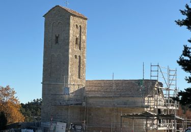
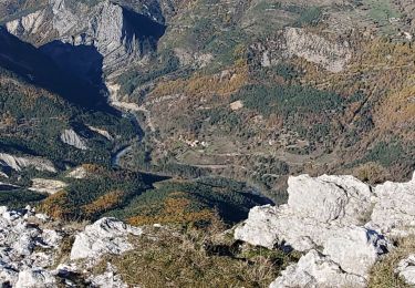
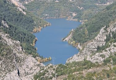
Grande Traversée des Préalpes, les Chemins du Soleil. Parcours officiel labellisé par la Fédération Française de Cyclisme. Pour apprécier comme il se doit les descentes, il faut savoir transpirer dans les montées ! De fait, cette étape offre la possibilité de profiter pleinement du paysage. Après 4 kilomètres de montée de sentier, où il vous faudra parfois pousser, vous apprécierez les quelques replats et prairies verdoyantes non loin de l’ombre des pins noirs. Votre effort sera récompensé par le panorama que réserve la station du Stade des Neiges de Vauplane. Vous pouvez éviter le poussage et rejoindre Vauplane en passant par une petite route longeant le Lac de Chaudanne, traverser Demandolx et rejoindre le balisage avant le col de St Barnabé. Consultez toutes les informations sur les hébergements et les services associés sur la fiche du tronçon.

Elevation profile

Photos

Positioning

Country:
France
Region :
Provence-Alpes-Côte d'Azur
Department/Province :
Alpes-de-Haute-Provence
Municipality :
Castellane
Location:
Unknown
Start:(Dec)
Start:(UTM)
302214 ; 4857459 (32T) N.

Trails nearby

Trail Mountain bike Castellane - vtt-de-castellane-au-lac-de-castillon - Photo
Mountain bike
GUIDE
pascalou73

Mountain bike

Very easy
Castellane, Provence-Alpes-Côte d'Azur, Alpes-de-Haute-Provence, France
14.7 km | 19.5 km-effort
Unknown
Yes
Trail Walking Castellane - castellane - Photo
Walking
RoMo

Walking

Medium
Castellane, Provence-Alpes-Côte d'Azur, Alpes-de-Haute-Provence, France
4.7 km | 8 km-effort
1h 26min
Yes
Trail Walking Castellane - La Colle : Cadières de Brandis - Photo
Walking
ETMU5496

Walking

Difficult
Castellane, Provence-Alpes-Côte d'Azur, Alpes-de-Haute-Provence, France
17.5 km | 30 km-effort
6h 54min
Yes
Trail Walking Demandolx - Demandolx cremon 1000m 16kms  - Photo
Walking
GUIDE
Danielba

Walking

Very difficult
Demandolx, Provence-Alpes-Côte d'Azur, Alpes-de-Haute-Provence, France
14.8 km | 27 km-effort
8h 5min
Yes
Trail Walking Castellane - Thyrs : sommet du Robion - Photo
Walking
ETMU5496

Walking

Difficult
Castellane, Provence-Alpes-Côte d'Azur, Alpes-de-Haute-Provence, France
14.6 km | 28 km-effort
6h 16min
Yes
Trail Walking Castellane - robion castellane 1226m 15k - Photo
Walking
GUIDE
Danielba

Walking

Very difficult
Castellane, Provence-Alpes-Côte d'Azur, Alpes-de-Haute-Provence, France
13.9 km | 27 km-effort
7h 50min
Yes
Trail Walking Castellane - 2023-10-27 Sommet de Destourbes - Photo
Walking
GUIDE
Kargil

Walking

Difficult
Castellane, Provence-Alpes-Côte d'Azur, Alpes-de-Haute-Provence, France
13.6 km | 24 km-effort
5h 33min
Yes
Trail Walking Castellane - robion sommet - Photo
Walking
GUIDE
Danielba

Walking

Very difficult
Castellane, Provence-Alpes-Côte d'Azur, Alpes-de-Haute-Provence, France
16.6 km | 32 km-effort
8h 17min
Yes
Trail Walking Demandolx - le hameau de ville - Photo
Walking
pln30

Walking

Easy
Demandolx, Provence-Alpes-Côte d'Azur, Alpes-de-Haute-Provence, France
4.3 km | 7.8 km-effort
2h 2min
Yes


Close
My subscriptions