


15.5 km | 26 km-effort


User


FREE GPS app for hiking
 SityTrail
IGN / Geographical institutes
SityTrail World
The world is yours!
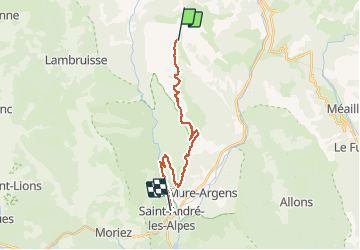
Trail Mountain bike of 19.3 km to be discovered at Provence-Alpes-Côte d'Azur, Alpes-de-Haute-Provence, La Mure-Argens. This trail is proposed by tracegps.
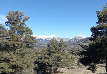
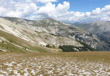
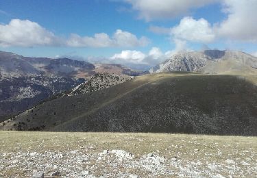
Grande Traversée des Préalpes, les Chemins du Soleil. Parcours officiel labellisé par la Fédération Française de Cyclisme. Sur la montagne de Maurel, vous entrez dans le Parc Naturel Régional du Verdon. Vous êtes ici dans « le sauvage » qui recèle des raffinements inattendus : gerbes de pivoines, de trolles et de lis martagon au printemps, vol de l'alexanor, un papillon rare et protégé qui fréquente les épis fleuris des lavandes fines. Roulez calmement et patience : chevreuils, chamois, et même Gélinotte croiseront peut-être votre chemin. Le plus dur a été fait précédemment. Ce tronçon contourne une vaste étendue de pâturage d'altitude puis vous monterez jusque l'antenne de la Montagne de Maurel. Quasiment 800m de dénivelée négative sur sentiers ludiques vous y attendent. Un faux plat descendant fait ensuite la jonction avec Saint André les Alpes en bordure du Lac de Castillon. Mesure de prudence : zone d'élevage : présence du Patou. Ce chien de troupeau a besoin de vous identifier, s'il vous approche continuez à contourner le troupeau ou arrêtez vous. Pour votre sécurité, adoptez un comportement calme. Balisage à vue dans la première partie de la descente. Soyez vigilant. Consultez toutes les informations sur les hébergements et les services associés sur la fiche du tronçon.


Walking
Mountain bike
Walking
Walking
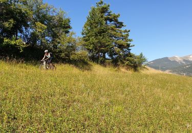
Mountain bike
Walking
Mountain bike
Mountain bike
Walking