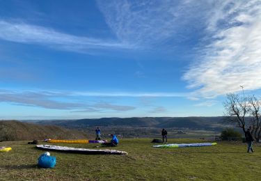
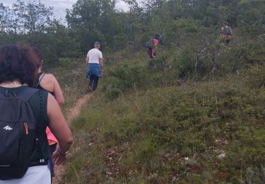
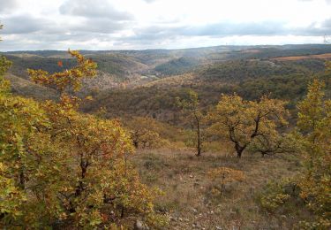
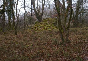
Trail Walking Saint-Vincent-Rive-d'Olt - Point de vue sur le cingle de Luzech - Photo

Point de vue sur le cingle de Luzech

 tracegps
tracegps

User

© OpenStreetMap contributors
Length
Length
4.6 km
Max alt
Max alt
282 m
Uphill gradient
Uphill gradient
202 m
Km-Effort
Km-Effort  
7.3 km
Min alt
Min alt
103 m
Downhill gradient
Downhill gradient
201 m
Boucle
Boucle
Yes
Creation date :
2014-12-10 00:00:00.0
Updated on :
2014-12-10 00:00:00.0

(1 Reviews)

Walking
Walking
1h30
Difficulty : Difficult

Scan this QR Code to open this trail in the SityTrail application

FREE GPS app for hiking

Logo SityTrail SityTrail

IGN / Geographical institutes

Download SityTrail from the App Store Download SityTrail from Google Play

Logo SityTrail SityTrail World

The world is yours!

Download SityTrail from the App Store Download SityTrail from Google Play Download SityTrail on Huawei AppGallery

About

Trail Walking of 4.6 km to be discovered at Occitania, Lot, Saint-Vincent-Rive-d'Olt. This trail is proposed by tracegps.

Description

Dans le centre du village, traverser le pont devant le parking et prendre la première rue à gauche. À une fourche avec un panneau "limitation 2 t" prendre à gauche et, un peu plus loin, continuer tout droit (panneau sentier des pervenches). Devant l'entrée d'une propriété, au niveau d'une boîte aux lettres, prendre le petit sentier qui part à droite. Longer le stade et suivre le fond de la vallée. À environ 2 km du départ, quitter le sentier des pervenches et en prendre un qui monte à droite (panneau les 20 voltes, Bimbotes). Sur le plateau passer entre 2 vignes, continuer sur un chemin assez large et prendre une petite route sur la droite. Quelques centaines de mètres plus bas (environ 500 m), prendre un chemin à gauche (panneau lo Plano, point de vue). Arriver sur un espace dégagé, point de départ de parapentes, et suivre un sentier sur la crête au bord de la falaise jusqu'à une route goudronnée. Passer entre le muret et la croix et prendre un petit sentier, peu visible au début, qui descend vers Saint-Vincent. En retrouvant le goudron prendre à gauche et rejoindre le parking.

Elevation profile

Photos

Positioning

Country:
France
Region :
Occitania
Department/Province :
Lot
Municipality :
Saint-Vincent-Rive-d'Olt
Location:
Unknown
Start:(UTM)
364767 ; 4924935 (31T) N.

Comments

Please log in to post a review or rate the element


Belle promenade typique du Causse, Lot, vignes de Cahors


Trails nearby

Trail Walking Saint-Vincent-Rive-d'Olt - St Vincent-rive  d’Holt (Lot) - Photo
Walking
houbart

Walking

Difficult
(1)
Saint-Vincent-Rive-d'Olt, Occitania, Lot, France
11.6 km | 17.4 km-effort
3h 57min
Yes
Trail Walking Crayssac - Crayssac Cévennes  - Photo
Walking
GUIDE
antignacs

Walking

Very easy
Crayssac, Occitania, Lot, France
6.3 km | 9.1 km-effort
1h 43min
No
Trail Walking Luzech - De Luzech à Castelfranc - Photo
Walking
tracegps

Walking

Very difficult
Luzech, Occitania, Lot, France
24 km | 32 km-effort
5h 0min
Yes
Trail Walking Luzech - LUZECH - Photo
Walking
RonanDAGORN

Walking

Medium
Luzech, Occitania, Lot, France
11.4 km | 16.1 km-effort
2h 52min
Yes
Trail Walking Douelle - filles mamu aprem - Photo
Walking
pedromartin

Walking

Difficult
Douelle, Occitania, Lot, France
11.4 km | 14.2 km-effort
3h 8min
No
Trail Walking Trespoux-Rassiels - filles de manu 1juin24 - Photo
Walking
pedromartin

Walking

Medium
Trespoux-Rassiels, Occitania, Lot, France
5 km | 7.2 km-effort
1h 33min
Yes
Trail Walking Cambayrac - Cambeyrac - Photo
Walking
thomas.o.vert

Walking

Medium
Cambayrac, Occitania, Lot, France
9.8 km | 12.4 km-effort
2h 11min
Yes
Trail Walking Douelle - Douelle_Mader/Combe de Vadaillac/les Roubines 6 - Photo
Walking
PariseJL

Walking

Easy
Douelle, Occitania, Lot, France
6 km | 8.9 km-effort
2h 8min
Yes
Trail Walking Luzech - Fages_Pech-vert_Foulquet 6,5 - Photo
Walking
PariseJL

Walking

Very easy
Luzech, Occitania, Lot, France
6.5 km | 8.9 km-effort
2h 7min
Yes


Close
My subscriptions