Trail Walking Berles-au-Bois - Berles Au Bois - La Cauchie - Bailleulmont - Bailleulval - Photo

Berles Au Bois - La Cauchie - Bailleulmont - Bailleulval

 tracegps
tracegps

User

© OpenStreetMap contributors
Length
Length
9.6 km
Max alt
Max alt
154 m
Uphill gradient
Uphill gradient
114 m
Km-Effort
Km-Effort  
11.1 km
Min alt
Min alt
107 m
Downhill gradient
Downhill gradient
115 m
Boucle
Boucle
Yes
Creation date :
2014-12-10 00:00:00.0
Updated on :
2014-12-10 00:00:00.0

(0 Reviews)

Walking
Walking
2h00
Difficulty : Medium

Scan this QR Code to open this trail in the SityTrail application

FREE GPS app for hiking

Logo SityTrail SityTrail

IGN / Geographical institutes

Download SityTrail from the App Store Download SityTrail from Google Play

Logo SityTrail SityTrail World

The world is yours!

Download SityTrail from the App Store Download SityTrail from Google Play Download SityTrail on Huawei AppGallery

About

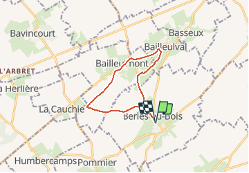
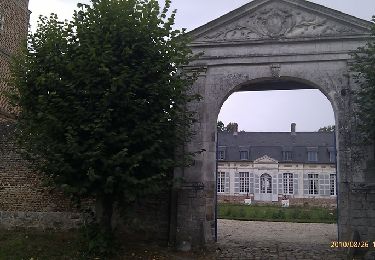
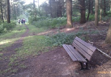
Trail Walking of 9.6 km to be discovered at Hauts-de-France, Pas-de-Calais, Berles-au-Bois. This trail is proposed by tracegps.

Description

Belle randonnée reliant 3 villages par des chemins vallonnés.

Elevation profile

Photos

Positioning

Country:
France
Region :
Hauts-de-France
Department/Province :
Pas-de-Calais
Municipality :
Berles-au-Bois
Location:
Unknown
Start:(UTM)
473544 ; 5560562 (31U) N.

Trails nearby

Trail Walking Souastre - Sentier du Moulin de Bois - Souastre - Photo
Walking
tracegps

Walking

Difficult
Souastre, Hauts-de-France, Pas-de-Calais, France
13.8 km | 14.9 km-effort
3h 25min
Yes
Trail Walking Basseux - Basseux - Bailleulmont - Berles au Bois - Photo
Walking
tracegps

Walking

Medium
Basseux, Hauts-de-France, Pas-de-Calais, France
9.7 km | 11.1 km-effort
2h 0min
Yes
Trail Walking Rivière - Rivière - Pas de Calais - Photo
Walking
tracegps

Walking

Medium
Rivière, Hauts-de-France, Pas-de-Calais, France
8.2 km | 9 km-effort
1h 40min
Yes
Trail Walking Ransart - Ransart - Bois d'Adinfer - Photo
Walking
tracegps

Walking

Medium
Ransart, Hauts-de-France, Pas-de-Calais, France
6.8 km | 7.8 km-effort
1h 30min
Yes
Trail Walking Bavincourt - Le sentier de la longue Borne - Bavincourt - Photo
Walking
tracegps

Walking

Medium
Bavincourt, Hauts-de-France, Pas-de-Calais, France
9.8 km | 10.9 km-effort
2h 30min
Yes
Trail Mountain bike Beaumetz-lès-Loges - Beaumetz les Loges - Photo
Mountain bike
tracegps

Mountain bike

Medium
Beaumetz-lès-Loges, Hauts-de-France, Pas-de-Calais, France
59 km | 66 km-effort
2h 45min
Yes
Trail Walking Rivière - Rivière 7 km - Photo
Walking
Barney62

Walking

Medium
Rivière, Hauts-de-France, Pas-de-Calais, France
7 km | 7.7 km-effort
1h 45min
Yes
Trail Walking Rivière - Rivière - Photo
Walking
Barney62

Walking

Difficult
Rivière, Hauts-de-France, Pas-de-Calais, France
13.7 km | 15.2 km-effort
3h 27min
Yes
Trail Walking Souastre - Souastre - Photo
Walking
jpblimond

Walking

Easy
Souastre, Hauts-de-France, Pas-de-Calais, France
15.2 km | 17.2 km-effort
3h 39min
Yes


Close
My subscriptions