![](/images/other/stat-length.png)
![Trail Walking Saint-Michel - Forêt d'Orion - Photo](https://media.geolcdn.com/t/1900/400/ext.pjpeg?maxdim=2&url=https%3A%2F%2Fstatic1.geolcdn.com%2Fsiteimages%2Fupload%2Ffiles%2F1553511878bg_sport_marche.png)
Forêt d'Orion
DECHAMPD
User
![Length](/images/other/stat-length.png)
Length
13.2 km
![Max alt](https://static1.geolcdn.com/siteimages/upload/files/1508320355ic_sort_altitude_max_24dp.png)
Max alt
1169 m
![Uphill gradient](https://static1.geolcdn.com/siteimages/upload/files/1508320355ic_sort_den_pos_24dp.png)
Uphill gradient
578 m
![Km-Effort](/images/other/stat-length.png)
Km-Effort
21 km
![Min alt](https://static1.geolcdn.com/siteimages/upload/files/1508320355ic_sort_altitude_min_24dp.png)
Min alt
751 m
![Downhill gradient](https://static1.geolcdn.com/siteimages/upload/files/1508320355ic_sort_den_neg_24dp.png)
Downhill gradient
578 m
![Boucle](https://static1.geolcdn.com/siteimages/upload/files/16400158638029165_repeat_loop_refresh_sync_direction_icon.png)
Boucle
Yes
Creation date :
2019-01-14 17:29:57.089
Updated on :
2019-01-14 17:29:57.155
![Walking](https://static1.geolcdn.com/sitytour/trail-icons/101.png)
4h18
Difficulty : Easy
![Scan this QR Code to open this trail in the SityTrail application](https://capi.geolives.com/qq0zvz2zws4bq2lad0pu/sitytour/trails/1046529/qr.png?size=200)
FREE GPS app for hiking
About
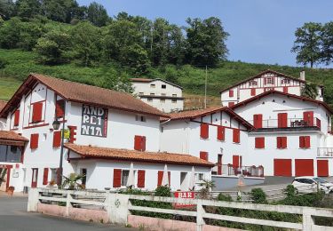
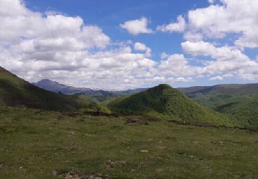
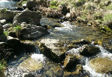
Trail Walking of 13.2 km to be discovered at New Aquitaine, Pyrénées-Atlantiques, Saint-Michel. This trail is proposed by DECHAMPD.
Description
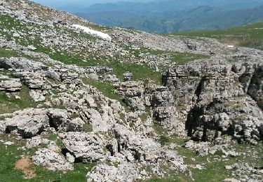
Depuis le col d'Irei, Garateko borda, le bois d'hartsuri, Vierge d'Orisson, redoute de Château Pignon, le rocher de Zerkupe et la grotte aux cabanes d'elhursaro.
Positioning
Country:
France
Region :
New Aquitaine
Department/Province :
Pyrénées-Atlantiques
Municipality :
Saint-Michel
Location:
Unknown
Start:(Dec)
Start:(UTM)
644737 ; 4772224 (30T) N.
Comments
Trails nearby
![Trail Walking Estérençuby - URCULU 2015 05 12 effectuée - Photo](https://media.geolcdn.com/t/375/260/ext.jpg?maxdim=2&url=https%3A%2F%2Fservices.sitytrail.com%2FGeolivesWS%2FDownloadMedia.ashx%3FTrailID%3D419942%26Media%3Dfix__20150512133806.jpg)
![Walking Walking](https://static1.geolcdn.com/sitytour/trail-icons/101.png)
URCULU 2015 05 12 effectuée
Walking
Medium
(2)
Estérençuby,
New Aquitaine,
Pyrénées-Atlantiques,
France
![](/images/other/stat-length.png)
12.3 km | 19.6 km-effort
3h 46min
![](https://static1.geolcdn.com/siteimages/upload/files/16400158638029165_repeat_loop_refresh_sync_direction_icon.png)
Yes
![Trail Walking Estérençuby - esterençuby fait - Photo](https://media.geolcdn.com/t/375/260/08a3bfec-1be5-430d-b7b7-2a06d84f8372.jpg&format=jpg&maxdim=2)
![Walking Walking](https://static1.geolcdn.com/sitytour/trail-icons/101.png)
esterençuby fait
Walking
Very easy
Estérençuby,
New Aquitaine,
Pyrénées-Atlantiques,
France
![](/images/other/stat-length.png)
12.8 km | 20 km-effort
5h 41min
![](https://static1.geolcdn.com/siteimages/upload/files/16400158638029165_repeat_loop_refresh_sync_direction_icon.png)
Yes
![Trail Walking Estérençuby - GROTTE D'HARPEA - Photo](https://media.geolcdn.com/t/375/260/ext.jpg?maxdim=2&url=https%3A%2F%2Fstatic1.geolcdn.com%2Fsiteimages%2Fupload%2Ffiles%2F1553511878bg_sport_marche.png)
![Walking Walking](https://static1.geolcdn.com/sitytour/trail-icons/101.png)
GROTTE D'HARPEA
Walking
Medium
(1)
Estérençuby,
New Aquitaine,
Pyrénées-Atlantiques,
France
![](/images/other/stat-length.png)
12.1 km | 23 km-effort
4h 49min
![](https://static1.geolcdn.com/siteimages/upload/files/16400158638029165_repeat_loop_refresh_sync_direction_icon.png)
Yes
![Trail Walking Estérençuby - Esterençuby au col de Ernagako Borda - 6 km de randonnée - Photo](https://media.geolcdn.com/t/375/260/d0fe1fb9-8d0b-483b-ab93-6c6dbdfedde5.jpg&format=jpg&maxdim=2)
![Walking Walking](https://static1.geolcdn.com/sitytour/trail-icons/101.png)
Esterençuby au col de Ernagako Borda - 6 km de randonnée
Walking
Very difficult
Estérençuby,
New Aquitaine,
Pyrénées-Atlantiques,
France
![](/images/other/stat-length.png)
13.3 km | 22 km-effort
5h 4min
![](https://static1.geolcdn.com/siteimages/upload/files/16400158638029165_repeat_loop_refresh_sync_direction_icon.png)
No
![Trail Walking Saint-Michel - compostelle - camino Frances J2 : de Orisson à Espinal - Photo](https://media.geolcdn.com/t/375/260/20a6e720-4338-4926-9405-8088c87e561f.jpg&format=jpg&maxdim=2)
![Walking Walking](https://static1.geolcdn.com/sitytour/trail-icons/101.png)
compostelle - camino Frances J2 : de Orisson à Espinal
Walking
Medium
Saint-Michel,
New Aquitaine,
Pyrénées-Atlantiques,
France
![](/images/other/stat-length.png)
20 km | 28 km-effort
7h 30min
![](https://static1.geolcdn.com/siteimages/upload/files/16400158638029165_repeat_loop_refresh_sync_direction_icon.png)
No
![Trail Walking Estérençuby - GR 10 7ème étape : gîte de Kaskoleta - com d’Okabe - chalet Iraty - Photo](https://media.geolcdn.com/t/375/260/501d613f-cef8-4e6f-a900-e37dd44e3d86.jpg&format=jpg&maxdim=2)
![Walking Walking](https://static1.geolcdn.com/sitytour/trail-icons/101.png)
GR 10 7ème étape : gîte de Kaskoleta - com d’Okabe - chalet Iraty
Walking
Difficult
Estérençuby,
New Aquitaine,
Pyrénées-Atlantiques,
France
![](/images/other/stat-length.png)
23 km | 41 km-effort
6h 27min
![](https://static1.geolcdn.com/siteimages/upload/files/16400158638029165_repeat_loop_refresh_sync_direction_icon.png)
No
![Trail Walking Estérençuby - Harpéa - Photo](https://media.geolcdn.com/t/375/260/ext.jpg?maxdim=2&url=https%3A%2F%2Fservices.sitytrail.com%2FGeolivesWS%2FDownloadMedia.ashx%3FTrailID%3D748133%26Media%3Dfix__20170507143514.jpg)
![Walking Walking](https://static1.geolcdn.com/sitytour/trail-icons/101.png)
Harpéa
Walking
Medium
Estérençuby,
New Aquitaine,
Pyrénées-Atlantiques,
France
![](/images/other/stat-length.png)
15.9 km | 29 km-effort
5h 52min
![](https://static1.geolcdn.com/siteimages/upload/files/16400158638029165_repeat_loop_refresh_sync_direction_icon.png)
Yes
![Trail Walking Estérençuby - source de la Nive et grotte Harpéa. - Photo](https://media.geolcdn.com/t/375/260/ext.jpg?maxdim=2&url=https%3A%2F%2Fservices.sitytrail.com%2FGeolivesWS%2FDownloadMedia.ashx%3FTrailID%3D405148%26Media%3Dfix__20150407120019.jpg)
![Walking Walking](https://static1.geolcdn.com/sitytour/trail-icons/101.png)
source de la Nive et grotte Harpéa.
Walking
Very difficult
Estérençuby,
New Aquitaine,
Pyrénées-Atlantiques,
France
![](/images/other/stat-length.png)
12 km | 21 km-effort
4h 43min
![](https://static1.geolcdn.com/siteimages/upload/files/16400158638029165_repeat_loop_refresh_sync_direction_icon.png)
Yes
![Trail Other activity Saint-Michel - Orisson-Ronceveau - Photo](https://media.geolcdn.com/t/375/260/ext.jpg?maxdim=2&url=https%3A%2F%2Fstatic1.geolcdn.com%2Fsiteimages%2Fupload%2Ffiles%2F1545311037marcheuse_200dpi.jpg)
![Other activity Other activity](https://static1.geolcdn.com/sitytour/trail-icons/900.png)
Orisson-Ronceveau
Other activity
Very easy
(1)
Saint-Michel,
New Aquitaine,
Pyrénées-Atlantiques,
France
![](/images/other/stat-length.png)
21 km | 33 km-effort
5min
![](https://static1.geolcdn.com/siteimages/upload/files/16400158638029165_repeat_loop_refresh_sync_direction_icon.png)
No