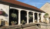
Trail Mountain bike Échigey - Bourges (18) - Breurey lès Faverney (70) - Etape 5/6 - De Echigey à Seveux - Photo

Bourges (18) - Breurey lès Faverney (70) - Etape 5/6 - De Echigey à Seveux

 tracegps
tracegps

User

© OpenStreetMap contributors
Length
Length
92 km
Max alt
Max alt
248 m
Uphill gradient
Uphill gradient
641 m
Km-Effort
Km-Effort  
101 km
Min alt
Min alt
177 m
Downhill gradient
Downhill gradient
640 m
Boucle
Boucle
No
Creation date :
2014-12-10 00:00:00.0
Updated on :
2014-12-10 00:00:00.0

(0 Reviews)

Mountain bike
Mountain bike
8h30
Difficulty : Difficult

Scan this QR Code to open this trail in the SityTrail application

FREE GPS app for hiking

Logo SityTrail SityTrail

IGN / Geographical institutes

Download SityTrail from the App Store Download SityTrail from Google Play

Logo SityTrail SityTrail World

The world is yours!

Download SityTrail from the App Store Download SityTrail from Google Play Download SityTrail on Huawei AppGallery

About

Trail Mountain bike of 92 km to be discovered at Bourgogne-Franche-Comté, Côte-d'Or, Échigey. This trail is proposed by tracegps.

Description

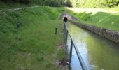
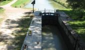
Traversées des très belles forêts de Longchamp et St Léger, pour rejoindre les rives de Saône, le canal de la Marne à la Saône, puis de nouveau les rives de Saône. A l'écluse n°13 de Savoyeux, la voie d'eau est souterraine. Vous passerez au dessus du tunnel pour arriver à Seveux, chambre d'hôtes, rue du Paquis, terme de cette 5ème étape. Faire le bon choix (gauche ou droit) de la rive de Saône à prendre, pour éviter les kilomètres supplémentaires. -Rive gauche à Lamarche. -Rive droite à Pontailler. -Traverser la Saône par la D39 à Apremont. -A Gray, rester rive gauche. -Rive droite à Quitteur jusqu'au tunnel. -Rive gauche après le tunnel jusqu'à Seveux.

Elevation profile

Photos

Positioning

Country:
France
Region :
Bourgogne-Franche-Comté
Department/Province :
Côte-d'Or
Municipality :
Échigey
Location:
Unknown
Start:(UTM)
666354 ; 5227887 (31T) N.

Trails nearby

Trail sport Tart - TART le Haut 24 - Photo
sport
Bonnefois Bernard

sport

Very easy
Tart, Bourgogne-Franche-Comté, Côte-d'Or, France
5.6 km | 6.4 km-effort
Unknown
Yes
Trail Cycle Tart - J2 Genlis Coussey - Photo
Cycle
legris

Cycle

Very easy
Tart, Bourgogne-Franche-Comté, Côte-d'Or, France
158 km | 180 km-effort
10h 47min
No
Trail Walking Tart - Bois de Tart le Haut - Photo
Walking
Danyjoub21

Walking

Easy
Tart, Bourgogne-Franche-Comté, Côte-d'Or, France
13.1 km | 14.4 km-effort
3h 12min
Yes


Close
My subscriptions