![](/images/other/stat-length.png)
![Trail Walking Sanilhac - Notre-Dame de Sanilhac-Boucle d'Ambroise - Photo](https://media.geolcdn.com/t/1900/400/ext.pjpeg?maxdim=2&url=https%3A%2F%2Fstatic1.geolcdn.com%2Fsiteimages%2Fupload%2Ffiles%2F1553511878bg_sport_marche.png)
Notre-Dame de Sanilhac-Boucle d'Ambroise
sidore
User
![Length](/images/other/stat-length.png)
Length
9.5 km
![Max alt](https://static1.geolcdn.com/siteimages/upload/files/1508320355ic_sort_altitude_max_24dp.png)
Max alt
223 m
![Uphill gradient](https://static1.geolcdn.com/siteimages/upload/files/1508320355ic_sort_den_pos_24dp.png)
Uphill gradient
251 m
![Km-Effort](/images/other/stat-length.png)
Km-Effort
12.9 km
![Min alt](https://static1.geolcdn.com/siteimages/upload/files/1508320355ic_sort_altitude_min_24dp.png)
Min alt
121 m
![Downhill gradient](https://static1.geolcdn.com/siteimages/upload/files/1508320355ic_sort_den_neg_24dp.png)
Downhill gradient
250 m
![Boucle](https://static1.geolcdn.com/siteimages/upload/files/16400158638029165_repeat_loop_refresh_sync_direction_icon.png)
Boucle
Yes
Creation date :
2018-09-21 16:07:58.461
Updated on :
2018-09-25 21:52:14.384
![Walking](https://static1.geolcdn.com/sitytour/trail-icons/101.png)
1h50
Difficulty : Easy
![Scan this QR Code to open this trail in the SityTrail application](https://capi.geolives.com/qq0zvz2zws4bq2lad0pu/sitytour/trails/1044215/qr.png?size=200)
FREE GPS app for hiking
About
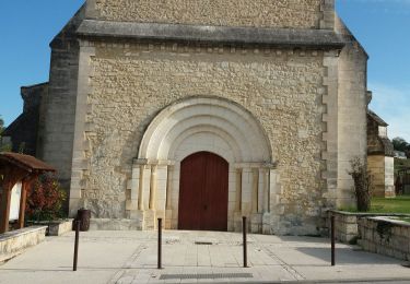
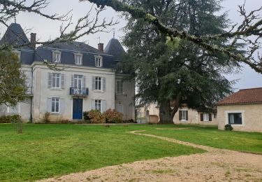
Trail Walking of 9.5 km to be discovered at New Aquitaine, Dordogne, Sanilhac. This trail is proposed by sidore.
Description
Se garer sur le bas côté. Bien vérifier qu’il n’ y a pas de petit fossé à cet endroit.
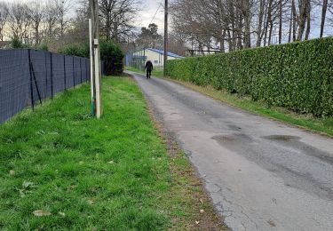
Rando très sympa, mélange de bois et à découvert.
Positioning
Country:
France
Region :
New Aquitaine
Department/Province :
Dordogne
Municipality :
Sanilhac
Location:
Notre-Dame-de-Sanilhac
Start:(Dec)
Start:(UTM)
318576 ; 4999673 (31T) N.
Comments
Trails nearby
![Trail Walking Boulazac Isle Manoire - Atur - Photo](https://media.geolcdn.com/t/375/260/ext.jpg?maxdim=2&url=https%3A%2F%2Fstatic1.geolcdn.com%2Fsiteimages%2Fupload%2Ffiles%2F1553511878bg_sport_marche.png)
![Walking Walking](https://static1.geolcdn.com/sitytour/trail-icons/101.png)
Atur
Walking
Easy
(1)
Boulazac Isle Manoire,
New Aquitaine,
Dordogne,
France
![](/images/other/stat-length.png)
12.5 km | 15.8 km-effort
3h 23min
![](https://static1.geolcdn.com/siteimages/upload/files/16400158638029165_repeat_loop_refresh_sync_direction_icon.png)
Yes
![Trail Walking Coursac - boucle du rosier marche bleue - Photo](https://media.geolcdn.com/t/375/260/d83b7788-1fdb-42b9-9fbc-149baeab5508.jpg&format=jpg&maxdim=2)
![Walking Walking](https://static1.geolcdn.com/sitytour/trail-icons/101.png)
boucle du rosier marche bleue
Walking
Medium
Coursac,
New Aquitaine,
Dordogne,
France
![](/images/other/stat-length.png)
6.6 km | 8.8 km-effort
1h 57min
![](https://static1.geolcdn.com/siteimages/upload/files/16400158638029165_repeat_loop_refresh_sync_direction_icon.png)
Yes
![Trail Walking Coursac - grande boucle des lavoirs de coursac - Photo](https://media.geolcdn.com/t/375/260/3fa5f0c6-b1d7-42fd-8ff2-bc6e455cff21.jpg&format=jpg&maxdim=2)
![Walking Walking](https://static1.geolcdn.com/sitytour/trail-icons/101.png)
grande boucle des lavoirs de coursac
Walking
Medium
Coursac,
New Aquitaine,
Dordogne,
France
![](/images/other/stat-length.png)
15.7 km | 21 km-effort
3h 23min
![](https://static1.geolcdn.com/siteimages/upload/files/16400158638029165_repeat_loop_refresh_sync_direction_icon.png)
No
![Trail Walking Coursac - boucle des 3 lavoirs - Photo](https://media.geolcdn.com/t/375/260/8c9c2f7a-ce33-413d-8132-a9034753067e.jpg&format=jpg&maxdim=2)
![Walking Walking](https://static1.geolcdn.com/sitytour/trail-icons/101.png)
boucle des 3 lavoirs
Walking
Easy
Coursac,
New Aquitaine,
Dordogne,
France
![](/images/other/stat-length.png)
9 km | 12.3 km-effort
1h 46min
![](https://static1.geolcdn.com/siteimages/upload/files/16400158638029165_repeat_loop_refresh_sync_direction_icon.png)
No
![Trail Nordic walking Coursac - Coursac - Photo](https://media.geolcdn.com/t/375/260/ext.jpg?maxdim=2&url=https%3A%2F%2Fstatic1.geolcdn.com%2Fsiteimages%2Fupload%2Ffiles%2F1545311037marcheuse_200dpi.jpg)
![Nordic walking Nordic walking](https://static1.geolcdn.com/sitytour/trail-icons/102.png)
Coursac
Nordic walking
Very easy
(1)
Coursac,
New Aquitaine,
Dordogne,
France
![](/images/other/stat-length.png)
9.9 km | 13 km-effort
2h 23min
![](https://static1.geolcdn.com/siteimages/upload/files/16400158638029165_repeat_loop_refresh_sync_direction_icon.png)
Yes
![Trail Walking Sanilhac - ND de Sanilhac-Boucle du Pic - Photo](https://media.geolcdn.com/t/375/260/ext.jpg?maxdim=2&url=https%3A%2F%2Fstatic1.geolcdn.com%2Fsiteimages%2Fupload%2Ffiles%2F1553511878bg_sport_marche.png)
![Walking Walking](https://static1.geolcdn.com/sitytour/trail-icons/101.png)
ND de Sanilhac-Boucle du Pic
Walking
Easy
(2)
Sanilhac,
New Aquitaine,
Dordogne,
France
![](/images/other/stat-length.png)
7.3 km | 9 km-effort
1h 43min
![](https://static1.geolcdn.com/siteimages/upload/files/16400158638029165_repeat_loop_refresh_sync_direction_icon.png)
Yes
![Trail Walking Église-Neuve-de-Vergt - Eglise Neuve Vergt - Photo](https://media.geolcdn.com/t/375/260/c1219e7f-9e9a-411f-9248-f2ee6d3c3c64.jpg&format=jpg&maxdim=2)
![Walking Walking](https://static1.geolcdn.com/sitytour/trail-icons/101.png)
Eglise Neuve Vergt
Walking
Easy
Église-Neuve-de-Vergt,
New Aquitaine,
Dordogne,
France
![](/images/other/stat-length.png)
11.5 km | 14.3 km-effort
2h 36min
![](https://static1.geolcdn.com/siteimages/upload/files/16400158638029165_repeat_loop_refresh_sync_direction_icon.png)
Yes
![Trail Walking Creyssensac-et-Pissot - boucle creyssensac - Photo](https://media.geolcdn.com/t/375/260/ext.jpg?maxdim=2&url=https%3A%2F%2Fservices.sitytrail.com%2FGeolivesWS%2FDownloadMedia.ashx%3FTrailID%3D921085%26Media%3Dfix__20180311164914.jpg)
![Walking Walking](https://static1.geolcdn.com/sitytour/trail-icons/101.png)
boucle creyssensac
Walking
Easy
Creyssensac-et-Pissot,
New Aquitaine,
Dordogne,
France
![](/images/other/stat-length.png)
10.2 km | 12.7 km-effort
2h 14min
![](https://static1.geolcdn.com/siteimages/upload/files/16400158638029165_repeat_loop_refresh_sync_direction_icon.png)
Yes
![Trail Other activity Creyssensac-et-Pissot - étang des rosiers - Photo](https://media.geolcdn.com/t/375/260/ext.jpg?maxdim=2&url=https%3A%2F%2Fservices.sitytrail.com%2FGeolivesWS%2FDownloadMedia.ashx%3FTrailID%3D617235%26Media%3Dfix__20160730115705.jpg)
![Other activity Other activity](https://static1.geolcdn.com/sitytour/trail-icons/900.png)
étang des rosiers
Other activity
Very easy
Creyssensac-et-Pissot,
New Aquitaine,
Dordogne,
France
![](/images/other/stat-length.png)
11.1 km | 14.6 km-effort
3h 17min
![](https://static1.geolcdn.com/siteimages/upload/files/16400158638029165_repeat_loop_refresh_sync_direction_icon.png)
Yes