![](/images/other/stat-length.png)
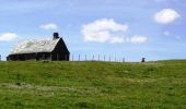
![Trail Mountain bike Condom-d'Aubrac - Site VTT FFC Aubrac - Vallée du Lot - Circuit n°5 - Les Enguilhens - Photo](https://media.geolcdn.com/t/1900/400/ext.pjpeg?maxdim=2&url=https%3A%2F%2Fservices.sitytrail.com%2FGeolivesWS%2FDownloadMedia.ashx%3FTrailID%3D104369%26Media%3D7616_2.jpg)
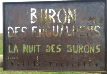
Site VTT FFC Aubrac - Vallée du Lot - Circuit n°5 - Les Enguilhens
tracegps
User
![Length](/images/other/stat-length.png)
![Max alt](https://static1.geolcdn.com/siteimages/upload/files/1508320355ic_sort_altitude_max_24dp.png)
![Uphill gradient](https://static1.geolcdn.com/siteimages/upload/files/1508320355ic_sort_den_pos_24dp.png)
![Km-Effort](/images/other/stat-length.png)
![Min alt](https://static1.geolcdn.com/siteimages/upload/files/1508320355ic_sort_altitude_min_24dp.png)
![Downhill gradient](https://static1.geolcdn.com/siteimages/upload/files/1508320355ic_sort_den_neg_24dp.png)
![Boucle](https://static1.geolcdn.com/siteimages/upload/files/16400158638029165_repeat_loop_refresh_sync_direction_icon.png)
![Mountain bike](https://static1.geolcdn.com/sitytour/trail-icons/202.png)
1h40
Difficulty : Difficult
![Scan this QR Code to open this trail in the SityTrail application](https://capi.geolives.com/qq0zvz2zws4bq2lad0pu/sitytour/trails/104369/qr.png?size=200)
FREE GPS app for hiking
About
Trail Mountain bike of 20 km to be discovered at Occitania, Aveyron, Condom-d'Aubrac. This trail is proposed by tracegps.
Description
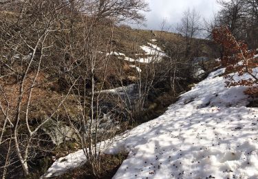
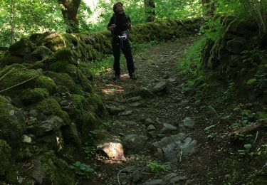
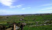
Site VTT FFC Aubrac – Vallée du Lot - Circuit n°5 - Les Enguilhens Circuit officiel labellisé par la Fédération Française de Cyclisme. Parcours roulant, longue montée physique, quelques passages rocheux, étroits et humides. Possibilité de petite boucle de 5 km avec retour sur Condom d’Aubrac. Attention en périodes de battues. Espace VTT ouvert d’Avril à Octobre. Renseignements : Office du Tourisme de St-Geniez-d'Olt - 4 Rue Cours - 12130 St-Geniez-d'Olt : 05 65 70 43 42.
Positioning
Comments
Trails nearby
![Trail Walking Saint-Chély-d'Aubrac - La voie romaine - Saint Chély d'Aubrac - Photo](https://media.geolcdn.com/t/375/260/ext.jpg?maxdim=2&url=https%3A%2F%2Fservices.sitytrail.com%2FGeolivesWS%2FDownloadMedia.ashx%3FTrailID%3D107212%26Media%3D12075_1.jpg)
![Walking Walking](https://static1.geolcdn.com/sitytour/trail-icons/101.png)
Walking
![](/images/other/stat-length.png)
![](https://static1.geolcdn.com/siteimages/upload/files/16400158638029165_repeat_loop_refresh_sync_direction_icon.png)
![Trail Walking Saint-Chély-d'Aubrac - Saint Chely Espalion Avril 2018 - Photo](https://media.geolcdn.com/t/375/260/ext.jpg?maxdim=2&url=https%3A%2F%2Fservices.sitytrail.com%2FGeolivesWS%2FDownloadMedia.ashx%3FTrailID%3D954993%26Media%3Dfix__20180422144532.jpg)
![Walking Walking](https://static1.geolcdn.com/sitytour/trail-icons/101.png)
Walking
![](/images/other/stat-length.png)
![](https://static1.geolcdn.com/siteimages/upload/files/16400158638029165_repeat_loop_refresh_sync_direction_icon.png)
![Trail Walking Saint-Chély-d'Aubrac - St Chelsy, Aubrac, Les Enfrux - Photo](https://media.geolcdn.com/t/375/260/6866939b-d70d-4ab6-a2bf-25d7795a7efa.jpg&format=jpg&maxdim=2)
![Walking Walking](https://static1.geolcdn.com/sitytour/trail-icons/101.png)
Walking
![](/images/other/stat-length.png)
![](https://static1.geolcdn.com/siteimages/upload/files/16400158638029165_repeat_loop_refresh_sync_direction_icon.png)
![Trail Walking Saint-Chély-d'Aubrac - st chely st urcize - Photo](https://media.geolcdn.com/t/375/260/1113cc59-e9db-4d87-b498-865d86c5cb16.jpg&format=jpg&maxdim=2)
![Walking Walking](https://static1.geolcdn.com/sitytour/trail-icons/101.png)
Walking
![](/images/other/stat-length.png)
![](https://static1.geolcdn.com/siteimages/upload/files/16400158638029165_repeat_loop_refresh_sync_direction_icon.png)
![Trail On foot Condom-d'Aubrac - Sentier Aubrac - Abbaye de Bonneval - Espalion - Photo](https://media.geolcdn.com/t/375/260/8e3993c7-168b-4f83-9050-caf329372b49.jpeg&format=jpg&maxdim=2)
![On foot On foot](https://static1.geolcdn.com/sitytour/trail-icons/100.png)
On foot
![](/images/other/stat-length.png)
![](https://static1.geolcdn.com/siteimages/upload/files/16400158638029165_repeat_loop_refresh_sync_direction_icon.png)
![Trail Walking Saint-Chély-d'Aubrac - S’y chely - Photo](https://media.geolcdn.com/t/375/260/389820e6-c2c8-454b-a940-011f0455be25.jpg&format=jpg&maxdim=2)
![Walking Walking](https://static1.geolcdn.com/sitytour/trail-icons/101.png)
Walking
![](/images/other/stat-length.png)
![](https://static1.geolcdn.com/siteimages/upload/files/16400158638029165_repeat_loop_refresh_sync_direction_icon.png)
![Trail Walking Curières - Autour roquette bonneval deveze - Photo](https://media.geolcdn.com/t/375/260/c3edeb43-4a50-4e7d-9e0e-641be5c77f03.jpg&format=jpg&maxdim=2)
![Walking Walking](https://static1.geolcdn.com/sitytour/trail-icons/101.png)
Walking
![](/images/other/stat-length.png)
![](https://static1.geolcdn.com/siteimages/upload/files/16400158638029165_repeat_loop_refresh_sync_direction_icon.png)
![Trail Walking Saint-Chély-d'Aubrac - St chely Aubrac - Photo](https://media.geolcdn.com/t/375/260/c658b19b-ea02-4e7f-bc49-bac78f64ab5b.jpg&format=jpg&maxdim=2)
![Walking Walking](https://static1.geolcdn.com/sitytour/trail-icons/101.png)
Walking
![](/images/other/stat-length.png)
![](https://static1.geolcdn.com/siteimages/upload/files/16400158638029165_repeat_loop_refresh_sync_direction_icon.png)
![Walking Walking](https://static1.geolcdn.com/sitytour/trail-icons/101.png)
Walking
![](/images/other/stat-length.png)
![](https://static1.geolcdn.com/siteimages/upload/files/16400158638029165_repeat_loop_refresh_sync_direction_icon.png)
Excellent parcours très agréable