Trail Mountain bike Bruz - Randonnée Pont-Péan Pont-Réan 17kms - Photo

Randonnée Pont-Péan Pont-Réan 17kms

 tracegps
tracegps

User

© OpenStreetMap contributors
Length
Length
17.2 km
Max alt
Max alt
37 m
Uphill gradient
Uphill gradient
126 m
Km-Effort
Km-Effort  
18.9 km
Min alt
Min alt
12 m
Downhill gradient
Downhill gradient
126 m
Boucle
Boucle
Yes
Creation date :
2014-12-10 00:00:00.0
Updated on :
2014-12-10 00:00:00.0

(0 Reviews)

Mountain bike
Mountain bike
1h30
Difficulty : Easy

Scan this QR Code to open this trail in the SityTrail application

FREE GPS app for hiking

Logo SityTrail SityTrail

IGN / Geographical institutes

Download SityTrail from the App Store Download SityTrail from Google Play

Logo SityTrail SityTrail World

The world is yours!

Download SityTrail from the App Store Download SityTrail from Google Play Download SityTrail on Huawei AppGallery

About

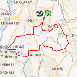
Trail Mountain bike of 17.2 km to be discovered at Brittany, Ille-et-Vilaine, Bruz. This trail is proposed by tracegps.

Description

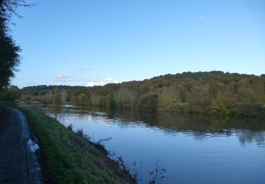
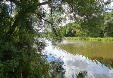
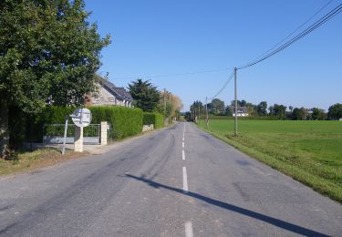
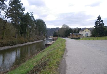
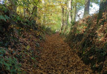
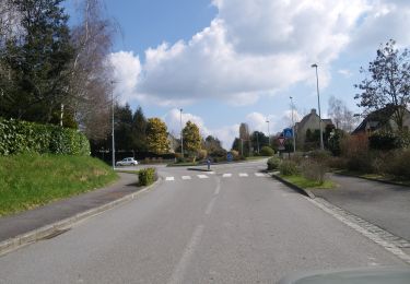
Balade au Sud de Bruz Passage près de la clinique du moulin , puis direction Pont-Péan par petite route. De Pont-Réan, toujours par les petites routes, on rejoint le moulin du Boël (passage moyennement goudronné du coté des lavandières). Passer au dessus de la Vilaine par le pont longeant la voie de chemin de fer (assez étroit : incertain pour le passage de carriole enfant). Direction Pont-Réan par le chemin de hallage, le long de la Vilaine. A ne pas rater. Retour vers Bruz par les petites routes. Ce parcours laisse découvrir de belles demeures en pierre de taille dans des endroits peu fréquentés. Très agréable.

Elevation profile

Positioning

Country:
France
Region :
Brittany
Department/Province :
Ille-et-Vilaine
Municipality :
Bruz
Location:
Unknown
Start:(UTM)
594381 ; 5319836 (30U) N.

Trails nearby

Trail Mountain bike Pont-Péan - Le long de la Vilaine - Pont Péan - Photo
Mountain bike
tracegps

Mountain bike

Difficult
(1)
Pont-Péan, Brittany, Ille-et-Vilaine, France
35 km | 41 km-effort
2h 15min
Yes
Trail Walking Pont-Péan - Randonnée autour de Pont-Péan - Photo
Walking
tracegps

Walking

Medium
(1)
Pont-Péan, Brittany, Ille-et-Vilaine, France
7.9 km | 8.5 km-effort
2h 0min
Yes
Trail On foot Laillé - Laillé la Chapelle - Photo
On foot
GUIDE+

On foot

Easy
Laillé, Brittany, Ille-et-Vilaine, France
13.2 km | 15.6 km-effort
3h 33min
Yes
Trail On foot Guichen - Les landes du Boël - Photo
On foot
GUIDE+

On foot

Easy
Guichen, Brittany, Ille-et-Vilaine, France
5.2 km | 6.1 km-effort
1h 23min
Yes
Trail On foot Guichen - Les bords de Vilaine - Photo
On foot
GUIDE+

On foot

Easy
Guichen, Brittany, Ille-et-Vilaine, France
6.9 km | 8.4 km-effort
1h 54min
Yes
Trail On foot Guichen - Pont-Réan Le Boël - Photo
On foot
GUIDE+

On foot

Easy
Guichen, Brittany, Ille-et-Vilaine, France
9.3 km | 11.5 km-effort
2h 37min
Yes
Trail Walking Laillé - Laillé, Roche qui chome - Photo
Walking
nolsim

Walking

Very easy
Laillé, Brittany, Ille-et-Vilaine, France
11.4 km | 13.1 km-effort
2h 40min
Yes
Trail On foot Orgères - Circuit des deux Monts et du Télégraphe - Photo
On foot
GUIDE+

On foot

Easy
Orgères, Brittany, Ille-et-Vilaine, France
6.2 km | 7.4 km-effort
1h 40min
Yes
Trail Walking Bruz -  Boucle Le Boël - gare de Laillé - Photo
Walking
ilur56

Walking

Medium
Bruz, Brittany, Ille-et-Vilaine, France
8.4 km | 10 km-effort
2h 22min
Yes


Close
My subscriptions