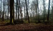
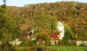
Trail Mountain bike Verges - Centre VTT FFC Premier Plateau, entre Lacs et Vignobles - Le tour de la Côte de l'Heute - Circuit n°17 - Photo

Centre VTT FFC Premier Plateau, entre Lacs et Vignobles - Le tour de la Côte de l'Heute - Circuit n°17

 tracegps
tracegps

User

© OpenStreetMap contributors
Length
Length
24 km
Max alt
Max alt
624 m
Uphill gradient
Uphill gradient
366 m
Km-Effort
Km-Effort  
29 km
Min alt
Min alt
481 m
Downhill gradient
Downhill gradient
366 m
Boucle
Boucle
Yes
Creation date :
2014-12-10 00:00:00.0
Updated on :
2014-12-10 00:00:00.0

(0 Reviews)

Mountain bike
Mountain bike
2h19
Difficulty : Difficult

Scan this QR Code to open this trail in the SityTrail application

FREE GPS app for hiking

Logo SityTrail SityTrail

IGN / Geographical institutes

Download SityTrail from the App Store Download SityTrail from Google Play

Logo SityTrail SityTrail World

The world is yours!

Download SityTrail from the App Store Download SityTrail from Google Play Download SityTrail on Huawei AppGallery

About

Trail Mountain bike of 24 km to be discovered at Bourgogne-Franche-Comté, Jura, Verges. This trail is proposed by tracegps.

Description

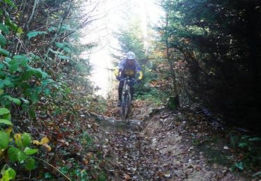
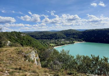
Centre VTT - FFC Premier Plateau, entre Lacs et Vignobles. Circuit officiel labellisé par la Fédération Française de Cyclisme. Centre VTT FFC Premier Plateau, entre Lacs et Vignobles – Le tour de la Côte de l’Heute - Circuit n°17. Au départ de la gare de Verges. En empruntant ce circuit, vous saisirez la difficulté de franchissement de la côte de l'Heute . Celle-ci est un chaînon résultant d'un mouvement de l'écorce terrestre qui a fait surgir, à l'époque tertiaire, les massifs montagneux des Alpes et du Jura. Vous traverserez les villages de Châtillon, Mirebel et Verges qui possèdent chacun un château. Beau belvédère sur la vallée de l'Ain au dessus de Châtillon. Circuit très roulant classé rouge en raison de la montée de Mirebel. Ce tracé a été relevé sur le terrain par le club Vtt Conliège.

Elevation profile

Photos

Positioning

Country:
France
Region :
Bourgogne-Franche-Comté
Department/Province :
Jura
Municipality :
Verges
Location:
Unknown
Start:(UTM)
704952 ; 5168746 (31T) N.

Trails nearby

Trail Mountain bike Briod - Centre VTT FFC Premier Plateau, entre Lacs et Vignobles - La Haute Roche - Circuit n°11 - Photo
Mountain bike
tracegps

Mountain bike

Difficult
(2)
Briod, Bourgogne-Franche-Comté, Jura, France
23 km | 30 km-effort
2h 0min
Yes
Trail Walking Verges - GR_559_AB_02_Verges_Fontenu_20210913 - Photo
Walking
patrickdanilo

Walking

Medium
Verges, Bourgogne-Franche-Comté, Jura, France
18.6 km | 24 km-effort
5h 11min
No
Trail Walking Nogna - Chateau de Beauregard - Photo
Walking
GUIDE
David25400

Walking

Very easy
Nogna, Bourgogne-Franche-Comté, Jura, France
4.7 km | 6.6 km-effort
1h 19min
Yes
Trail sport Mesnois - Château de Binans par Mesnois - Photo
sport
GUIDE
David25400

sport

Very easy
Mesnois, Bourgogne-Franche-Comté, Jura, France
6.4 km | 8.9 km-effort
Unknown
Yes
Trail Walking Mesnois - Balade Taïga - Photo
Walking
GUIDE
David25400

Walking

Very easy
Mesnois, Bourgogne-Franche-Comté, Jura, France
9.2 km | 12.4 km-effort
1h 38min
No
Trail sport Conliège - Les hauts de Revigny - Photo
sport
GUIDE
David25400

sport

Very easy
Conliège, Bourgogne-Franche-Comté, Jura, France
3.5 km | 4.2 km-effort
Unknown
Yes
Trail Walking Perrigny - Bois de Perrigny - Photo
Walking
GUIDE
David25400

Walking

Very easy
Perrigny, Bourgogne-Franche-Comté, Jura, France
5.4 km | 7.3 km-effort
1h 28min
Yes
Trail Walking Perrigny - Bois de Perrigny - Photo
Walking
GUIDE
David25400

Walking

Very easy
Perrigny, Bourgogne-Franche-Comté, Jura, France
4.2 km | 5.4 km-effort
1h 7min
Yes
Trail Walking Publy - Le château Beauregard  - Le château de Binan - Photo
Walking
Genisset

Walking

Medium
Publy, Bourgogne-Franche-Comté, Jura, France
15.1 km | 21 km-effort
3h 8min
Yes


Close
My subscriptions